
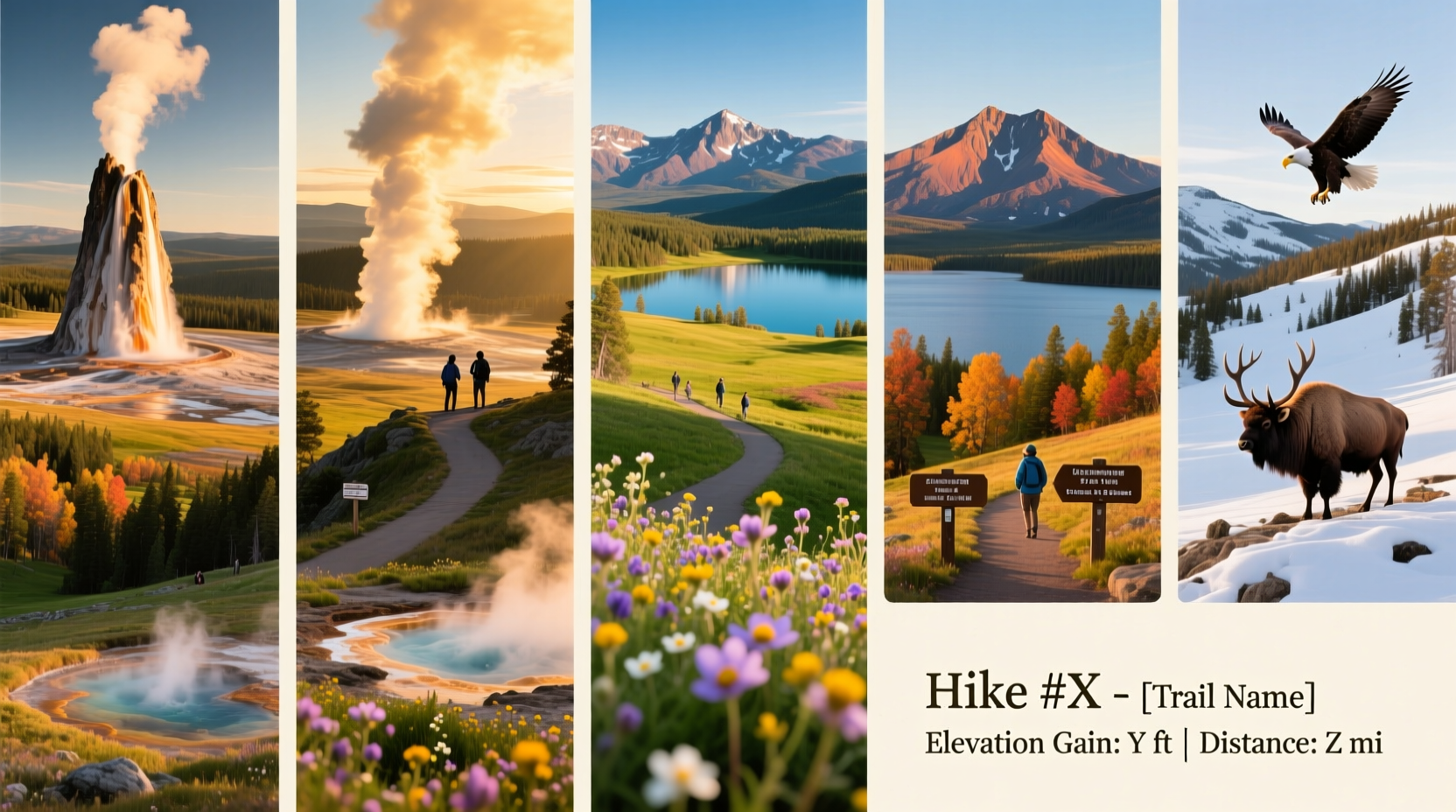
Yellowstone National Park spans over 2.2 million acres of wilderness, geothermal wonders, and alpine beauty. While many visitors stick to boardwalks and scenic overlooks, those who venture on foot are rewarded with panoramic vistas, hidden waterfalls, and intimate wildlife encounters. The park offers a wide range of day hikes—short and accessible, yet rich in natural drama. From geyser basins to canyon rims, these ten trails deliver exceptional views with minimal logistical challenges, making them ideal for families, casual hikers, and seasoned adventurers alike.
Why Day Hiking in Yellowstone Stands Out
Unlike traditional mountain parks where summit views require strenuous climbs, Yellowstone combines geological spectacle with approachable terrain. Many trails lead directly to active thermal features, cascading rivers, or sweeping overlooks—all within a few miles. Elevation varies, but most day hikes stay below 8,500 feet, reducing altitude strain. Wildlife is abundant: elk graze near trailheads, bison cross meadows, and bears occasionally pass through backcountry zones (though rarely on well-traveled routes).
The park’s infrastructure supports accessibility. Most trailheads are reachable via paved roads, and rangers maintain clear signage and up-to-date trail conditions. With proper planning, even first-time visitors can safely experience some of the most iconic landscapes in the American West.
Top 10 Day Hikes for Scenic Beauty and Accessibility
- Artist Point Trail – Lower Yellowstone Falls View
Distance: 0.3 miles round trip | Elevation Gain: Minimal
This short, paved path from the parking lot delivers one of the most photographed views in North America: the 308-foot Lower Falls plunging into the Grand Canyon of the Yellowstone. Artist Point offers a dramatic frontal perspective, framed by rust-colored cliffs. Wheelchair accessible and stroller-friendly. - Uncle Tom’s Trail – Glimpse of the Lower Falls Up Close
Distance: 0.8 miles round trip | Elevation Gain: 540 feet
A steep but rewarding descent via 328 metal steps leads to an observation deck just above the churning base of the Lower Falls. Though brief, the climb back up tests the legs—but the roar of falling water and mist on your face make it unforgettable. - Brink of the Upper Falls Trail – Power of Nature at Eye Level
Distance: 0.6 miles round trip | Elevation Gain: 100 feet
Connected to the Uncle Tom’s Trail system, this route ends at a viewing platform directly beside the thunderous Upper Falls. The trail follows the Yellowstone River as it narrows before the plunge. Caution: railings are low; keep children close. - Fairy Falls Trail – Boardwalk-Free Thermal Adventure
Distance: 5.4 miles round trip | Elevation Gain: 200 feet
Begins at the Firehole Lake Drive parking area and winds through quiet forest before opening to a 197-foot waterfall—the tallest in Yellowstone. Continue past the falls to an unmarked spur trail leading to the Grand Prismatic Overlook (additional 1.6 miles round trip), offering a breathtaking aerial view of the colorful hot spring. - Mystic Falls Trail – Waterfall Amid Geysers
Distance: 2.4 miles round trip | Elevation Gain: 300 feet
Starting from the Biscuit Basin boardwalk, this loop passes steaming vents and bubbling mud pots before climbing to a graceful 70-foot cascade. You can extend the hike to an overlook above the falls for a wider valley panorama. - Lamar Valley Trail – Wildlife Corridor Walk
Distance: Flexible (2–6 miles) | Elevation Gain: Minimal
Not a formal trail, but a network of dirt paths along the Lamar River. Ideal for early morning or dusk hikes when wolves, bison, pronghorn, and grizzlies are most active. Park at the Lamar Ranger Station and follow old service roads with expansive mountain views. - Mount Washburn – Summit Panorama
Distance: 6.2 miles round trip (via Dunraven Pass) | Elevation Gain: 1,400 feet
One of the most popular summit hikes in the park, Mount Washburn rewards climbers with 360-degree views across Yellowstone’s volcanic plateau. Look for bighorn sheep near the summit and use binoculars to spot distant herds. Note: Thunderstorms develop quickly—start before noon. - Osprey Falls Trail – Hidden Cascade via Old Roadbed
Distance: 1.6 miles round trip | Elevation Gain: 600 feet (steep)
Accessed via the undervisited Trout Lake trailhead, this route descends sharply to a powerful waterfall on the Gardner River. The trail follows an abandoned road, so grades are consistent but rocky. Fewer people mean better solitude and birdwatching opportunities. - Sheepeater Cliff Trail – Lava Flow History
Distance: 0.5 miles loop | Elevation Gain: Minimal
Located off the road to Mammoth Hot Springs, this interpretive trail explores a columnar basalt formation created by ancient lava cooling. Short and educational, with signage explaining how the Sheepeater band of Shoshone used the area for shelter. - Storm Point Trail – Quiet Lakeside Escape
Distance: 2.2 miles loop | Elevation Gain: Minimal
Beginning near the Fishing Bridge, this flat trail skirts Yellowstone Lake through willow flats and marshes. Often overlooked, it offers serene water views and frequent moose sightings in late summer. Great for photography and peaceful reflection.
Essential Hiking Tips for Yellowstone
Hiking in Yellowstone is not like hiking in a typical national park. The presence of wildlife, unpredictable terrain, and fragile ecosystems demands extra awareness. Follow these guidelines to ensure safety and preserve the environment.
- Stay at least 100 yards from bears and wolves, 25 yards from all other wildlife.
- Never leave food unattended or feed animals—this includes scraps and pet food.
- Stick to designated trails. Thermal areas have thin crusts that can collapse underfoot.
- Check trail conditions daily at visitor centers or online via the NPS website.
- Weather changes rapidly—pack layers, rain gear, and sun protection regardless of forecast.
“Hiking in Yellowstone isn’t just about scenery—it’s about coexisting with one of the last intact temperate ecosystems in the world.” — Dr. Rebecca Turner, National Park Service Ecologist
What to Pack: A Day Hiker’s Checklist
Preparation makes the difference between a memorable hike and a stressful ordeal. Use this checklist before heading out:
- ✅ Bear spray (with safety clip removed and holstered on your belt)
- ✅ Topographic map or offline GPS app (cell service is unreliable)
- ✅ At least 2 liters of water per person (more in summer)
- ✅ High-energy snacks (nuts, jerky, energy bars)
- ✅ Layered clothing (moisture-wicking base, insulating mid, waterproof outer)
- ✅ Sturdy hiking boots with ankle support
- ✅ First aid kit and whistle
- ✅ Sunscreen, sunglasses, and wide-brimmed hat
- ✅ Camera or phone for photos (but stay present!)
Do’s and Don’ts on Yellowstone Trails
| Do | Don't |
|---|---|
| Keep dogs leashed and under control (only allowed on paved paths) | Bring pets on hiking trails—pets are prohibited on all unpaved routes |
| Take only photos, leave only footprints | Collect rocks, plants, or thermal features—even small souvenirs are illegal |
| Hike in groups of three or more for bear safety | Hike alone, especially in remote areas like Lamar or Pelican Valleys |
| Report wildlife sightings to rangers (helps track animal movements) | Approach or attempt to photograph animals up close |
| Use restroom facilities before starting your hike | Defecate near trails or water sources—bury waste 6–8 inches deep and 200 feet from water |
Real Example: A Family’s Sunrise Hike to Fairy Falls
The Peterson family from Colorado arrived at Yellowstone in mid-June, eager to see more than just Old Faithful. They researched lesser-known trails and chose Fairy Falls for its combination of waterfall and optional Grand Prismatic viewpoint. Starting at 6:30 a.m., they avoided the midday heat and encountered only two other hikers. After reaching the falls, their 10-year-old daughter spotted a fox darting through the trees. Later, using a downloaded map, they found the unofficial overlook trail and gasped at the rainbow hues of Grand Prismatic Spring stretching below. “It felt like we discovered something secret,” said Mr. Peterson. “And it was safe, manageable, and absolutely magical.”
Frequently Asked Questions
Are any of these hikes wheelchair accessible?
Yes. Artist Point, parts of the Firehole Basin boardwalk (Mystic Falls trailhead), and the path to Sheepeater Cliff are ADA-compliant with paved or compacted surfaces. Always verify current conditions with park staff, as repairs or erosion may temporarily affect access.
Can I bring my dog on these trails?
No. Pets are restricted to paved roads, parking lots, and specific campgrounds. They are not permitted on any hiking trails, boardwalks (except service animals), or in the backcountry due to wildlife risks and ecosystem protection.
When is the best time of year to hike these trails?
Mid-June to early September offers the most reliable trail access and mild temperatures. Some high-elevation trails like Mount Washburn may still have snow in June. Early fall (September–October) brings fewer crowds and golden foliage, but nighttime temperatures can drop below freezing.
Final Thoughts: Step Off the Boardwalk, Into the Wild
The true soul of Yellowstone lies beyond the guardrails and visitor centers. These ten day hikes offer gateways to that deeper experience—where the scent of pine mingles with geothermal steam, where silence is broken only by wind and wings, and where every turn reveals another wonder carved by fire, ice, and time. Whether you're standing at the brink of a roaring falls or scanning the horizon from a windswept summit, you’re not just seeing nature—you’re part of it.


 浙公网安备
33010002000092号
浙公网安备
33010002000092号 浙B2-20120091-4
Comments
No comments yet. Why don't you start the discussion?