
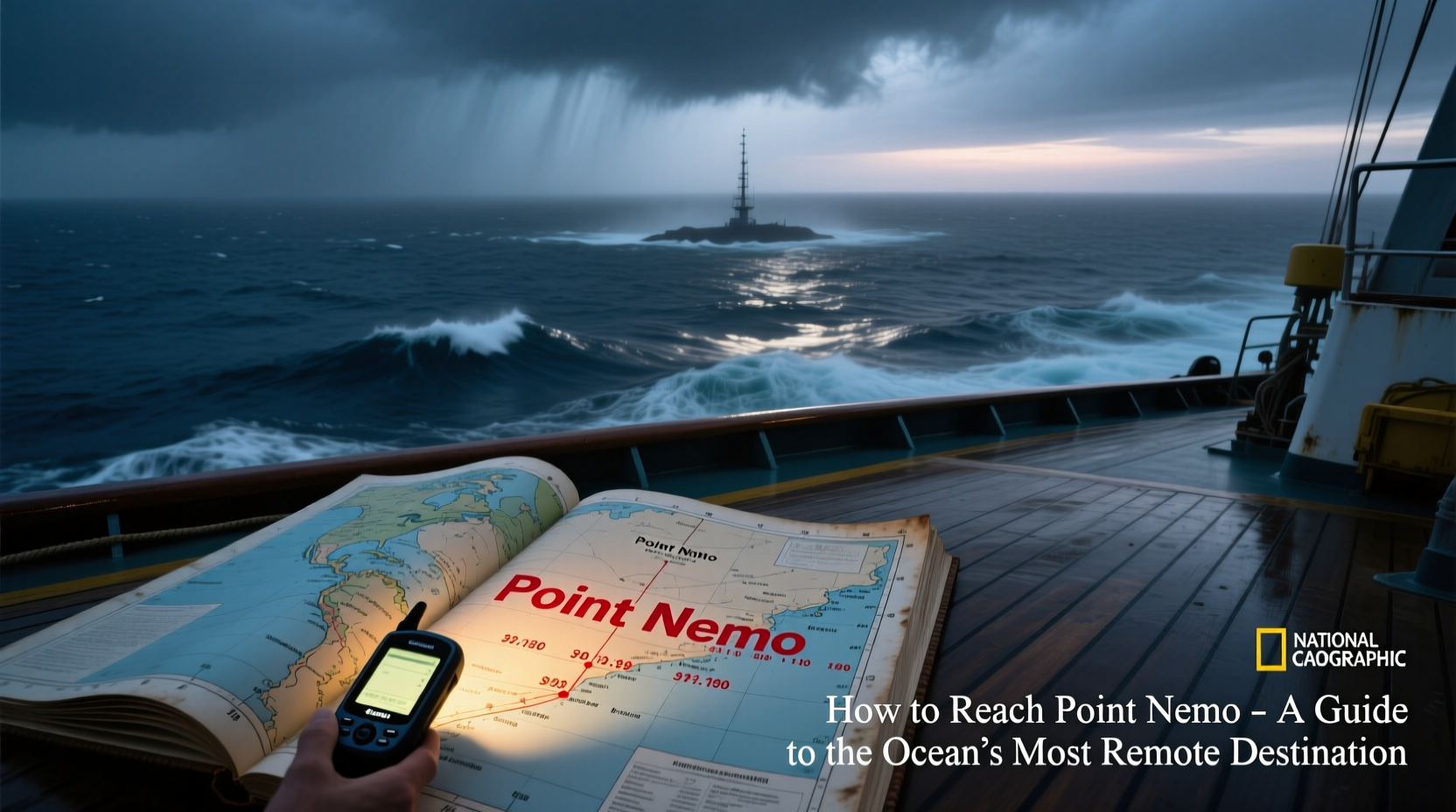
Point Nemo, officially known as the oceanic pole of inaccessibility, lies farther from land than any other point on Earth. Located in the South Pacific Ocean, it is approximately 2,688 kilometers (1,670 miles) from the nearest three islands: Ducie Island (Pitcairn group), Motu Nui (near Easter Island), and Maher Island (Antarctica). This desolate coordinate—48°52.6′S 123°23.6′W—is not just a geographical curiosity; it represents one of the last true frontiers of isolation. Reaching it demands meticulous planning, exceptional resources, and an understanding of both maritime logistics and environmental responsibility.
The Significance of Point Nemo
Naming “Nemo” after Jules Verne’s Captain Nemo, the spot was identified in 1992 by Croatian-Canadian survey engineer Hrvoje Lukatela using geospatial software. Unlike popular tourist destinations, Point Nemo has no permanent structures, no wildlife colonies, and no human presence. Its remoteness makes it ideal for specific scientific research and even serves as a spacecraft graveyard, where decommissioned satellites and space stations are deorbited to minimize risk to populated areas.
The region surrounding Point Nemo is characterized by low biological productivity due to its distance from nutrient-rich coastal upwellings. Known as an oceanic desert, it hosts minimal phytoplankton activity, which in turn limits the food chain above it. This ecological stillness adds to its mystique—but also underscores the fragility of such untouched environments.
“The oceanic pole of inaccessibility isn’t just far from land—it’s a mirror reflecting our planet’s vast emptiness and the limits of human reach.” — Dr. Elena Torres, Marine Geographer, University of Tasmania
Practical Challenges of Reaching Point Nemo
Reaching Point Nemo is not a casual voyage. It requires crossing thousands of kilometers of open ocean with no ports, no refueling stations, and no emergency landing zones for aircraft. The journey typically begins from either French Polynesia, Chile, or New Zealand, each adding significant time and complexity.
Most vessels attempting this route are deep-sea research ships, private expedition yachts with extended range, or government-operated marine survey craft. Commercial cruises do not visit Point Nemo, and there are no tour operators offering scheduled trips. Any attempt must be self-sufficient for weeks at sea.
Key Obstacles
- Distance: Over 2,500 km from nearest land in any direction.
- Weather volatility: Southern Pacific storms can arise quickly with limited forecasting support.
- Navigation precision: GPS accuracy is critical; errors of even a few minutes can leave you hundreds of kilometers off target.
- Supply chain: All fuel, food, water, spare parts, and medical supplies must be carried onboard.
- Environmental regulations: Strict adherence to MARPOL and Antarctic Treaty protocols is required, especially near the southern boundary.
Step-by-Step Guide to Planning the Expedition
Successfully reaching Point Nemo is less about speed and more about endurance, preparation, and risk mitigation. Below is a structured approach to organizing such a journey.
- Determine vessel suitability: Choose a bluewater-capable ship with a minimum range of 8,000 nautical miles, redundant navigation systems, and robust hull construction.
- Assemble crew and specialists: Include a certified captain, engineer, medic, and preferably a marine biologist or oceanographer if conducting research.
- Secure permits: Depending on origin and route, approvals may be needed from Chilean, French (for French Polynesia), or New Zealand maritime authorities.
- Plan the route: Use great-circle navigation tools to optimize passage. Avoid winter months (May–October) in the Southern Hemisphere due to storm frequency.
- Conduct safety drills: Man-overboard, fire suppression, engine failure, and satellite comms loss scenarios should be rehearsed.
- Reach and document Point Nemo: Upon arrival, confirm position via multiple GPS sources. Consider deploying a buoy with identification (non-polluting materials only).
- Return safely: Retrace or adjust return path based on weather. Maintain communication throughout re-entry into territorial waters.
Available Transportation Options
There are no direct routes or commercial services to Point Nemo. Access depends entirely on private or institutional maritime capability.
| Transport Type | Feasibility | Estimated Duration (one-way) | Notes |
|---|---|---|---|
| Research Vessel | High | 14–21 days | Best option; equipped for science, safety, and long duration. |
| Private Expedition Yacht | Moderate | 18–25 days | Requires extensive provisioning and experienced crew. |
| Sailboat | Low | 30+ days | Risky due to wind dependence and slower speeds; not recommended without backup engine. |
| Aircraft (helicopter/drones) | Very Low | N/A | No nearby bases; impractical except for military or NASA-level operations. |
Real-World Example: The 2018 RV Sonne Expedition
In 2018, Germany’s RV Sonne, a state-of-the-art oceanographic research vessel, passed within 120 kilometers of Point Nemo during a deep-sea mapping mission across the South Pacific. The team, led by Dr. Anja Karstensen, used multibeam sonar to study abyssal plains and microplastic distribution.
Despite advanced technology, the crew faced unexpected gale-force winds and had to reroute slightly north to maintain stability. Their experience highlighted the unpredictability of the region—even for well-funded scientific teams. Still, they collected valuable data showing trace levels of synthetic fibers at depths exceeding 4,000 meters, proving that even Earth’s most isolated point is not immune to human impact.
Do’s and Don’ts When Visiting Point Nemo
| Do’s | Don’ts |
|---|---|
| Carry redundant communication devices (e.g., Iridium phone, EPIRB, HF radio) | Leave any physical markers or waste behind |
| Log GPS coordinates and environmental observations | Attempt the journey without emergency medical training |
| Coordinate with international maritime tracking networks | Underestimate fuel consumption in headwinds |
| Respect marine conservation zones near approach paths | Share exact real-time location publicly (piracy/safety concerns) |
Frequently Asked Questions
Can tourists visit Point Nemo?
No formal tourism exists for Point Nemo. While technically possible for private yachts or chartered research vessels, the cost, danger, and logistical barriers make it inaccessible to all but the most prepared expeditions. No cruise lines include it in itineraries.
Is there anything to see at Point Nemo?
Visually, it appears like any open ocean—endless water and sky. However, its symbolic value as the most isolated place on Earth gives it profound meaning for explorers. Scientifically, the seafloor below is part of the South Pacific Abyssal Plain, largely unmapped and unexplored.
Why is Point Nemo used as a spacecraft graveyard?
Due to its extreme remoteness, space agencies including NASA and ESA deorbit decommissioned satellites and modules (like Russia’s Mir station) into this zone. The likelihood of debris impacting human populations is nearly zero, making it the safest disposal area for large orbital objects.
Final Checklist Before Departure
- Vessel Readiness
- Full engine service, backup generator, desalination unit operational
- Navigation & Comms
- Dual GPS units, paper charts, satellite phone, AIS transponder
- Supplies
- Minimum 150% of expected food/water needs, medical kit with telemedicine access
- Emergency Protocols
- Life rafts, flares, MOB system, man-overboard recovery gear
- Environmental Compliance
- No plastic discharge, waste retention tanks sealed, oil filters checked
Conclusion: A Journey for the Few, Remembered by Many
Reaching Point Nemo is not about conquest—it’s about respect. Respect for the ocean’s scale, for the limits of human engineering, and for the silent balance of ecosystems far from shore. Whether you’re a scientist measuring ocean acidity, a sailor testing personal endurance, or simply someone captivated by Earth’s extremes, Point Nemo stands as a monument to solitude.
While few will ever stand on deck at 48°52.6′S 123°23.6′W, understanding how to get there reveals much about preparation, humility, and the enduring allure of the unknown. If you're inspired to explore further—whether through virtual maps, ocean advocacy, or supporting deep-sea research—start today. The world’s quietest place deserves our attention, even from afar.


 浙公网安备
33010002000092号
浙公网安备
33010002000092号 浙B2-20120091-4
Comments
No comments yet. Why don't you start the discussion?