
Geography is far more than memorizing countries and capitals. It is a dynamic discipline that examines the relationships between people, places, and environments. In an era defined by rapid environmental change, global connectivity, and complex socio-political challenges, geographers play a crucial role in shaping informed decisions across industries and governments. Their expertise bridges natural sciences, social sciences, and technology, making them indispensable in addressing some of the most pressing issues of our time.
Understanding the Scope of Geography
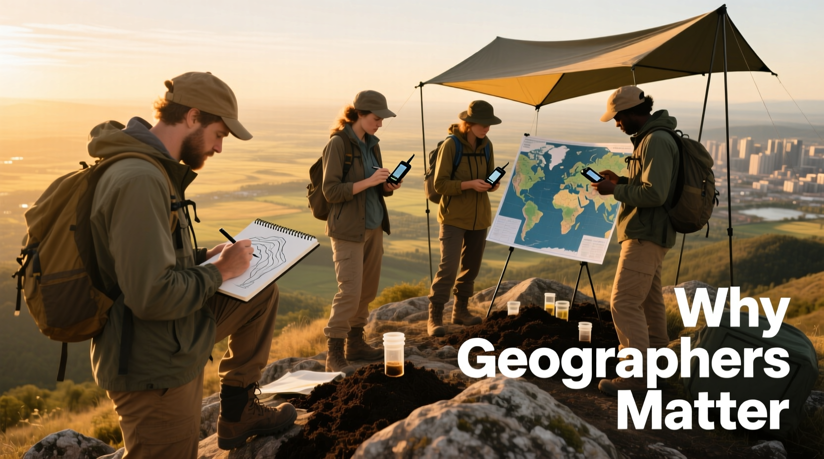
Modern geography is divided into two main branches: physical geography and human geography. Physical geography studies natural processes—such as climate systems, landforms, and ecosystems—while human geography explores how societies interact with space and place, including urban development, migration patterns, and economic systems. Many geographers also specialize in geographic information systems (GIS), remote sensing, and spatial analysis, tools that allow for data-driven insights into both natural and human phenomena.
Unlike disciplines that focus narrowly on isolated systems, geography’s strength lies in its integrative approach. A geographer doesn’t just ask what is happening—they ask where it is happening, why it is happening there, and how location influences outcomes. This spatial perspective is critical when analyzing everything from disease outbreaks to supply chain logistics.
The Role of Geographers in Environmental Sustainability
Climate change, deforestation, biodiversity loss, and water scarcity are among the defining challenges of the 21st century. Geographers contribute directly to sustainability efforts by mapping environmental changes, modeling future scenarios, and identifying high-risk zones. For example, through satellite imagery and GIS, geographers can track glacier retreat in the Arctic or monitor illegal logging in the Amazon rainforest.
They also assess the impact of human activity on ecosystems, helping policymakers design conservation strategies that are both effective and equitable. By analyzing spatial patterns of pollution, resource use, and population growth, geographers provide the evidence base needed for sustainable development planning.
“Geographers are the cartographers of crisis and recovery. They map not just terrain, but vulnerability and resilience.” — Dr. Lena Torres, Environmental Geographer, University of Edinburgh
Urban Planning and Smart Cities
As over half the world’s population now lives in cities—a figure expected to rise to 70% by 2050—urban planning has never been more critical. Geographers help design efficient, livable, and resilient cities by analyzing land use, transportation networks, housing density, and access to services like healthcare and education.
Using spatial data, they identify underserved neighborhoods, optimize public transit routes, and model the effects of new infrastructure projects. In smart city initiatives, geographers integrate real-time data from sensors and mobile devices to improve traffic flow, reduce energy consumption, and enhance emergency response systems.
A real-world example is seen in Medellín, Colombia, where geographers collaborated with urban planners to transform one of Latin America’s most dangerous cities into a model of inclusive development. By mapping crime hotspots and socioeconomic disparities, they helped guide investments in cable cars, libraries, and community centers in marginalized hillside communities—reducing violence and improving quality of life.
Key Contributions of Geographers in Urban Development
| Area | Geographer’s Role | Impact |
|---|---|---|
| Transportation | Optimize bus routes using commuter flow data | Reduced congestion and emissions |
| Housing | Map informal settlements and assess risk factors | Informed relocation and upgrading programs |
| Disaster Preparedness | Model flood zones and evacuation routes | Improved emergency planning |
| Public Health | Analyze proximity of clinics to vulnerable populations | Better access to medical care |
Geopolitics and National Security
Geographers are increasingly involved in defense, intelligence, and international relations. Understanding the physical and cultural landscapes of conflict zones allows military strategists and diplomats to make informed decisions. For instance, knowledge of terrain, climate, and ethnic distributions can influence peacekeeping operations or humanitarian aid delivery.
In national security, geospatial analysts use satellite imagery and GPS data to monitor border activities, detect illicit construction, or track movements of armed groups. During the 2022 Russian invasion of Ukraine, open-source geographers used publicly available satellite images to document troop buildups, destroyed infrastructure, and refugee flows—providing transparency when official channels were compromised.
This blend of technical skill and contextual awareness makes geographers key players in crisis response and long-term stability planning.
Public Health and Disease Mapping
The COVID-19 pandemic highlighted the importance of spatial thinking in public health. Geographers were instrumental in tracking the virus’s spread, identifying clusters, and predicting future hotspots. Dashboards powered by GIS became essential tools for governments and health organizations worldwide.
Beyond pandemics, geographers study the spatial distribution of chronic diseases, access to healthcare, and environmental health risks such as air pollution or contaminated water. For example, research has shown that low-income neighborhoods in major U.S. cities are disproportionately exposed to industrial pollutants—a finding made possible through spatial epidemiology.
By visualizing these inequities, geographers advocate for policy changes that promote health equity and environmental justice.
Step-by-Step: How Geographers Solve Real-World Problems
Geographers follow a structured, evidence-based process to address complex challenges. Here's how they typically approach a problem:
- Define the Issue: Identify a specific question or problem, such as “Why are certain neighborhoods experiencing higher asthma rates?”
- Collect Spatial Data: Gather relevant data from satellites, surveys, sensors, or government databases.
- Analyze Patterns: Use GIS software to visualize and interpret spatial relationships.
- Test Hypotheses: Examine correlations—e.g., proximity to highways and respiratory illness.
- Develop Solutions: Propose targeted interventions, such as relocating schools away from industrial zones.
- Communicate Findings: Present results through maps, reports, or interactive dashboards for decision-makers.
FAQ
What do geographers do in everyday jobs?
Geographers work in diverse fields including environmental consulting, urban planning, disaster management, public health, and intelligence. Their tasks range from creating detailed maps and analyzing satellite images to advising policymakers on land use and climate adaptation strategies.
Do you need advanced technology to be a geographer?
While traditional fieldwork remains important, modern geographers rely heavily on tools like GIS, remote sensing software, and GPS. However, many entry-level positions offer training, and open-source platforms like QGIS make these technologies accessible to students and professionals alike.
Can geographers help combat climate change?
Absolutely. Geographers model sea-level rise, predict wildfire risks, assess carbon sequestration potential, and support renewable energy planning by identifying optimal locations for wind farms or solar arrays based on terrain and weather patterns.
Checklist: Supporting Geographic Literacy and Careers
- Advocate for geography education in schools—ensure students learn spatial thinking.
- Support open-access geospatial data initiatives for transparency and innovation.
- Encourage interdisciplinary collaboration between geographers, engineers, and policymakers.
- Promote diversity in geography to include indigenous knowledge and local perspectives.
- Invest in GIS training programs for public sector employees.
Conclusion
Geographers are not merely mapmakers—they are problem solvers, analysts, and visionaries who help us understand the complexities of our world. From guiding sustainable development to protecting public health and ensuring national security, their contributions are foundational to informed decision-making in a rapidly changing planet. As global challenges become increasingly interconnected, the spatial insight provided by geographers will only grow in value.


 浙公网安备
33010002000092号
浙公网安备
33010002000092号 浙B2-20120091-4
Comments
No comments yet. Why don't you start the discussion?