
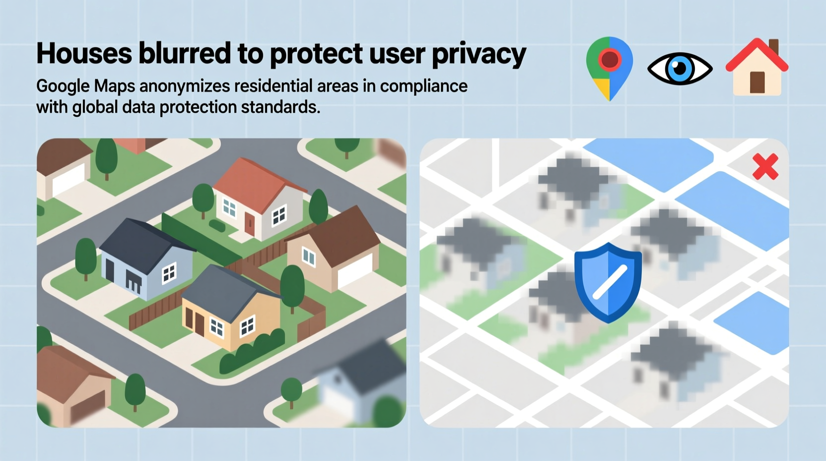
When browsing Google Maps or Google Earth, you may have noticed that certain homes appear blurred or pixelated while surrounding areas remain in clear detail. This isn't a technical glitch—it's an intentional measure taken by Google to protect individual privacy. As satellite imagery and street-level photography have become more advanced, so too have concerns about personal security and data exposure. The blurring of houses is part of Google’s broader commitment to balancing public access to information with the right to privacy.
This practice raises important questions: Why does Google blur some homes but not others? Who decides which properties get blurred? And can homeowners request this protection? Understanding the reasoning behind house blurring provides insight into digital ethics, technological capabilities, and evolving norms around personal space in the digital age.
The Origins of House Blurring on Google Maps
Google began incorporating blurring techniques in the mid-2000s as part of its Street View service rollout. Initially, the focus was on obscuring faces and license plates to prevent identification. However, as high-resolution imagery became more widespread, concerns grew about the visibility of private residences—especially those in secluded or rural locations.
In response, Google introduced optional blurring for entire buildings upon request. The first major implementation occurred in Germany in 2010, where public backlash over privacy led to a nationwide opt-out program. Homeowners could formally request their homes be blurred, and Google complied with thousands of such requests. This precedent influenced policies in other countries, including the United States, Canada, and parts of Europe.
The technology used for blurring involves image recognition algorithms that detect building outlines and apply a pixelation filter. These tools are trained to identify structures consistent with residential architecture, though human review often verifies automated decisions—especially when manual requests are submitted.
Privacy Concerns Driving Image Obfuscation
The primary reason houses are blurred on Google Maps is to safeguard personal privacy. A clearly visible home can reveal more than just its physical appearance—it might expose security vulnerabilities (like unlocked gates or unguarded windows), indicate occupancy patterns, or even enable stalking and harassment. In extreme cases, criminals have used publicly available imagery to plan burglaries or target individuals.
Legal frameworks in various jurisdictions support these privacy protections. For example, the European Union’s General Data Protection Regulation (GDPR) recognizes images of private property as potentially sensitive personal data if they allow inference about an individual’s lifestyle, habits, or security measures. While the U.S. lacks a federal equivalent to GDPR, courts have acknowledged a “reasonable expectation of privacy” in one’s home under the Fourth Amendment.
Moreover, cultural attitudes vary significantly. In countries like Germany, where privacy rights are deeply embedded in law and society, there is strong public resistance to unsolicited photography of private spaces. In contrast, nations with fewer restrictions may see less demand for blurring—but Google maintains global standards to ensure consistency and minimize legal risk.
How Google Decides What Gets Blurred
Blurring on Google Maps happens in two main ways: automatically and manually.
- Automatic blurring: Uses AI-driven computer vision to detect and obscure license plates, faces, and sometimes entire homes in densely populated areas where privacy risks are higher.
- Manual blurring requests: Property owners can proactively ask Google to blur their homes via the \"Report a problem\" feature on Google Maps.
Once a request is submitted, Google typically processes it within a few weeks. The company confirms the location and applies a permanent blur effect across all platforms—Maps, Earth, and search results. Importantly, only the exterior of the home is blurred; nearby public spaces, roads, and neighboring properties remain unaffected unless also requested.
“Technology should empower people, not expose them. Blurring homes is a small step toward respecting digital boundaries.” — Dr. Lena Patel, Digital Ethics Researcher at Stanford University
Step-by-Step Guide to Requesting Your Home Be Blurred
If you'd like your house removed from clear view on Google Maps, follow this straightforward process:
- Open Google Maps on your desktop or mobile browser.
- Search for your address and navigate to the Street View image showing your home.
- Click the three dots (•••) menu icon in the bottom-right corner of the Street View pane.
- Select “Report a problem” from the dropdown menu.
- Choose the reason: “My residence is visible” or “Privacy concern.”
- Confirm your home’s location on the map and submit the report.
- Wait 2–6 weeks for Google to process your request.
After processing, reload the same Street View angle—you should see a blurred version of your home. Note that multiple angles may require separate submissions if your house appears from different directions.
Do’s and Don’ts When Managing Home Visibility Online
| Do | Don’t |
|---|---|
| Submit a blurring request if you feel exposed or unsafe | Expect immediate results—processing takes time |
| Use official Google channels to make requests | Contact neighbors’ homes without permission |
| Check both satellite and Street View regularly | Assume automatic updates will catch new photos |
| Understand that blurring doesn’t remove metadata entirely | Believe blurring offers complete anonymity online |
Mini Case Study: A Suburban Family’s Privacy Win
In 2022, the Thompson family in Portland, Oregon, noticed their newly built home appeared clearly on Google Street View shortly after moving in. Concerned about safety—particularly because their young daughter often played in the front yard—they worried about unwanted attention or potential threats. One evening, a stranger knocked on their door claiming he’d “seen the house online.” That incident prompted action.
Mrs. Thompson followed Google’s reporting steps and submitted a blurring request. Within three weeks, the image was updated. She later shared her experience in a local neighborhood group, encouraging others to take similar precautions. Her story highlights how seemingly minor digital exposures can lead to real-world consequences—and how simple tools exist to regain control.
Frequently Asked Questions
Can I blur my house on Google Maps permanently?
Yes. Once Google processes your request, the blur is applied permanently across all services. Even if new imagery is captured in future updates, the system flags previously blurred homes for continued obfuscation.
Does blurring work on satellite images too?
Yes. While most requests originate from Street View, Google extends blurring to aerial and satellite views when necessary. You can specify which perspectives concern you during the reporting process.
Are businesses eligible for blurring?
Generally, no. Commercial properties are considered public-facing and are not eligible for privacy-based blurring. However, exceptions may apply if sensitive operations (e.g., medical facilities or shelters) are involved.
Conclusion: Taking Control of Your Digital Footprint
The blurring of houses on Google Maps reflects a growing awareness of digital privacy in everyday life. While mapping technologies offer incredible utility—from navigation to urban planning—they also carry responsibilities. Google’s willingness to honor blurring requests empowers individuals to set boundaries in an increasingly transparent world.
Your home is more than just a structure on a map; it represents safety, family, and personal autonomy. By understanding how to manage its digital presence, you take a meaningful step toward protecting what matters most. Whether you live in a bustling city or a quiet countryside, the option to blur your home is a right worth knowing—and using, if needed.


 浙公网安备
33010002000092号
浙公网安备
33010002000092号 浙B2-20120091-4
Comments
No comments yet. Why don't you start the discussion?