
Ecuador, a small yet geographically diverse country straddling the northwest of South America, carries a name that stands out among nations. Unlike most countries named after peoples, rulers, or indigenous terms, Ecuador’s name derives from a scientific and geographical concept: the equator. But how did a nation come to be named after an invisible line circling the planet? The answer lies in a blend of exploration, colonial ambition, and national identity forged during Latin America’s turbulent 19th century.
The Geographic Significance of the Equator
The equator is an imaginary line that circles the Earth at 0 degrees latitude, dividing the planet into the Northern and Southern Hemispheres. It receives direct sunlight year-round, contributing to the tropical climate found across much of equatorial regions. While many countries lie along this line—such as Kenya, Uganda, Indonesia, and Brazil—only one officially bears its name: Ecuador.
The Spanish word *Ecuador* translates directly to “equator” in English. This makes Ecuador unique—it is the only country in the world named after a geographic coordinate. The naming was not arbitrary; it was a deliberate recognition of the country’s defining physical characteristic.
“Naming a nation after a line on a map might seem abstract, but for Ecuador, the equator is more than symbolism—it's part of the national soul.” — Dr. Carlos Mena, Geographer and Historian, Pontifical Catholic University of Ecuador
Colonial Context: Spanish Exploration and Mapping
The story begins in the 18th century, long before Ecuador existed as an independent nation. At the time, the region was part of the Spanish Viceroyalty of Peru, later incorporated into the Viceroyalty of New Granada. European scientists and cartographers were increasingly focused on measuring and understanding the shape of the Earth.
In 1736, the French Geodesic Mission arrived in what is now Ecuador with a groundbreaking mission: to measure the curvature of the Earth near the equator. Led by French scientists Charles-Marie de La Condamine, Pierre Bouguer, and Louis Godin, the expedition spent nearly a decade conducting surveys in the Andes. Their work confirmed Isaac Newton’s theory that the Earth is flattened at the poles and bulges at the equator.
Their presence brought international attention to the region’s proximity to the equator. Maps produced after their expedition began labeling the area as “Ecuador” or “la región del Ecuador,” emphasizing its central position on the globe. Though still under Spanish rule, the name started gaining traction among intellectuals and surveyors.
Birth of a Nation: Independence and Identity
Ecuador gained independence from Spain in 1822 as part of Simón Bolívar’s broader liberation movement across South America. Initially, it joined the Republic of Gran Colombia, a short-lived federation that included present-day Colombia, Venezuela, Panama, and parts of northern Peru.
When Gran Colombia dissolved in 1830, the territory that now comprises Ecuador chose to secede and form its own sovereign state. At this pivotal moment, leaders faced the task of selecting a formal name for the new republic.
Rather than choosing a name based on indigenous heritage (like “Quitu” or “Inca”) or honoring a political figure, they opted for *República del Ecuador*—the Republic of the Equator. This decision reflected both pride in the nation’s unique geographic position and a desire to project modernity and scientific awareness on the world stage.
The name was officially adopted in 1830, making Ecuador one of the first countries in the world to embrace a purely geographic identifier as its national title.
The Mitad del Mundo: Symbolism Made Visible
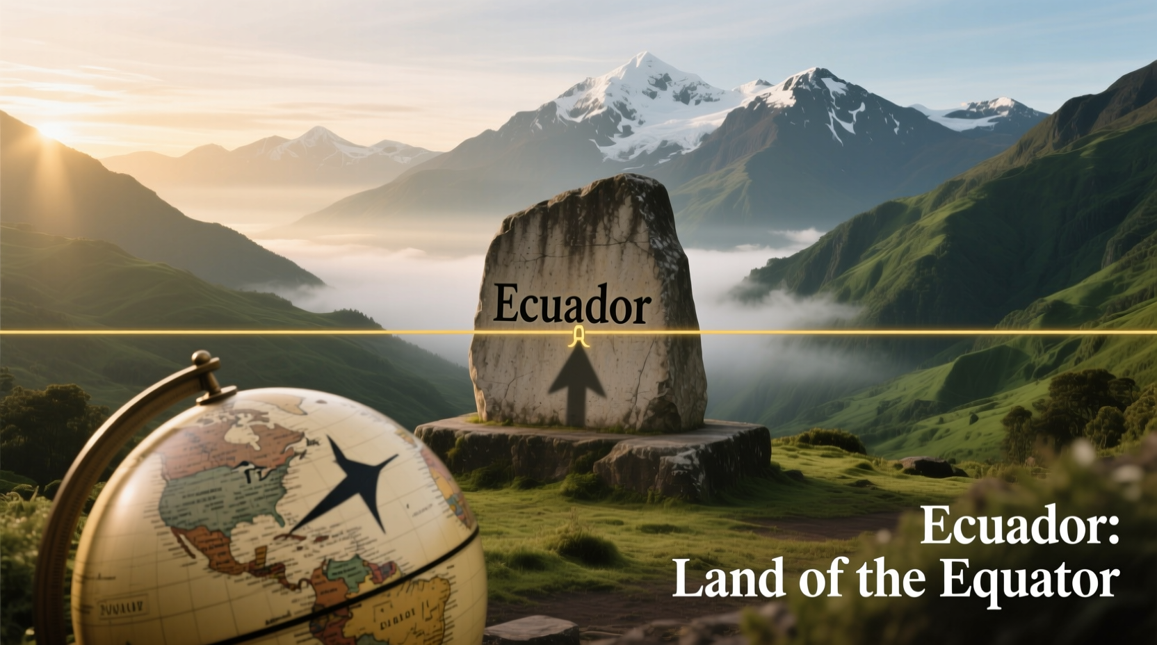
To honor its namesake, Ecuador constructed the **Mitad del Mundo** (Middle of the World) monument just north of Quito. Completed in 1979, the 30-meter-high stone obelisk marks the location where the French Geodesic Mission calculated the equator to pass.
Today, the site is a major tourist destination, complete with museums, cultural shows, and a painted yellow line symbolizing the equator. Visitors can stand with one foot in each hemisphere—a powerful, tangible connection to the country’s name.
Interestingly, modern GPS technology has revealed that the actual equatorial line lies about 240 meters north of the monument. Despite this discrepancy, the symbolic value remains unchanged. The Mitad del Mundo continues to embody Ecuador’s identity as the land of the equator.
| Feature | Mitad del Mundo Monument | True Equator (GPS) |
|---|---|---|
| Latitude | 0°0'8\"S (approximate) | 0°0'0\"N (exact) |
| Location | Pichincha Province, near Quito | ~240m north of monument |
| Height of Obelisk | 30 meters | N/A |
| Constructed | 1979 | Natural geographic feature |
| Visitor Experience | Museum, souvenirs, photo ops | Marked by Intiñan Solar Museum |
Why Not Other Equatorial Countries?
Over a dozen countries lie along the equator, including Brazil, Congo, Uganda, and Indonesia. Yet none have adopted the name. Why?
For many, national names evolved from tribal affiliations, colonial designations, or historical kingdoms. For example:
- Brazil: Named after the brazilwood tree, a valuable export during colonial times.
- Congo: Derived from the Kongo people and the Kingdom of Kongo.
- Uganda: Comes from the Buganda kingdom, which ruled the southern part of the country.
- Indonesia: A scholarly term meaning “Indian Islands,” coined in the 19th century.
Ecuador’s case was different. Emerging during an era of Enlightenment thinking and scientific curiosity, its founders saw an opportunity to align the nation with a universal, precise, and globally recognized reference point. In doing so, they created a brand-like identity centuries before branding became a tool of national promotion.
Timeline: How Ecuador Got Its Name
- 1736–1744: French Geodesic Mission measures the Earth’s shape near Quito, popularizing the term \"Ecuador.\"
- 1822: Region liberates from Spain and joins Gran Colombia.
- 1830: Gran Colombia dissolves; the southern district declares independence.
- 1830: Officially named “República del Ecuador” upon formation.
- 1936: Exact equator line commemorated with early markers.
- 1979: Mitad del Mundo monument inaugurated.
- 1980s–Present: Scientific confirmation of slight GPS deviation; cultural significance endures.
Frequently Asked Questions
Is the equator really in Ecuador?
Yes, the equator passes through several provinces in northern Ecuador, including Carchi, Imbabura, and Pichincha. While the Mitad del Mundo monument is slightly off due to 18th-century measurement limits, the true equator crosses the country just north of Quito.
Can you see the equator when you visit Ecuador?
You cannot see the equator as a visible line, but you can experience it through markers like the Mitad del Mundo monument and the Intiñan Museum, where guides demonstrate gravitational and directional anomalies attributed to the equatorial location.
Does Ecuador have two seasons because of the equator?
Most of Ecuador does not have traditional seasons. Instead, it has a dry season (June–September) and a wet season (October–May). Due to its equatorial position, temperatures remain relatively stable year-round, though altitude greatly influences climate across regions.
Conclusion: A Name That Speaks Volumes
The name Ecuador is more than a label—it’s a statement of identity. Born from scientific inquiry, shaped by independence, and celebrated through culture, it reflects a nation proud of its place on the planet. While other countries may cross the equator, only Ecuador wears it as a badge of honor.
Understanding the origin of the name reveals deeper truths about how geography, history, and human ambition intersect. It reminds us that even invisible lines can leave lasting marks—not just on maps, but on nations.


 浙公网安备
33010002000092号
浙公网安备
33010002000092号 浙B2-20120091-4
Comments
No comments yet. Why don't you start the discussion?