
The equator cuts across Earth like a belt, dividing the planet into northern and southern hemispheres. It’s not just a line on maps—it marks a region of intense heat, consistent climate, and unique environmental patterns. If you’ve ever traveled near the equator or studied global weather systems, you may have wondered: why is it so consistently hot there? The answer lies in a combination of astronomical positioning, solar geometry, atmospheric behavior, and geographic consistency.
Unlike temperate zones that experience dramatic seasonal shifts, equatorial regions maintain high temperatures throughout the year. But this isn’t due to proximity to the sun alone—Earth's distance from the sun varies only slightly over the year and doesn’t explain regional temperature differences. Instead, the key factors are how sunlight strikes the surface and how energy is distributed across latitudes.
The Role of Solar Angle and Direct Sunlight
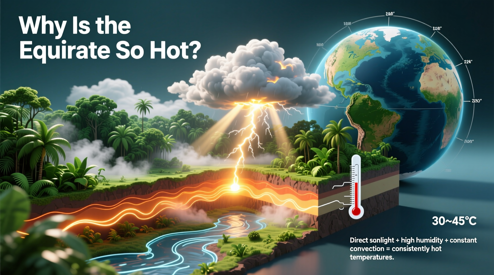
The most critical reason the equator is so hot is the angle at which sunlight hits the Earth’s surface. At the equator, the sun is nearly directly overhead for much of the year, especially during the equinoxes in March and September when the subsolar point (the spot receiving direct vertical rays) sits exactly on the equator.
When sunlight strikes the surface at a high angle—or close to 90 degrees—it delivers more concentrated energy per unit area. This means each square meter of land absorbs more solar radiation compared to higher latitudes, where sunlight arrives at an oblique angle and spreads the same amount of energy over a larger surface area.
This concentration of solar energy leads to rapid heating of both land and ocean surfaces. Over time, this sustained input warms the air above, driving convection and contributing to the humid, tropical climates found near the equator.
Daylight Consistency and Year-Round Exposure
Another major factor is the consistency of daylight. Equatorial regions receive approximately 12 hours of sunlight every day, all year long. There’s minimal variation in day length between seasons because the tilt of Earth’s axis has less effect near the middle of the planet.
In contrast, higher latitudes experience extreme variations—from short winter days to long summer days. While places like Scandinavia get extended sunlight in summer, they also endure long, dark winters. The equator avoids these extremes entirely, resulting in steady daily solar input that sustains high average temperatures.
This regular exposure prevents significant cooling periods. Without cold seasons to offset heat accumulation, thermal inertia keeps equatorial zones warm month after month.
Atmospheric Circulation and Heat Distribution
The atmosphere plays a crucial role in amplifying equatorial heat through global circulation patterns. Warm air rises at the equator due to intense surface heating, creating a low-pressure zone known as the Intertropical Convergence Zone (ITCZ). As this moist, warm air ascends, it cools and condenses, forming clouds and frequent thunderstorms—a hallmark of tropical climates.
Once aloft, the air moves toward the poles at high altitudes before descending around 30° north and south latitude, completing the Hadley Cell circulation. This process effectively transports heat from the equator toward the subtropics, helping regulate Earth’s overall climate balance.
However, the rising motion at the equator reinforces surface warmth by drawing in more warm, moist air from surrounding areas, perpetuating a cycle of heat and humidity.
“Solar insolation intensity combined with atmospheric dynamics makes the equatorial belt Earth’s primary heat engine.” — Dr. Lena Torres, Climatologist, University of Hawaii
Geographic and Surface Factors
Beyond celestial mechanics, geography influences equatorial heat retention. Much of the equatorial zone consists of dense rainforests, large water bodies, and dark vegetation—all of which absorb rather than reflect sunlight.
Albedo, or surface reflectivity, is relatively low in tropical regions. For example, oceans and forests absorb up to 90% of incoming solar radiation, while snow-covered polar regions can reflect up to 80%. This means equatorial surfaces convert more sunlight into heat, further elevating local temperatures.
Additionally, high humidity reduces evaporative cooling. Even though evaporation helps moderate heat, saturated air limits this effect, making the perceived temperature feel even hotter than the actual reading.
Common Misconceptions About Equatorial Heat
One widespread myth is that the equator is hot because it's “closest” to the sun. In reality, Earth orbits the sun in an almost circular path, and our distance varies by only about 3 million miles over the year—insufficient to cause regional temperature differences. Moreover, Earth is actually farthest from the sun (aphelion) in early July, when the Northern Hemisphere experiences summer, proving that distance isn't the driver.
Another misconception is that all equatorial locations are uniformly scorching. While temperatures remain consistently warm, elevation can drastically alter local climate. For instance, Quito, Ecuador, lies on the equator but sits at 2,850 meters (9,350 ft) above sea level, giving it an average temperature of just 14°C (57°F)—cool enough to require a jacket at night.
| Location | Latitude | Elevation | Avg. Temp |
|---|---|---|---|
| Nairobi, Kenya | 1.3°S | 1,795 m | 19°C (66°F) |
| Singapore | 1.3°N | 16 m | 27°C (81°F) |
| Quito, Ecuador | 0.2°S | 2,850 m | 14°C (57°F) |
| Kampala, Uganda | 0.3°N | 1,155 m | 23°C (73°F) |
This demonstrates that while solar geometry sets the baseline, local topography and altitude fine-tune the experience of heat.
Mini Case Study: Singapore vs. Quito
Singapore and Quito are both located within one degree of the equator, yet their climates differ dramatically. Singapore, barely above sea level, experiences sweltering heat year-round with average highs near 31°C (88°F) and oppressive humidity. Its urban environment, surrounded by water, traps heat and limits airflow.
Quito, despite being on the equator, enjoys spring-like conditions thanks to its high-altitude Andean setting. Residents wear sweaters in the evening, and frost occasionally forms at dawn. Yet both cities receive nearly identical amounts of sunlight annually—the difference lies entirely in elevation and terrain.
This contrast underscores that while the equator receives maximum solar energy, real-world temperature outcomes depend on multiple interacting factors beyond latitude alone.
Practical Implications and Travel Tips
Understanding equatorial heat isn’t just academic—it informs travel planning, agriculture, and infrastructure design. Visitors to equatorial regions should prepare for constant warmth, high humidity, and sudden rainfall.
- Avoid midday sun exposure between 11 a.m. and 3 p.m., when UV radiation peaks.
- Use broad-spectrum sunscreen even on cloudy days—equatorial UV levels remain high year-round.
- Choose accommodations with ventilation or air conditioning, especially in lowland tropical zones.
- Be aware of altitude changes—even small climbs can significantly reduce temperatures.
Frequently Asked Questions
Does the equator have seasons?
Not in the traditional sense. Instead of winter and summer, equatorial regions typically alternate between wet and dry seasons driven by shifts in the ITCZ. Temperatures remain stable throughout the year.
Why don’t equatorial regions get hotter over time?
While they receive continuous solar input, natural processes like cloud formation, evaporation, and atmospheric circulation help regulate heat. Thunderstorms release latent heat upward, and wind patterns redistribute excess energy poleward.
Are deserts common at the equator?
No. Most equatorial areas are humid and support rainforests due to abundant rainfall. True deserts are rare here; instead, arid zones tend to form around 30° latitude where dry, descending air from the Hadley Cells suppresses precipitation.
Conclusion: Embracing the Equator’s Thermal Reality
The equator’s heat is not random—it’s the result of precise planetary mechanics, consistent solar delivery, and reinforcing atmospheric systems. From the perpendicular angle of sunlight to the relentless rhythm of 12-hour days, every element contributes to a climate that pulses with thermal energy year after year.
By understanding these forces, we gain deeper insight into Earth’s climate engine and better prepare for life in tropical environments. Whether you're traveling, studying geography, or simply curious about our planet, recognizing the science behind equatorial heat enriches your perspective.


 浙公网安备
33010002000092号
浙公网安备
33010002000092号 浙B2-20120091-4
Comments
No comments yet. Why don't you start the discussion?