All categories
Featured selections
Trade Assurance
Buyer Central
Help Center
Get the app
Become a supplier

2021 New CHC GPS GNSS Receiver RTK GPS Foif CHC Efix Cheap IMU RTK for Land Surveying

Product overview

Core functionalities

Applicable scenarios

Unique advantages

  • Precision Measurement: The 2021 New CHC GPS GNSS Receiver provides accurate RTK positioning for land surveying.
  • Advanced Technology: Equipped with IMU technology for enhanced stability and reliability in measurements.

Key features

  • 1. Advanced Material Technology

  • With its corrosion-resistant metal body, ensure long-lasting durability in challenging surveying environments.

  • 2. Interactive Design

  • With an intuitive touchscreen interface, you can navigate through various functions effortlessly, enhancing user experience.

  • 3. Superior Performance Parameters

  • With an advanced GNSS receiver, achieve precise land surveying results ~20% faster than traditional models* [*Disclaimer: Based on internal testing; actual results may vary].

  • 4. Versatile Scenario Solutions

  • With its adaptability for both urban and rural land surveying, you can achieve accurate measurements in diverse environments.

  • 5. Certification Standards

  • With eco-friendly certification, you can be confident in the product's compliance with environmental safety standards.

Product details

2021 New CHC GPS GNSS Receiver RTK GPS Foif CHC Efix Cheap IMU RTK for Land Surveying

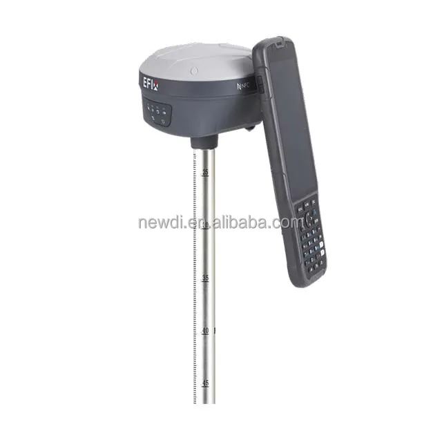
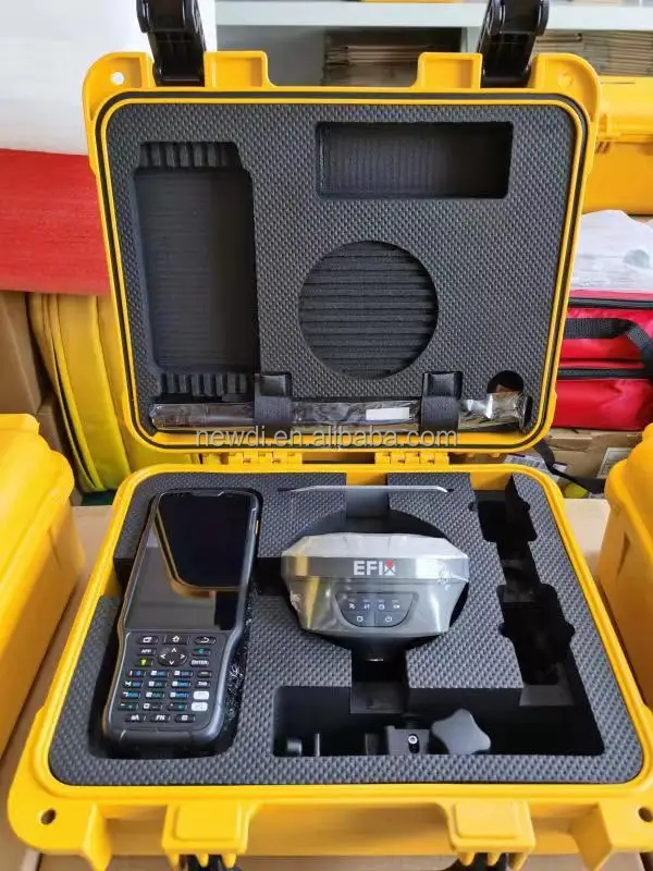
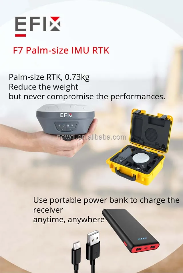
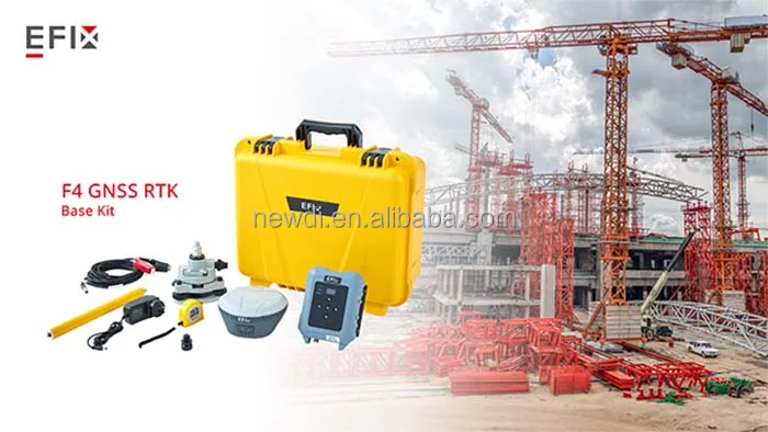
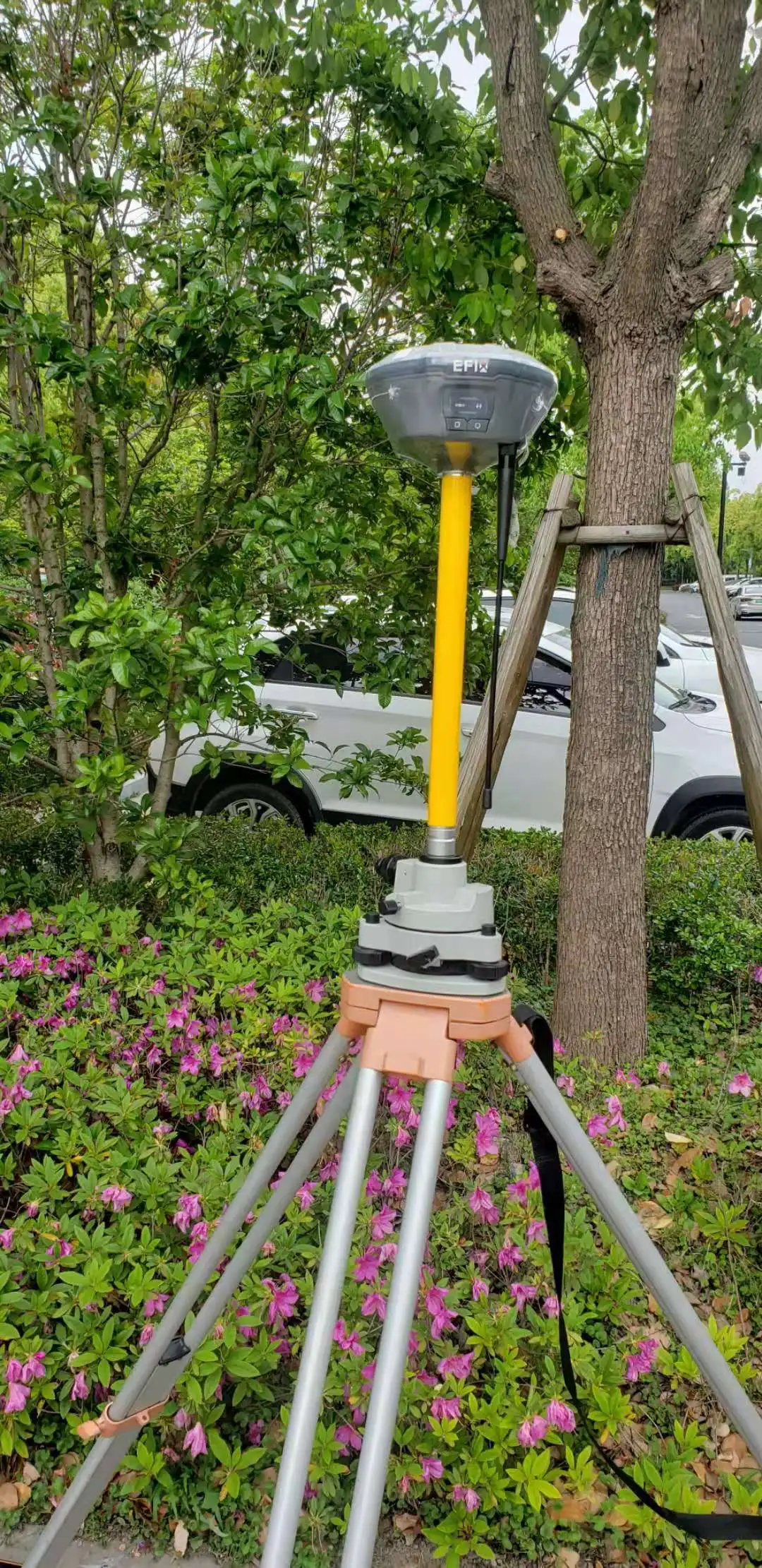
The 2021 New CHC GPS GNSS Receiver is a cutting-edge RTK GPS device designed for precision land surveying. Its advanced IMU technology ensures accurate and reliable measurements, making it an ideal choice for professionals in the field.

Technical specifications

FeatureSpecificationBenefit
GNSS ReceiverMulti-frequencyEnhanced accuracy
IMU TechnologyIntegratedStability in motion
RTK CapabilityYesReal-time positioning
Battery Life10 hoursExtended field work

Customization guide

Adjustable frequency settings to meet specific surveying requirements and geographic conditions.

Get inspired

With the CHC GPS GNSS Receiver, you can achieve unparalleled accuracy in land surveying, revolutionizing your approach to precision mapping.

Choose your model

ParameterBase ModelAdvanced ModelPro Model
Accuracy LevelStandard[+15%][+30%]*
Battery Duration8 hours10 hours12 hours
ConnectivityBasicEnhancedPremium

Supplier's note

The Pro version's integrated IMU technology significantly enhances measurement stability, making it three times more reliable in dynamic environments. When paired with its extended battery life, this model is ideal for comprehensive surveying projects.
For users seeking to maximize efficiency, the Advanced Model offers enhanced accuracy, suitable for most professional applications, while the Base Model provides reliable performance for everyday tasks.

Frequently asked questions

  • Which model of CHC GPS GNSS Receiver is best for land surveying?

  • How do I maintain the CHC GPS GNSS Receiver for optimal performance?

  • What are the advantages of using a CHC GPS GNSS Receiver over other models?

  • Can the CHC GPS GNSS Receiver be customized for specific surveying needs?

  • Is the CHC GPS GNSS Receiver approved for industrial measuring and testing?

  • How does the CHC GPS GNSS Receiver compare to other surveying instruments?

  • What materials are used in the construction of the CHC GPS GNSS Receiver?

  • Can I get technical support for the CHC GPS GNSS Receiver?

Product comparison

CategoryUsage ScenariosCharacteristicsAdvantagesDisadvantages
Industrial Measuring InstrumentsLand SurveyingHigh precision (±1cm accuracy in RTK mode)Ensures accurate measurementsRequires clear sky view for best results
GPS GNSS ReceiverGeolocation TrackingMulti-band support (L1, L2, L5)Improved signal reliabilityCan be costly
RTK GPSConstruction ProjectsReal-time kinematic capability (instantaneous position fix)Reduces surveying time significantlyNeeds base station setup
Foif GNSS SystemsInfrastructure MappingDual-frequency operation (reduces ionospheric errors)Enhanced accuracy in dense areasComplex setup for beginners
IMU RTKAerial MappingIntegrated IMU (Inertial Measurement Unit)Provides stable navigation in motionHigher power consumption
CHC EfixBoundary DemarcationRugged design (IP67 rated)Suitable for harsh environmentsIncreased weight for portability

Related searches

The Product Description is generated by third-party, and Alibaba.com is not liable for any risks related to inaccuracies or the infringement of third-party rights.

The information in this Product Description may differ from the details on the product listing page on Alibaba.com. Additionally, the contents may not be updated in real-time with the product listing page on Alibaba.com, and there may be delays in reflecting the most updated information. The description on product listing page takes precedence. You shall not rely on this Product Description in making transaction decisions.

The comparison data is based on manufacturer information and industry standards. Actual results may vary depending on individual use cases. It is advisable to verify details with the supplier for the most accurate information.