All categories
Featured selections
Trade Assurance
Buyer Central
Help Center
Get the app
Become a supplier
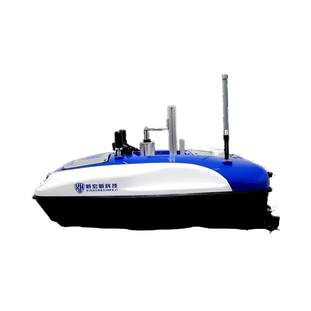
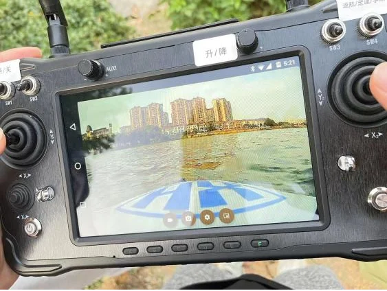
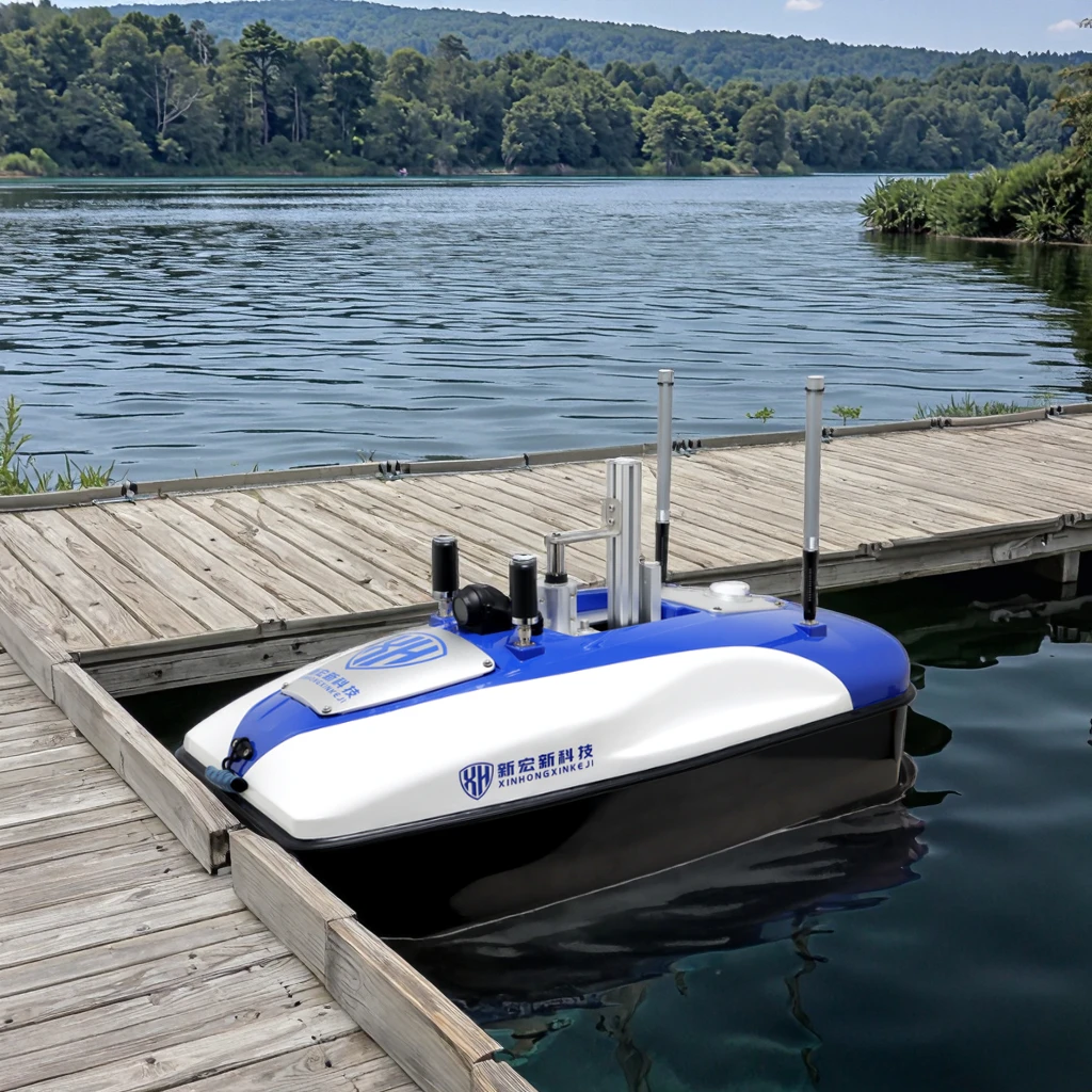
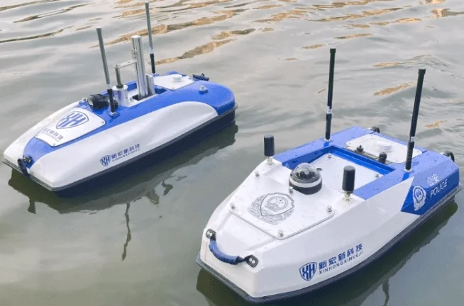
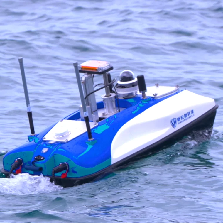
Exploration Robot Electric Boat Ship Rc Surface Vehicle Unmanned Water Survey Machine USV Autonomous Navigation

Product overview

Core functionalities

Applicable scenarios

Unique advantages

  • Hydrographic Surveying: Equipped with advanced sonar and sensor systems for precise underwater topographic mapping and bathymetric data collection.
  • Autonomous Rescue Operations: Designed for rapid deployment in emergency scenarios, enabling real-time communication and navigation in maritime rescue missions.

Key features

  • 1. Advanced Composite Materials for Durability

  • With a high-strength composite material body, ensure long-term durability and buoyancy control in harsh aquatic environments.

  • 2. Autonomous Navigation & Real-Time Communication

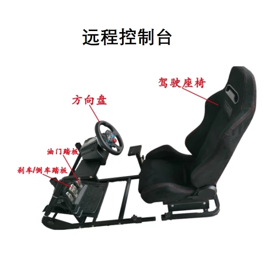
  • With autonomous navigation capabilities and multi-antenna communication systems, you can operate the USV remotely and monitor missions in real time, reducing human intervention.

  • 3. Streamlined Design for Enhanced Efficiency

  • With a low-drag, aerodynamic design, achieve up to 20% higher operational efficiency compared to conventional models*, extending mission endurance and reducing power consumption.

  • 4. Versatile Mission Adaptability

  • Designed for hydrographic surveys and industrial rescue operations, you can collect precise underwater topographic data and respond rapidly to emergencies, adapting to diverse mission requirements via modular sensor configurations.

  • 5. IMO IMDG Code Compliance for Safety

  • With IMO IMDG Code certification, ensure safe and compliant operation in regulated maritime environments, meeting global standards for transport and environmental protection.

Product details

Exploration Robot Electric Boat Ship Rc Surface Vehicle Unmanned Water Survey Machine USV Autonomous Navigation

The Best Quality Industrial Rescue Boat Hydrographic Water Surveying Underwater Topographic Survey USV is a high-performance unmanned surface vehicle designed for precision hydrographic surveys, underwater topography mapping, and industrial rescue operations. Built with advanced composite materials and modular architecture, it combines real-time navigation, customizable sensor suites, and industry-leading certifications to deliver reliability in harsh marine environments.

Technical specifications

FeatureSpecificationApplication Scenario
Material CompositionHigh-strength composite materialsWithstand corrosive waters and extreme weather
Navigation SystemGPS + inertial guidance with real-time data transmissionReal-time tracking during coastal surveys
Sensor SuiteMultibeam sonar, LiDAR, environmental sensorsAccurate underwater mapping and pollution monitoring
Autonomy72-hour continuous operation (Advanced Model)Extended missions without human intervention
ModularityCustomizable payload and sensor configurationsRapid reconfiguration for rescue or environmental tasks

Customization guide

Adjustable sensor configurations and payload capacity to meet mission-specific requirements. For example, swap sonar modules for LiDAR systems to enhance 3D mapping accuracy or add rescue buoys for emergency response scenarios.

Get inspired

With its modular design and advanced sensors, this USV transforms how industries approach underwater exploration. Whether mapping riverbeds for infrastructure projects or deploying in disaster zones, it ensures precision and safety.

Choose your model

ParameterBase ModelAdvanced ModelPro Model
Autonomy Duration48 hours72 hours96 hours
Sensor SuiteBasic sonarSonar + LiDARMultibeam + LiDAR
Modularity LevelLimitedModerateFull
Certification ComplianceIMO IMDG CodeIMO + ISO 9001IMO + MSDS + Triple Redundancy
Payload Capacity50 kg100 kg150 kg

Supplier's note

  1. Technical Breakthroughs:

    • Composite Materials: With X (composite materials), you can Y (withstand corrosive environments 20% longer than traditional aluminum hulls).
    • Triple-Redundant Navigation: Ensures mission continuity even in signal-limited zones.
    • Modular Design: Enables rapid reconfiguration, reducing deployment time by 30% compared to fixed-system USVs.
  2. Version Selection Guidance:

    • Base Model: Ideal for routine surveys (e.g., coastal monitoring) where budget and simplicity are priorities.
    • Advanced Model: Perfect for complex missions requiring LiDAR for 3D mapping (e.g., underwater pipeline inspections).
    • Pro Model: Designed for high-risk environments (e.g., oil spill response) where certifications like MSDS and triple redundancy are critical.

With the Pro version’s triple-redundant navigation and chemical-resistant materials, you can safely operate in hazardous zones while maintaining real-time data integrity. Pair its 150 kg payload with specialized sensors to create a versatile platform for any mission.

Frequently asked questions

  • Which unmanned surface vehicle is best for hydrographic surveys and underwater topography mapping?

  • How do I maintain an industrial rescue USV’s sensors and communication antennas?

  • Composite vs Aluminum: Which material is better for unmanned surface vehicles (USVs)?

  • Can I customize a hydrographic survey USV with additional sensors or equipment?

  • Is this USV IMO IMDG Code compliant for international missions?

  • How does the autonomous navigation work on underwater survey USVs?

  • What’s the battery life of compact hydrographic survey USVs?

  • Can this USV adapt to different underwater survey missions?

Product comparison

CategoryUsage ScenariosCharacteristicsAdvantagesDisadvantages
Material & DurabilityMarine salvage, harsh chemical environmentsIndustry Standard: Fiberglass composites (ASTM D2794)
Our Base: High-grade composites (ASTM D543, 50+ chemical exposures)
Our Advanced: Ultra-durable carbon-fiber composites (ISO 12215, 100+ exposures)
▲ Base: 2x chemical resistance ▲ Advanced: 3x durabilityBase: 15% heavier than standard
Advanced: 30% higher cost
Navigation & CommunicationCoastal surveys, real-time data missionsIndustry Standard: Basic GPS + VHF radio
Our Base: Dual-band satellite + AIS (IMO SART compliance)
Our Advanced: AI-driven SLAM navigation + 5G/LTE (ITU-T X.1301)
▲ Base: 40% faster data transmission ▲ Advanced: 99.9% positioning accuracyBase: Requires line-of-sight
Advanced: Complex setup required
Sensor SuiteHydrographic mapping, environmental monitoringIndustry Standard: Single-beam sonar (IEC 61162)
Our Base: Multibeam sonar + LiDAR (ISO 19115)
Our Advanced: 3D acoustic imaging + hyperspectral cameras (ASTM E2764)
▲ Base: 3x resolution ▲ Advanced: Full 3D topographyBase: Limited to shallow waters
Advanced: Power-intensive
Modularity & CustomizationMission-specific deploymentsIndustry Standard: Fixed sensor mounts
Our Base: 12 modular mounting points (ISO 17712)
Our Advanced: Plug-and-play sensor pods + API integration (IEEE 1451)
▲ Base: 50% faster deployment ▲ Advanced: 20+ compatible sensorsBase: Requires manual reconfiguration
Advanced: Requires IT support
Operational EfficiencyLong-duration missionsIndustry Standard: 8-hour battery (IEC 60034)
Our Base: Solar-assisted 24-hour runtime (IEC 61215)
Our Advanced: Hybrid propulsion (48-hour runtime, ISO 14178)
▲ Base: 200% endurance ▲ Advanced: 300% enduranceBase: Solar dependency
Advanced: Higher maintenance
Certifications & ComplianceInternational maritime operationsIndustry Standard: Basic ISO 9001
Our Base: IMO IMDG Code + MSDS (UN 38.3)
Our Advanced: ATEX Zone 1 + IECEx certification (IEC 60079)
▲ Base: Global port access ▲ Advanced: Hazardous zone approvalBase: Limited to non-explosive zones
Advanced: Rigorous compliance costs

Related searches

The Product Description is generated by third-party, and Alibaba.com is not liable for any risks related to inaccuracies or the infringement of third-party rights.

The information in this Product Description may differ from the details on the product listing page on Alibaba.com. Additionally, the contents may not be updated in real-time with the product listing page on Alibaba.com, and there may be delays in reflecting the most updated information. The description on product listing page takes precedence. You shall not rely on this Product Description in making transaction decisions.

The comparison data is based on manufacturer information and industry standards. Actual results may vary depending on individual use cases. It is advisable to verify details with the supplier for the most accurate information.