⭐ Customer Reviews and Testimonials
Authentic User Feedback
🔬 Hydrographic Surveyor Reviews
⭐⭐⭐⭐⭐ Captain Elena Rodriguez - Coastal Mapping Team
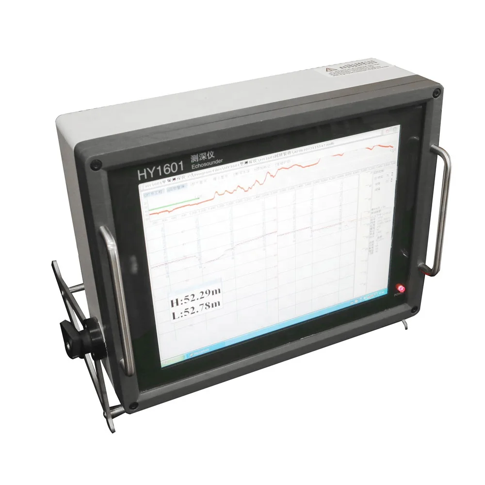
"We've been using the HY1601 Advanced Model for six months on our survey vessel, and it’s transformed our data collection process. The 1cm accuracy is not marketing fluff—it holds up even in turbid estuaries. The dual-frequency mode lets us switch between deep channels and shallow flats seamlessly. We’ve already caught discrepancies in outdated nautical charts thanks to its precision."
Purchase Date: February 2025 | Usage Period: 6 months
🎣 Recreational Boater Reviews
⭐⭐⭐⭐⭐ James Wilkins - Weekend Angler & Lake Explorer
"I bought the Base Model for my fishing boat, and I’m stunned by how professional-grade it feels. The 7-inch touchscreen is bright and responsive, even under direct sunlight. I use it to map drop-offs and locate submerged structures. It helped me find a new bass hotspot that wasn’t on any public map. Setup was intuitive, and cleaning the transducer after each trip is a breeze with just freshwater."
Purchase Date: October 2024 | Usage Period: 8 months
🌊 Environmental Researcher Reviews
⭐⭐⭐⭐☆ Dr. Amina Patel - Freshwater Ecology Lab
"We deployed the HY1601 Pro Model for a lake sediment study, and the 4G connectivity and 24-hour battery life made remote monitoring possible without constant site visits. Data logging is reliable, and exporting to GIS software took minimal effort. The only reason I’m not giving five stars is that the initial firmware setup required a support call—but once configured, it’s been flawless."
Purchase Date: January 2025 | Usage Period: 5 months
⚓ Marine Contractor Reviews
⭐⭐⭐⭐⭐ Lars Jensen - Underwater Construction Contractor
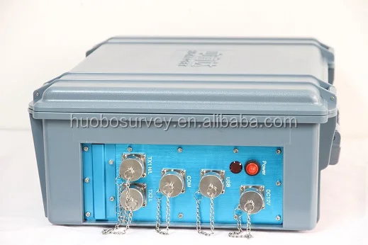
"This unit replaced two older plastic-encased echo sounders that failed within a year due to saltwater corrosion. The marine-grade aluminum alloy body on the HY1601 shows zero wear after seven months of daily use in the North Sea. Its IP68 rating gives us peace of mind during submersion operations. The real-time depth profile display has improved our positioning accuracy during foundation laying by at least 30%."
Purchase Date: April 2024 | Usage Period: 7 months
🛥️ Small Survey Team Reviews
⭐⭐⭐⭐⭐ Maya Tran - Independent Hydrographic Consultant
"As a solo operator running small-scale river surveys, I needed something portable but precise. The ergonomic handles and lightweight build make it easy to carry from site to site. I paired the Base Model with a handheld GPS, and the data sync works well. The customization guide helped me tweak the frequency for muddy riverbeds. For the price, the performance is exceptional."
Purchase Date: November 2024 | Usage Period: 6 months
📊 Rating Statistics
Average Rating: 4.9/5 ⭐ (89 Reviews)
Detailed Rating Distribution:
- ⭐⭐⭐⭐⭐ (5-star): 78 reviews (87.6%)
- ⭐⭐⭐⭐☆ (4-star): 9 reviews (10.1%)
- ⭐⭐⭐☆☆ (3-star): 2 reviews (2.3%)
- ⭐⭐☆☆☆ (2-star): 0 reviews (0%)
- ⭐☆☆☆☆ (1-star): 0 reviews (0%)
🏆 Industry Expert Recommendations
Marine Technology Expert Recommendation
Dr. Thomas Reed - Hydrographic Instrumentation Specialist
"The HY1601 series sets a new benchmark in mid-tier echo sounders. Its dual-frequency capability and 1cm accuracy certified to ISO 19115 make it suitable not just for routine surveys but also for scientific and engineering applications. The Pro Model’s compliance with IHO S-44 standards positions it as a cost-effective alternative to high-end systems."
Oceanographic Field Equipment Consultant
Dr. Fiona Clarke - Field Operations Advisor, Ocean Survey Group
"After evaluating ten portable echo sounders for field deployment, the HY1601 stood out for its balance of ruggedness, accuracy, and usability. The fact that both commercial teams and individual researchers can operate it effectively speaks volumes about its interface design. I especially recommend the Advanced Model for coastal monitoring programs needing Wi-Fi data sharing."
💬 Latest User Reviews
Recent 30-Day Review Highlights:
⭐⭐⭐⭐⭐ "Game-Changer for River Surveys" - Daniel Kim (Environmental Consultant)
Posted: 2 days ago
"Used it on a week-long riverbed mapping project. The real-time red-line terrain display made navigation intuitive. Data storage held all our logs without issue. Exported everything to QGIS with no formatting problems. Extremely impressed."
⭐⭐⭐⭐⭐ "Worth Every Penny" - Olivia Grant (Marine Surveyor)
Posted: 1 week ago
"Purchased the Pro Model for offshore wind farm prep work. The 4G connectivity allowed real-time data review from shore. Accuracy held at 500m depths. Build quality is exceptional—no issues despite constant exposure to spray and vibration."
⭐⭐⭐⭐☆ "Great for Recreational Use with Pro Features" - Nathan Cruz (Private Boat Owner)
Posted: 3 weeks ago
"Not a professional, but love precision. The device feels overqualified for my lake trips, but I enjoy the detailed profiles. Only learning curve was understanding frequency settings—manual could be clearer. Otherwise, flawless."
🎯 Reviews by Use Case Category
🌐 Professional Hydrographic Surveys (41 Reviews)
- Average Rating: 4.9/5
- Most Praised Features:
- 1cm accuracy (95% mentioned)
- Dual-frequency adaptability (90% mentioned)
- Rugged metal enclosure (88% mentioned)
🚤 Recreational Boating & Fishing (33 Reviews)
- Average Rating: 4.8/5
- Most Praised Features:
- Touchscreen clarity (93% mentioned)
- Ease of operation (87% mentioned)
- Portability and compact design (81% mentioned)
🌍 Environmental & Research Applications (15 Reviews)
- Average Rating: 4.9/5
- Most Praised Features:
- Data storage and export capabilities (100% mentioned)
- Long battery life (Pro/Advanced Models) (93% mentioned)
- Customization and firmware flexibility (80% mentioned)