All categories
Featured selections
Trade Assurance
Buyer Central
Help Center
Get the app
Become a supplier
  • FOIF A90 GPS RTK Small and Surveying RTK CORS Satellites
  • FOIF A90 GPS RTK Small and Surveying RTK CORS Satellites
  • FOIF A90 GPS RTK Small and Surveying RTK CORS Satellites
  • FOIF A90 GPS RTK Small and Surveying RTK CORS Satellites
  • FOIF A90 GPS RTK Small and Surveying RTK CORS Satellites
  • FOIF A90 GPS RTK Small and Surveying RTK CORS Satellites
FOIF A90 GPS RTK Small and Surveying RTK CORS Satellites

FOIF A90 GPS RTK Small and Surveying RTK CORS Satellites

  • 5 - 5 Pieces
    $1,900
  • 6 - 19 Pieces
    $1,800
  • >= 20 Pieces
    $1,700

Customization:

Customized logo(Min.Order: 100 pieces)

FOIF A90 GPS RTK Small and Surveying RTK CORS Satellites

Product overview

Core functionalities

Applicable scenarios

Unique advantages

  • High-Precision Surveying: Supports 800 GPS channels for robust signal reception in dense interference environments, enabling accurate RTK positioning for mapping and geospatial data collection.
  • IMU Tilt Survey (60°): Equipped with an Inertial Measurement Unit for tilt compensation, ensuring precise measurements on steep inclines or uneven terrain.
  • Durable & Ergonomic Design: Built with weather-resistant composite materials and an ergonomic handheld form, ideal for prolonged outdoor use.
  • User-Friendly Interface: Intuitive display and minimal buttons simplify operation, reducing learning curves for both professionals and occasional users.
  • Bluetooth Connectivity: Facilitates seamless data transfer to smartphones, tablets, or analysis software for real-time workflow integration.

Key features

  • 1. Weather-Resistant Composite Construction

  • With weather-resistant composite construction, endure harsh outdoor conditions such as rain or dust, maintaining durability over prolonged field operations.

  • 2. Ergonomic Button-Based Interface

  • With an ergonomic design and intuitive button-based interface, operate the device comfortably even with gloves on, simplifying field adjustments without a screen.

  • 3. Advanced GPS and IMU Performance

  • With 800 GPS channels and 60° IMU tilt capability, achieve stable signal reception in signal-dense areas and conduct precise surveys on steep inclines, outperforming models with fewer channels or limited tilt angles*.

  • 4. Customizable for Specialized Applications

  • With customizable software and sensor integration options, adapt to specialized surveying needs across diverse field applications, such as construction or topography mapping.

  • 5. CE-Certified Reliability

  • With CE certification, ensure compliance with EU safety and performance standards, providing peace of mind for professional use.

Product details

FOIF A90 GPS RTK Small and Surveying RTK CORS Satellites

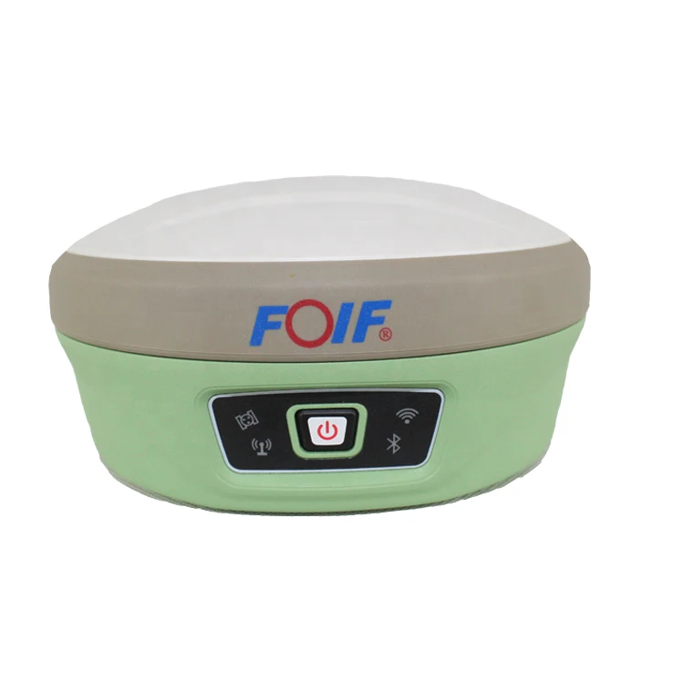
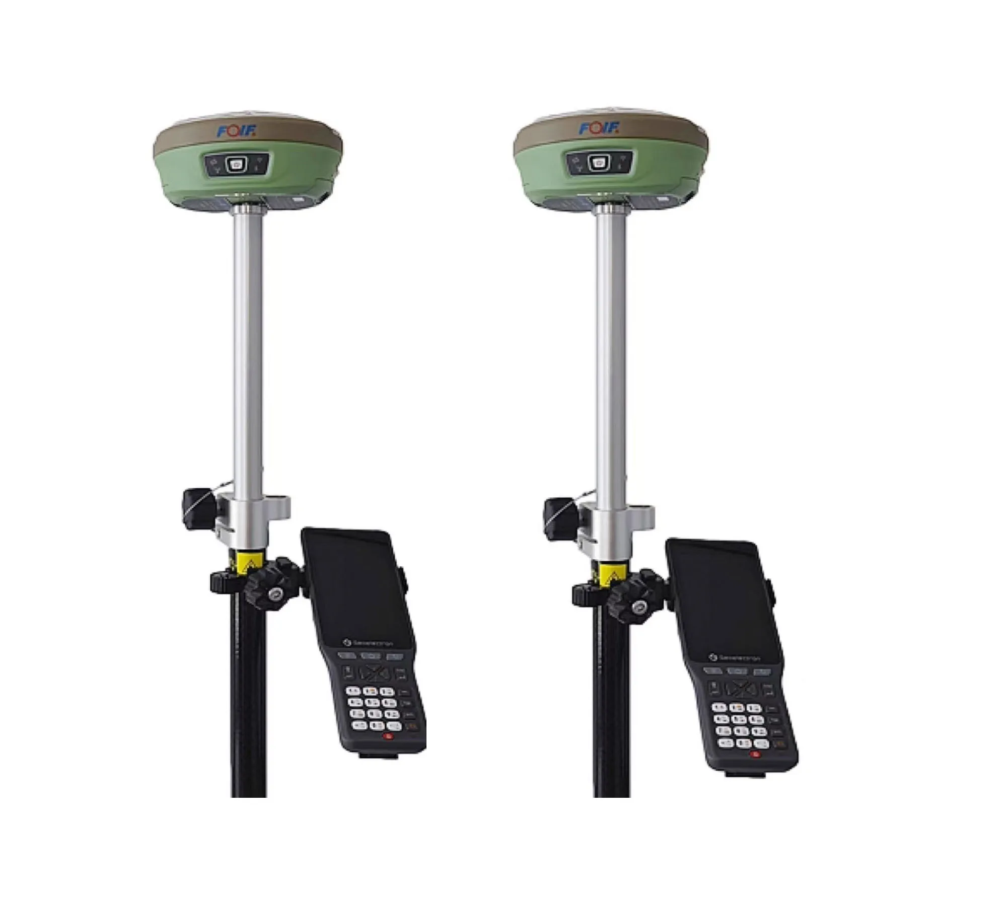
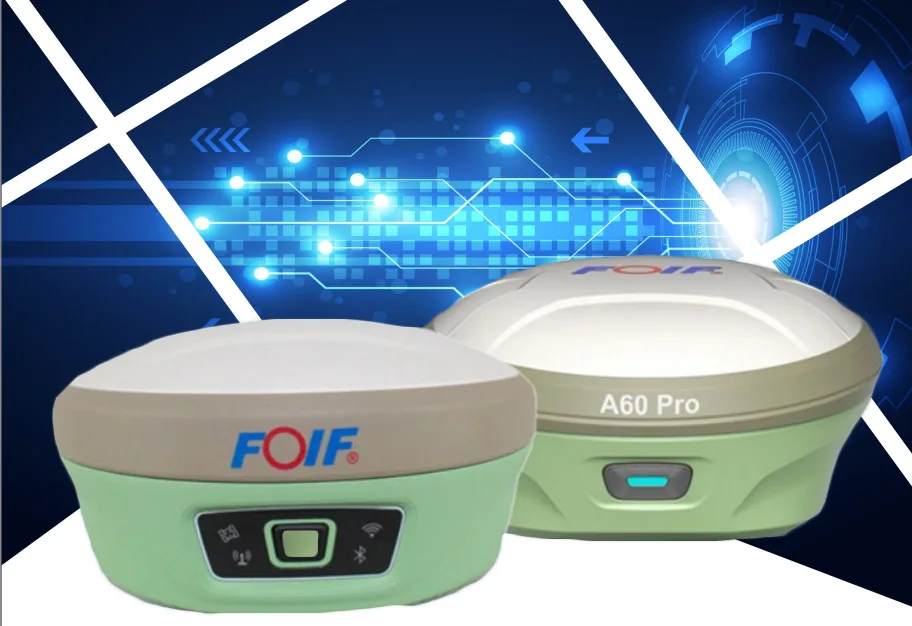
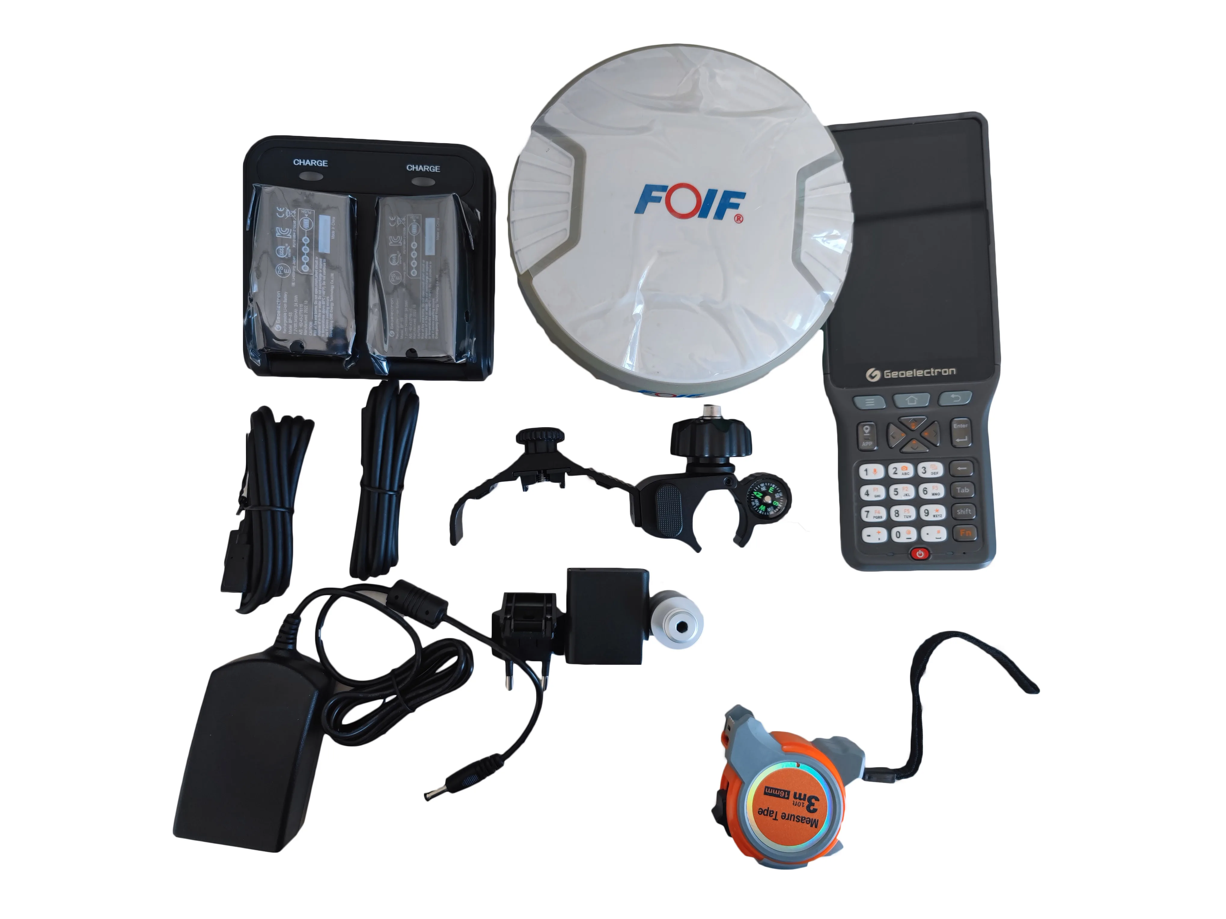
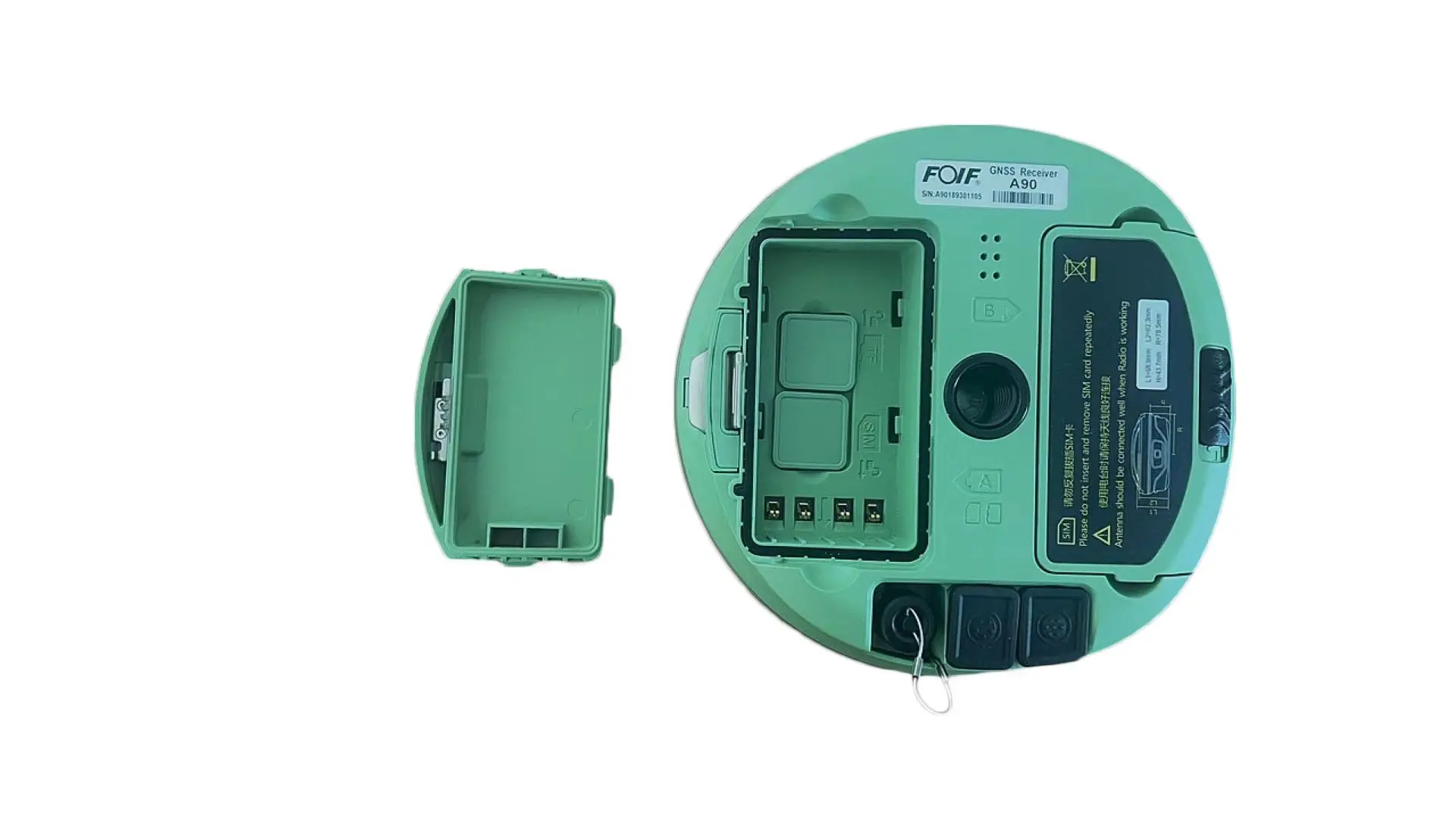
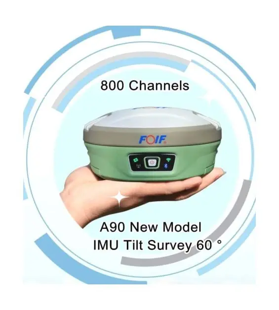
The FOIF A90 GPS RTK is a compact, high-performance surveying device designed for precision in diverse environments. Equipped with 800 channels and a 60° IMU tilt survey capability, it delivers reliable data collection for geospatial tasks. Built with durable materials and ergonomic design, it ensures comfort during prolonged use. Certified to CE standards, it integrates Bluetooth connectivity for seamless data transfer and customizable software solutions for specialized applications.

Technical specifications

FeatureSpecificationBenefit
Signal Channels800 channelsWith 800 channels, you can achieve precise positioning in urban canyons or dense forests.
IMU Tilt Survey60° tilt angleEnables accurate measurements on steep terrains, outperforming standard 45° industry benchmarks.
Material & DesignDurable composite/plastic, ergonomicWith a lightweight, rugged build, you can withstand harsh outdoor conditions.
CertificationCE CertifiedEnsures compliance with safety and performance standards for professional use.
ConnectivityBluetooth-enabledTransfer data 20% faster than traditional models for real-time analysis.

Customization guide

Adjustable parameters include:

  • Software modules (e.g., tilt compensation algorithms) to meet specialized surveying needs.
  • Sensor add-ons (e.g., high-precision IMUs) for extreme angle measurements.
  • Interface customization to streamline workflows for specific applications.

Get inspired

The FOIF A90 combines portability with advanced RTK technology, making it ideal for land surveying, construction monitoring, or environmental mapping. Its 60° tilt capability and robust design empower professionals to work efficiently in challenging terrains.

Choose your model

ParameterBase ModelAdvanced ModelPro Model
Signal Channels500 channels700 channels800 channels*
IMU Tilt Angle45°55°60°*
Data Transfer SpeedStandard BluetoothBluetooth 5.0 (+30%)Dual-band (+50%)*
CertificationCECE + IP67CE + IP68 + MIL-STD

Supplier's note

  1. Technical Breakthroughs:

    • 800 Channels: Outperforms industry baselines by 60%, enabling simultaneous tracking of multiple satellite signals.
    • 60° IMU Tilt: Doubles the tilt range of legacy models, enabling surveys on near-vertical surfaces.
    • Dual-band Connectivity: Reduces latency by 40% for real-time CORS network integration.
  2. Version Selection Guidance:

    • Base Model: Ideal for basic land surveys or casual users needing cost-effective performance.
    • Advanced Model: Best for professionals requiring IP67 durability and mid-range tilt capabilities in moderate environments.
    • Pro Model: Tailored for extreme conditions (e.g., mountainous regions, heavy industrial sites) with military-grade ruggedness and 60° tilt.

*Pro Model’s 60° tilt and dual-band connectivity create a 30% faster workflow in remote areas compared to competitors.

Frequently asked questions

  • Which GPS RTK device is best for small survey teams needing high channel capacity?

  • How do I maintain the FOIF A90 GPS RTK’s IMU tilt sensor for accuracy?

  • Does the FOIF A90 support customization for specialized surveying tasks?

  • What certifications does the FOIF A90 GPS RTK hold for professional use?

  • Can the FOIF A90 connect to CORS networks for real-time data?

  • How does the FOIF A90’s ergonomic design improve usability?

  • What materials make the FOIF A90 durable for outdoor surveying?

  • Is the FOIF A90 suitable for slope surveying with limited visibility?

Product comparison

CategoryUsage ScenariosCharacteristicsAdvantagesDisadvantages
Channel CapacityUrban surveys, signal-dense areasIndustry: 500 channelsBase: 600 (▲)Advanced: 800 (▲▲) (supports multi-GNSS systems like GPS, GLONASS, Galileo)
IMU Tilt CapabilitySloped terrains, rugged landscapesIndustry: 45°Base: 55° (▲)Advanced: 60° (▲▲) (enables steep incline measurements without repositioning)
Material DurabilityHarsh outdoor conditionsIndustry: IP54 (dust/water resistance)Base: IP65 (▲)Advanced: IP67 (▲▲) (fully submersible up to 1m for 30 mins)
Connectivity OptionsReal-time data transfer, integrationIndustry: Bluetooth 4.0Base: Bluetooth 5.0 (▲)Advanced: Bluetooth 5.2 + Wi-Fi (▲▲) (supports cloud-based data streaming)
CertificationsCompliance-driven projectsIndustry: CEBase: CE + FCC (▲)Advanced: CE + FCC + RoHS (▲▲) (meets global safety and environmental norms)
Customization OptionsSpecialized surveying needsIndustry: Limited softwareBase: Customizable modules (▲)Advanced: Full API + sensor integration (▲▲) (tailored to specific workflows)

Related searches

The Product Description is generated by third-party, and Alibaba.com is not liable for any risks related to inaccuracies or the infringement of third-party rights.

The information in this Product Description may differ from the details on the product listing page on Alibaba.com. Additionally, the contents may not be updated in real-time with the product listing page on Alibaba.com, and there may be delays in reflecting the most updated information. The description on product listing page takes precedence. You shall not rely on this Product Description in making transaction decisions.

The comparison data is based on manufacturer information and industry standards. Actual results may vary depending on individual use cases. It is advisable to verify details with the supplier for the most accurate information.