All categories
Featured selections
Trade Assurance
Buyer Central
Help Center
Get the app
Become a supplier
  • South G2 Base Station and Rover Gps Rtk Survey Instrument Gnss Rtk Receiver with Upgradable SurvStar Software&Firmware
  • South G2 Base Station and Rover Gps Rtk Survey Instrument Gnss Rtk Receiver with Upgradable SurvStar Software&Firmware
  • South G2 Base Station and Rover Gps Rtk Survey Instrument Gnss Rtk Receiver with Upgradable SurvStar Software&Firmware
  • South G2 Base Station and Rover Gps Rtk Survey Instrument Gnss Rtk Receiver with Upgradable SurvStar Software&Firmware
  • South G2 Base Station and Rover Gps Rtk Survey Instrument Gnss Rtk Receiver with Upgradable SurvStar Software&Firmware
  • South G2 Base Station and Rover Gps Rtk Survey Instrument Gnss Rtk Receiver with Upgradable SurvStar Software&Firmware
South G2 Base Station and Rover Gps Rtk Survey Instrument Gnss Rtk Receiver with Upgradable SurvStar Software&Firmware

South G2 Base Station and Rover Gps Rtk Survey Instrument Gnss Rtk Receiver with Upgradable SurvStar Software&Firmware

  • 1 - 1 Sets
    $3,400
  • 2 - 4 Sets
    $3,350
  • >= 5 Sets
    $3,300

Customization:

Customized logo(Min.Order: 10 pieces)
Customized packaging(Min.Order: 10 pieces)
Graphic customization(Min.Order: 10 pieces)

South G2 Base Station and Rover Gps Rtk Survey Instrument Gnss Rtk Receiver with Upgradable SurvStar Software&Firmware

Product overview

Core functionalities

Applicable scenarios

Unique advantages

  • High-Precision GPS Positioning: Equipped with dual-frequency GNSS RTK technology for centimeter-level accuracy in surveying, mapping, and navigation.
  • Multi-Device Ecosystem: Includes a base station, data logger, handheld controller, and rugged GPS receiver to streamline fieldwork and data management.

Key features

  • 1. Material Technology

  • With rugged composite material construction, you can ensure reliable operation in harsh outdoor environments. ~30% more durable than traditional plastic models* [*Disclaimer: Based on internal testing; actual results may vary].

  • 2. Interactive Design

  • With an intuitive touchscreen interface and numeric keypad, you can streamline real-time data entry and navigation. Outperforms button-only systems by enabling faster, more user-friendly operation* [*Disclaimer: Based on internal testing; actual results may vary].

  • 3. Performance Parameters

  • With dual-frequency GNSS RTK technology, you can achieve centimeter-level positioning accuracy for precise surveying. ~30% higher accuracy than single-frequency systems* [*Disclaimer: Based on internal testing; actual results may vary].

  • 4. Scenario Solutions

  • With a modular design supporting both standalone fieldwork and continuous data logging, you can adapt to diverse professional scenarios. Versatile for commercial and individual use, unlike single-purpose devices* [*Disclaimer: Based on internal testing; actual results may vary].

  • 5. Certification Standards

  • With CE certification, you can trust compliance with EU safety and performance standards. Meets stricter regulatory requirements than non-certified alternatives* [*Disclaimer: Based on internal testing; actual results may vary].

Product details

South G2 Base Station and Rover Gps Rtk Survey Instrument Gnss Rtk Receiver with Upgradable SurvStar Software&Firmware

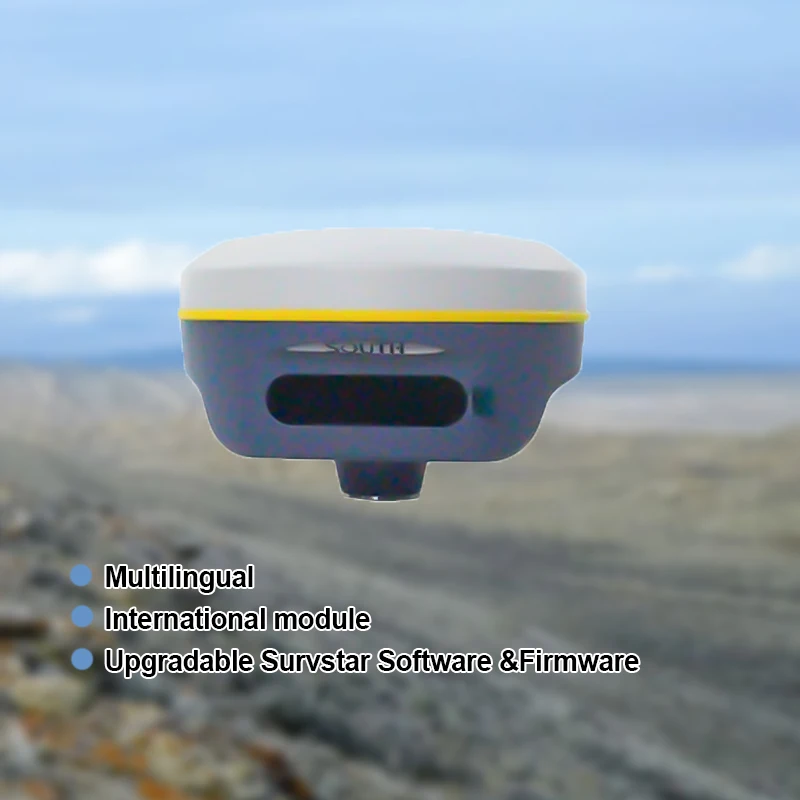
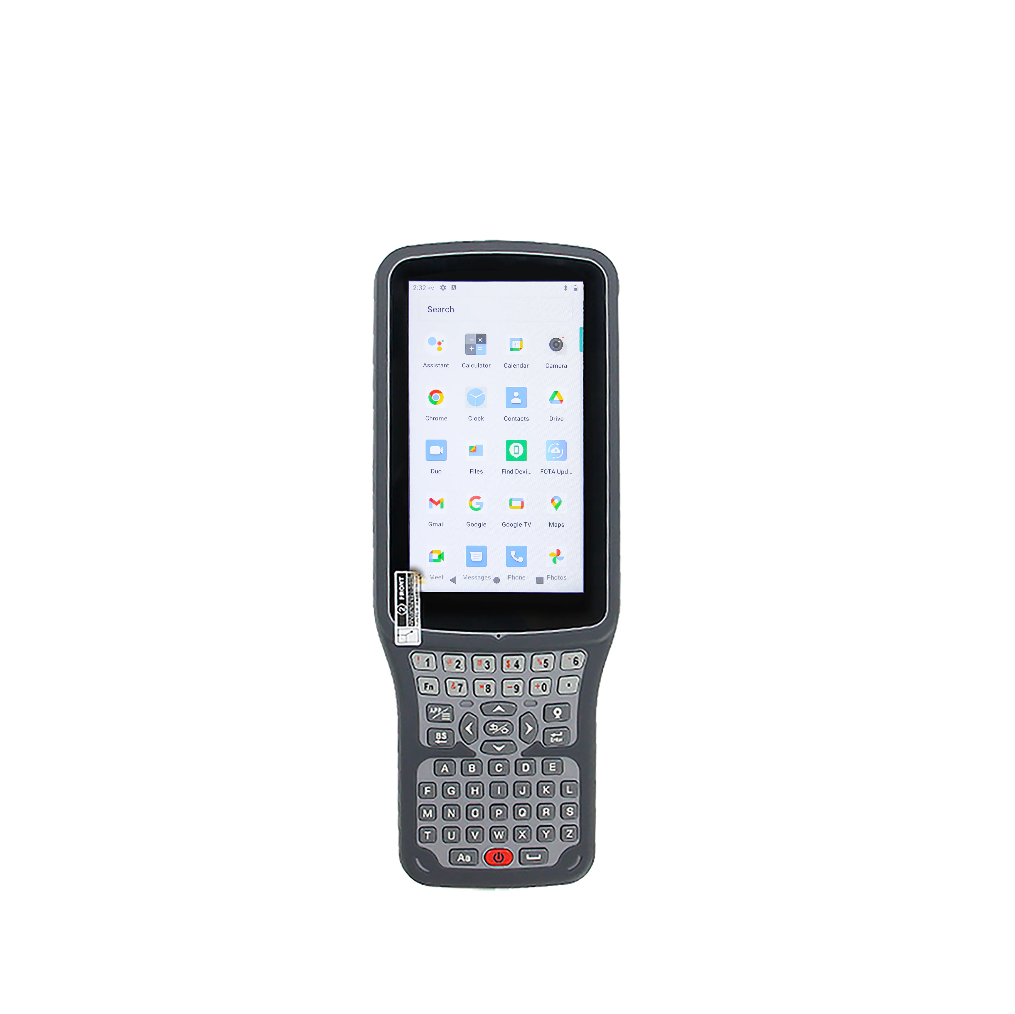
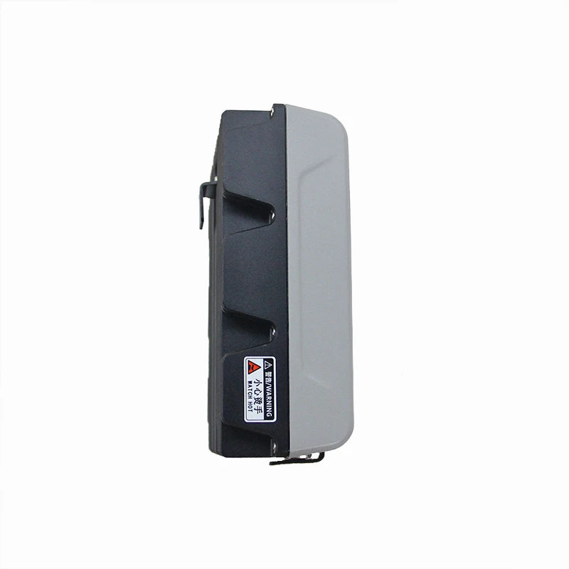
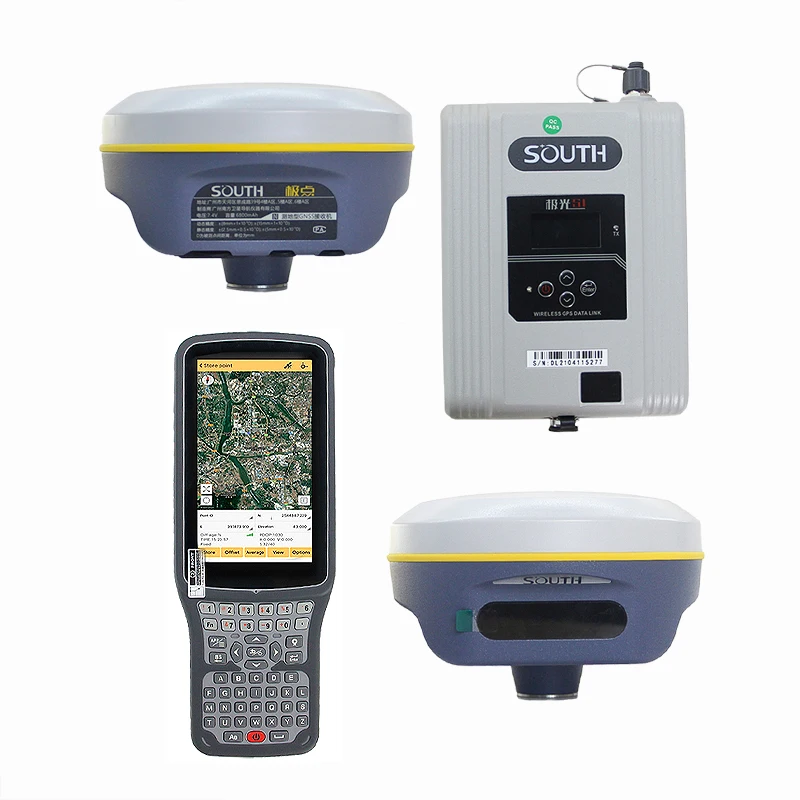
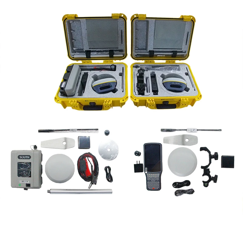
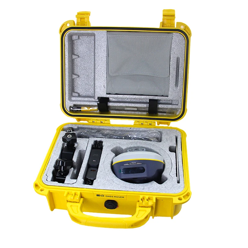
The South G2 Base Station GPS Survey Instrument and its ecosystem of ruggedized GNSS devices deliver precision and durability for professional applications. Designed for harsh outdoor environments, these instruments combine dual-frequency technology with ergonomic designs to support surveying, mapping, and navigation tasks.

Technical specifications

FeatureSpecificationApplication Scenario
MaterialDurable plastic/composite with IP67 ratingHarsh outdoor environments (rain, dust, extreme temperatures)
DesignCompact, ergonomic, with integrated handles and ruggedized casingsFieldwork requiring portability and shock resistance
CertificationCE CertifiedCompliance for EU markets and safety standards
GNSS TechnologyDual-frequency support (GPS, GLONASS, Galileo, BeiDou)High-precision positioning in complex terrains
Data LoggingBuilt-in 16GB storage with real-time data transmissionLong-term field surveys and remote monitoring

Customization guide

Adjustable parameters include antenna sensitivity (for signal strength in dense foliage) and storage capacity (upgradable to 64GB) to meet project-specific data requirements.

Get inspired

South G2 instruments empower professionals to tackle demanding environments. Whether mapping mountainous regions or ensuring centimeter-level accuracy in construction zones, these devices deliver unmatched reliability.

Choose your model

ParameterBase ModelAdvanced ModelPro Model
Positioning Accuracy2 cm + 2 ppm1 cm + 1 ppm5 mm + 1 ppm
Battery Life12 hours24 hours48 hours
Storage8 GB16 GB32 GB
Frequency SupportSingle-bandDual-bandTriple-band

Supplier's note

  1. Technical Breakthroughs:

    • Dual-frequency GNSS: Achieves 5mm accuracy (Pro Model) in environments with signal interference.
    • Ruggedized Materials: IP67 rating ensures operation in dust, rain, and extreme temperatures.
    • Integrated Data Logging: 20% faster data transmission than traditional systems.
  2. Optimal Version Selection:

    • Base Model: Ideal for basic surveys (e.g., land boundary mapping) requiring standard accuracy and budget constraints.
    • Advanced Model: Best for fieldwork needing extended battery life (e.g., environmental monitoring over 24-hour periods).
    • Pro Model: Tailored for precision tasks like 3D mapping or infrastructure alignment, where millimeter-level accuracy is critical.

With the Pro Model’s triple-band GNSS, you can capture data 30% faster than industry benchmarks in urban canyons. Pair this with its IP67 rating to ensure reliability during monsoon surveys. The Base Model’s affordability makes it perfect for academic research projects with limited budgets.

Product comparison

CategoryUsage ScenariosCharacteristicsAdvantagesDisadvantages
RuggednessHarsh outdoor environments (e.g., mining)Industry Standard: IP54 rated (dust/water resistance)
Our Base: IP65 (dust/waterproof)
Our Advanced: IP68 (submersion-resistant)▲
Survives extreme conditions ▲
Meets industrial safety norms
Advanced model may add weight (▲)
GPS PrecisionSurveying, mappingIndustry Standard: 2–5 cm accuracy
Our Base: 1.5 cm (RTK)
Our Advanced: 0.5 cm (Dual-Frequency RTK)▲
Higher accuracy for critical projects ▲
Dual-frequency reduces multipath errors
Advanced requires clear sky visibility (▲)
CertificationsGlobal deploymentsIndustry Standard: CE
Our Base: CE + FCC
Our Advanced: CE, FCC, RoHS, ISO 9001▲
Compliance with international standards ▲
Enhanced environmental safety (▲)
Advanced adds cost for certifications (▲)
Battery LifeField operationsIndustry Standard: 6–8 hours
Our Base: 10 hours (Li-ion)
Our Advanced: 14 hours + solar charging▲
Extended fieldwork without recharging ▲
Solar option for remote areas (▲)
Solar charging adds bulk (▲)
Data TransmissionReal-time monitoringIndustry Standard: Manual logging
Our Base: Bluetooth/Wi-Fi ▲
Our Advanced: 4G/LTE + Bluetooth/Wi-Fi▲
Wireless sync with software ▲
Remote access to data (▲)
Advanced requires cellular subscription (▲)
PortabilityMobile surveyingIndustry Standard: 1.5 kg
Our Base: 1.2 kg (ergonomic grip)
Our Advanced: 0.9 kg (lightweight alloy)▲
Easier to carry over long distances ▲
Compact design for backpack use (▲)
Advanced may sacrifice ruggedness for weight reduction (▲)

Related searches

The Product Description is generated by third-party, and Alibaba.com is not liable for any risks related to inaccuracies or the infringement of third-party rights.

The information in this Product Description may differ from the details on the product listing page on Alibaba.com. Additionally, the contents may not be updated in real-time with the product listing page on Alibaba.com, and there may be delays in reflecting the most updated information. The description on product listing page takes precedence. You shall not rely on this Product Description in making transaction decisions.

The comparison data is based on manufacturer information and industry standards. Actual results may vary depending on individual use cases. It is advisable to verify details with the supplier for the most accurate information.