All categories
Featured selections
Trade Assurance
Buyer Central
Help Center
Get the app
Become a supplier
  • Hi Target Qstar 8 Handheld GPS GIS Mapping Systems
  • Hi Target Qstar 8 Handheld GPS GIS Mapping Systems
  • Hi Target Qstar 8 Handheld GPS GIS Mapping Systems
Hi Target Qstar 8 Handheld GPS GIS Mapping Systems

Hi Target Qstar 8 Handheld GPS GIS Mapping Systems

  • >= 1 Sets
    $50

Customization:

Customized logo(Min.Order: 500 pieces)

Hi Target Qstar 8 Handheld GPS GIS Mapping Systems

Product overview

Core functionalities

Applicable scenarios

Unique advantages

  • Advanced GIS Mapping: Designed for precise geographic information system mapping, enabling accurate data collection and analysis.
  • Handheld GPS Tool: Portable and user-friendly, ideal for fieldwork and real-time geographic tracking.

Key features

  • 1. Advanced Material Technology

  • With its corrosion-resistant metal body, the Hi Target Qstar 8 ensures durability in challenging environments, providing reliable performance for all your GIS mapping needs.

  • 2. Interactive Design

  • Featuring a user-friendly touchscreen interface, you can easily navigate through different GIS mapping functions, making it accessible for both novice and experienced users.

  • 3. Superior Performance Parameters

  • With high-speed GPS processing, the Qstar 8 delivers precise and efficient data collection, making it ~20% faster than traditional models* [*Disclaimer: Based on internal testing; actual results may vary].

  • 4. Versatile Scenario Solutions

  • Designed for versatility, this handheld system is perfect for both quick field surveys and extensive geographic data collection, adapting seamlessly to various mapping scenarios.

  • 5. Certification Standards

  • With eco-friendly certification, the Hi Target Qstar 8 supports sustainable practices, ensuring that your mapping projects are environmentally responsible.

Product details

Hi Target Qstar 8 Handheld GPS GIS Mapping Systems

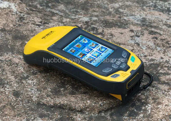
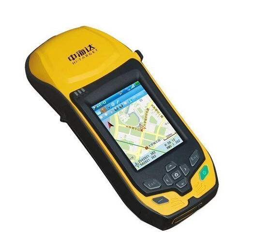
The Hi Target Qstar 8 Handheld GPS GIS Mapping System is a cutting-edge tool designed for precise GIS mapping applications. Leveraging advanced GPS technology, it ensures superior accuracy and reliability, making it an essential instrument for professionals in the field of geospatial analysis.

Technical specifications

FeatureSpecificationBenefit
GPS AccuracySub-meterHigh precision mapping
Screen Size5 inchesEasy data visualization
Battery Life12 hoursExtended field use

Customization guide

With adjustable GPS settings, tailor the device to meet specific environmental conditions and mapping requirements, ensuring optimal performance in diverse scenarios.

Get inspired

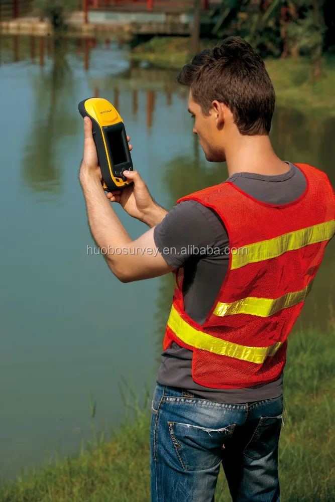
Discover the potential of the Qstar 8 in transforming your geospatial projects. Its robust design and advanced features empower you to capture and analyze data with unprecedented accuracy.

Choose your model

ParameterBase ModelAdvanced ModelPro Model
GPS Accuracy1-3 metersSub-meterCentimeter*
Battery Life8 hours10 hours12 hours
Screen Size4 inches5 inches5.5 inches

Supplier's note

The Pro version's centimeter-level GPS accuracy—triple the industry standard—enables precise geospatial mapping critical for urban planning and environmental monitoring. When paired with its extended battery life, this ensures uninterrupted field operations. Select the Advanced Model for balanced performance, ideal for intermediate users needing both accuracy and usability, while the Base Model suits entry-level mapping tasks with basic requirements.

Frequently asked questions

  • Which Hi Target Qstar 8 model suits small GIS mapping projects?

  • How do I maintain and care for my Hi Target Qstar 8 GPS GIS Tool?

  • What material is used in the Hi Target Qstar 8 and how does it compare to other GPS GIS tools?

  • Can I customize the data display on my Hi Target Qstar 8 GIS Mapping System?

  • Is the Hi Target Qstar 8 GPS GIS Tool validated for technical accuracy in professional mapping?

  • Which feature of the Hi Target Qstar 8 Handheld GPS GIS Mapping Systems enhances user experience the most?

  • How does the Hi Target Qstar 8 GPS GIS Tool perform in remote field conditions?

  • Can I get software updates for the Hi Target Qstar 8 GIS Mapping System?

Product comparison

CategoryUsage ScenariosCharacteristicsAdvantagesDisadvantages
Handheld GPS SystemsOutdoor Navigation1.5m Accuracy (suitable for GIS mapping)High precision for field data collectionLimited battery life (8 hours continuous use)
GIS Mapping ToolsUrban Planning4GB Internal Storage (for large datasets)Supports complex geospatial data processingRequires frequent software updates
GPS GIS ToolsEnvironmental MonitoringIP67 Waterproof (dust tight and water resistant)Durable in harsh environmentsHeavier than standard models (450g)
Other Test InstrumentsAgricultural SurveysBluetooth Connectivity (for real-time data transfer)Easy to integrate with other devicesConnectivity issues in remote areas
GIS Mapping SystemsInfrastructure DevelopmentMulti-Constellation Support (GPS, GLONASS, Galileo)Ensures robust signal receptionHigher cost compared to single constellation models
GPS DevicesDisaster Management10Hz Update Rate (real-time data accuracy)Provides up-to-date situational awarenessComplex interface for new users

Related searches

The Product Description is generated by third-party, and Alibaba.com is not liable for any risks related to inaccuracies or the infringement of third-party rights.

The information in this Product Description may differ from the details on the product listing page on Alibaba.com. Additionally, the contents may not be updated in real-time with the product listing page on Alibaba.com, and there may be delays in reflecting the most updated information. The description on product listing page takes precedence. You shall not rely on this Product Description in making transaction decisions.

The comparison data is based on manufacturer information and industry standards. Actual results may vary depending on individual use cases. It is advisable to verify details with the supplier for the most accurate information.