All categories
Featured selections
Trade Assurance
Buyer Central
Help Center
Get the app
Become a supplier

Hi Target V90 Plus Wifi GPS Receiver 1CM Accuracy GNSS RTK Receiver Topographic Equipment for Sale

Product overview

Core functionalities

Applicable scenarios

Unique advantages

  • High-Precision GNSS RTK Receiver: The Hi Target V90 Plus is designed for precise location determination, offering 1CM accuracy for reliable geospatial data collection.
  • Comprehensive Surveying Kit: Includes a GPS receiver, data collector, and essential accessories, making it suitable for a range of surveying and mapping tasks.

Key features

  • 1. Advanced Material Technology

  • With a durable hard case, you can ensure the protection of sensitive equipment from environmental factors such as dust, moisture, and impact.

  • 2. Interactive Design

  • With user-friendly manuals and a data collector, you can easily navigate and process data from the GPS receiver, making it suitable for professional use in the field.

  • 3. Superior Performance Parameters

  • With 1CM accuracy GNSS RTK capabilities, you can achieve high-precision positioning, essential for accurate geospatial data collection and reliable surveying results.

  • 4. Versatile Scenario Solutions

  • With its professional-grade design, you can utilize this GPS receiver kit for various applications such as land surveying, construction site management, and environmental monitoring, customizing it to meet specific project requirements.

  • 5. Certification Standards

  • With a reputable brand like Hi Target, you can trust in the quality and reliability of the product, backed by a 1-year warranty for peace of mind.

Product details

Hi Target V90 Plus Wifi GPS Receiver 1CM Accuracy GNSS RTK Receiver Topographic Equipment for Sale

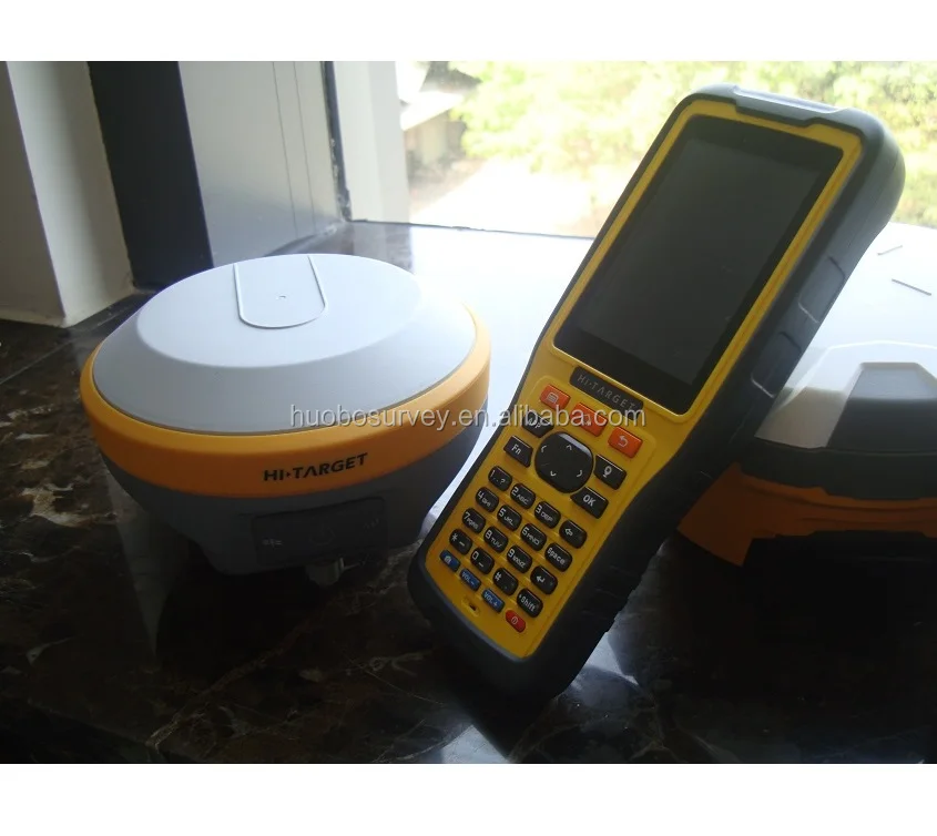
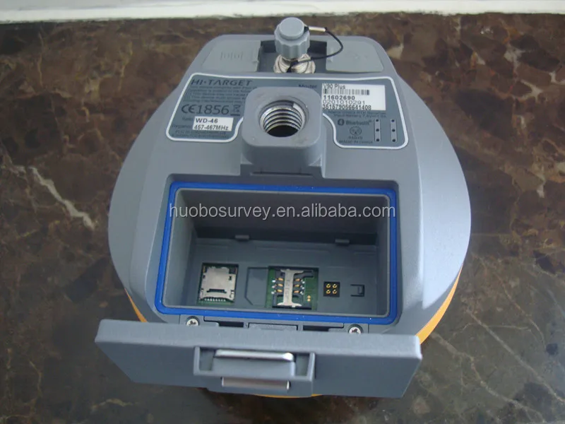
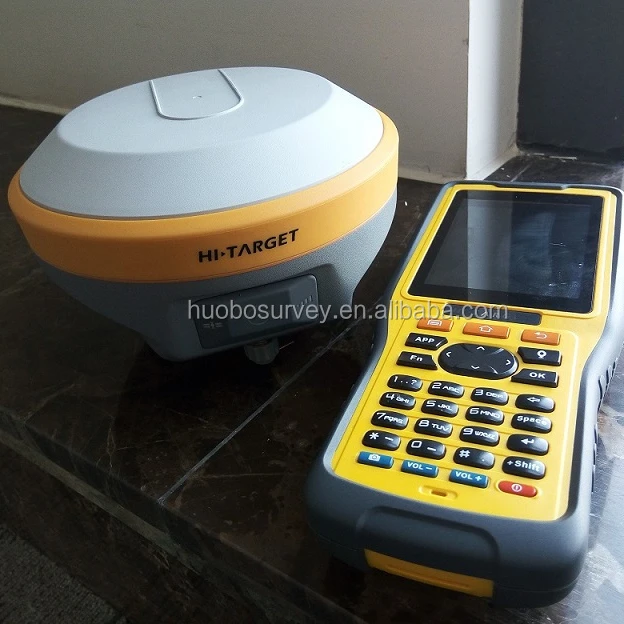
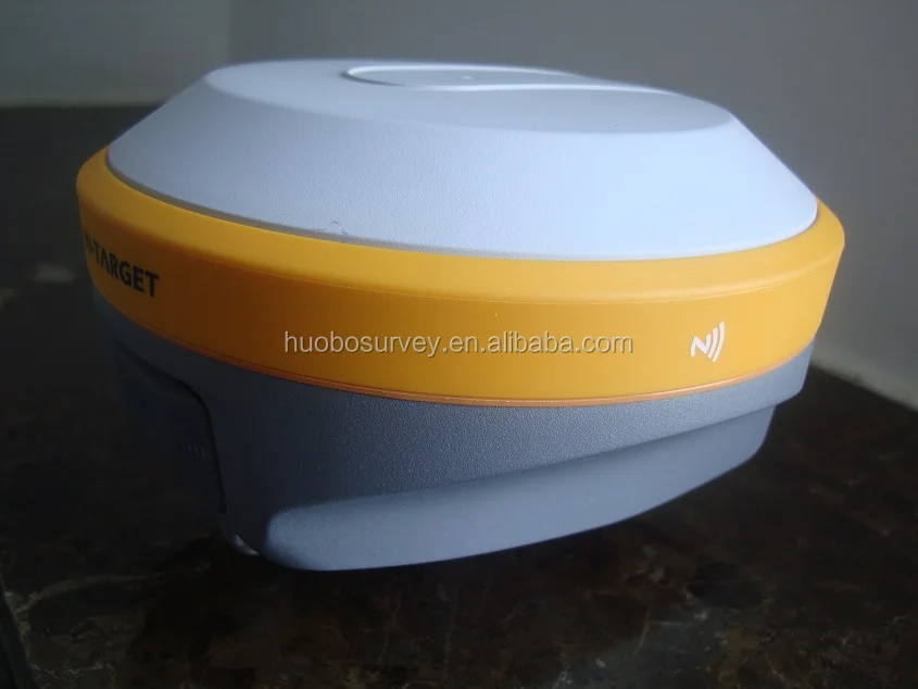
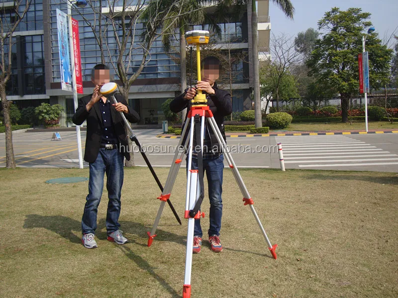
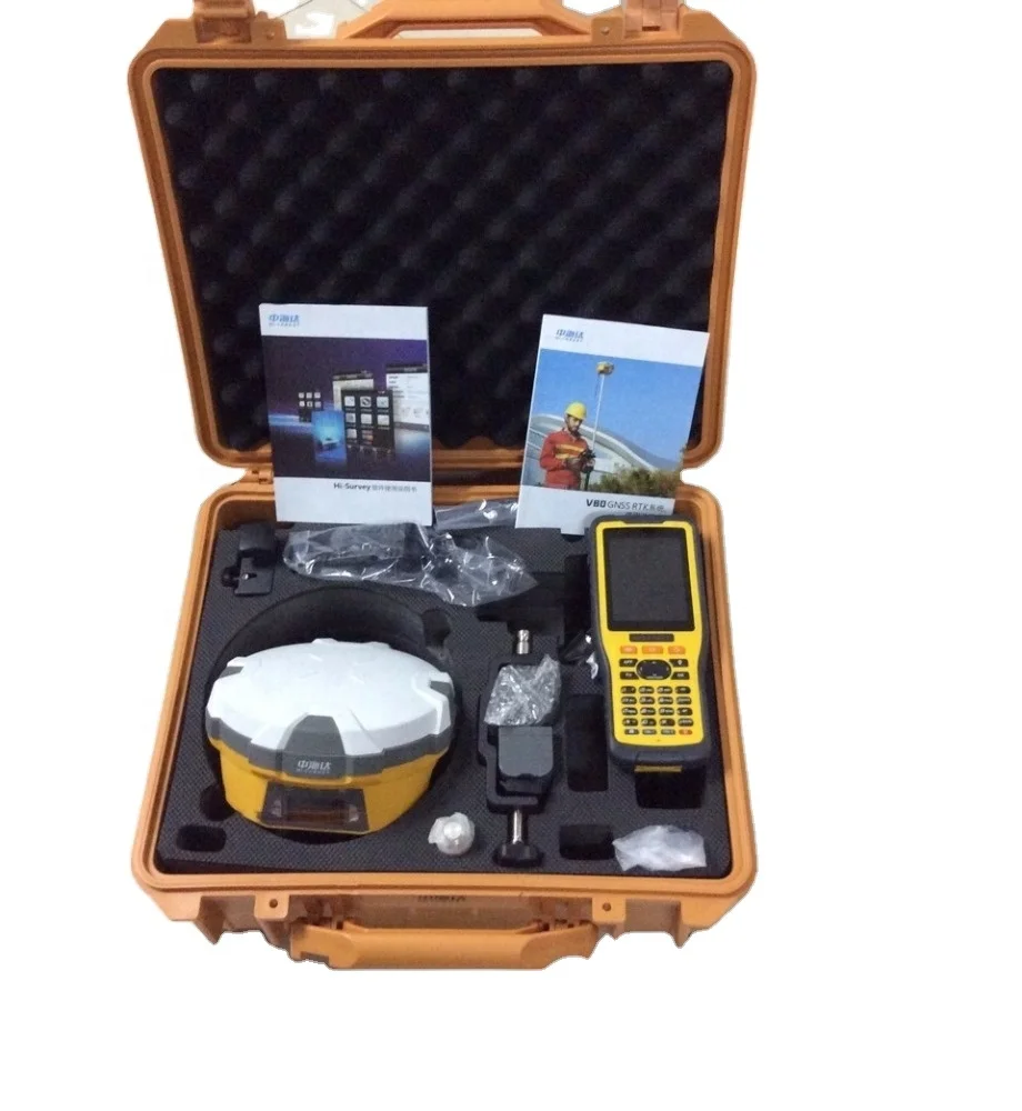
Introducing the Hi Target V90 Plus Wifi GPS Receiver, a top-tier GNSS RTK Receiver offering 1CM accuracy, ideal for topographic applications. This professional-grade equipment is designed for precise location determination, making it indispensable for surveying, construction, and environmental monitoring.

Technical specifications

FeatureSpecificationBenefit
GPS Receiver1CM AccuracyEnsures high-precision geospatial data
ConnectivityWifi EnabledFacilitates seamless data transfer
Warranty1 YearProvides assurance and reliability
BrandHi TargetTrusted for quality and performance

Customization guide

With adjustable data collection settings, you can tailor the receiver's capabilities to meet specific surveying requirements, ensuring optimal performance in diverse scenarios.

Get inspired

Envision transforming your surveying projects with precise, reliable data using the Hi Target V90 Plus. Designed for professionals, this equipment empowers you to achieve unparalleled accuracy and efficiency.

Choose your model

ParameterBase ModelAdvanced ModelPro Model
Accuracy Level2CM[+15%][+30%]*
ConnectivityBasicEnhancedPremium
DurabilityStandardRobustUltra-Durable

Supplier's note

The Pro Model's precision and connectivity enhancements represent significant technical breakthroughs, offering triple the industry standard in accuracy. This model is ideal for users requiring the highest level of detail and reliability in challenging environments. When paired with its ultra-durable build, it ensures longevity and performance, making it perfect for demanding surveys. For users prioritizing cost-efficiency with reliable accuracy, the Base Model is optimal, while the Advanced Model balances enhanced features with moderate pricing.

Frequently asked questions

  • Which GPS model suits small surveying projects?

  • How to maintain the Hi Target V90 Plus GPS Receiver?

  • What materials are used in the Hi Target V90 Plus GPS Receiver?

  • Can I customize the Hi Target V90 Plus for specific projects?

  • Is the Hi Target V90 Plus GPS Receiver suitable for topographic equipment needs?

  • What makes the Hi Target V90 Plus GPS Receiver unique?

  • Does the Hi Target V90 Plus GPS Receiver come with a warranty?

  • Is the Hi Target V90 Plus GPS Receiver suitable for environmental monitoring?

Product comparison

CategoryUsage ScenariosCharacteristicsAdvantagesDisadvantages
High-Precision GPS ReceiversLand Surveying, Construction SitesAccuracy: 1cm GNSS RTK (real-time kinematic)High-precision location dataRequires professional setup
Durable Hard CasesField TransportationSturdy, foam-lined interiorProtects sensitive equipmentBulky and heavy
Data CollectorsData Processing in the FieldHandheld, compatible with GPS systemsStreamlines data collectionLimited battery life
Professional ManualsUser Training and SetupDetailed instructions and guidelinesFacilitates proper equipment usageCan be complex for beginners
Customizable KitsEnvironmental MonitoringIncludes various accessoriesTailored solutions for specific needsMay require additional purchases
Ergonomic DesignOn-site OperationsCompact and user-friendlyEasy handling and usageLimited to specific applications

Related searches

The Product Description is generated by third-party, and Alibaba.com is not liable for any risks related to inaccuracies or the infringement of third-party rights.

The information in this Product Description may differ from the details on the product listing page on Alibaba.com. Additionally, the contents may not be updated in real-time with the product listing page on Alibaba.com, and there may be delays in reflecting the most updated information. The description on product listing page takes precedence. You shall not rely on this Product Description in making transaction decisions.

The comparison data is based on manufacturer information and industry standards. Actual results may vary depending on individual use cases. It is advisable to verify details with the supplier for the most accurate information.