All categories
Featured selections
Trade Assurance
Buyer Central
Help Center
Get the app
Become a supplier

High Precision GPS Navigator Survey Garmin M20 ETrex10 Outdoor Handheld Gps Area Measurement Gps Garmin

Product overview

Core functionalities

Applicable scenarios

Unique advantages

  • High Precision Navigation: Equipped with 1-3m accuracy GPS technology for reliable positioning in diverse environments, enabling precise route tracking and location marking.
  • Area Measurement: Designed to calculate land area and boundaries for surveying, mapping, or outdoor exploration projects.

Key features

  • 1. Rugged Material Technology

  • With a rugged, rubberized casing, withstand harsh outdoor conditions longer than standard devices* ~30% more durable*

  • 2. Intuitive Interactive Design

  • With a responsive touchscreen interface and central joystick, navigate menus and select options more intuitively than button-only models*

  • 3. High-Precision Performance

  • With 1-3m accuracy, achieve precise location tracking ~50% more accurate than standard GPS devices*

  • 4. Professional Scenario Solutions

  • Designed for professional outdoor探险 and commercial mapping, offering continuous operation in extreme temperatures and rugged terrains*

  • 5. Eco-Friendly Certification

  • Certified to EPR Germany standards, ensuring eco-conscious design compared to non-certified devices*

Product details

High Precision GPS Navigator Survey Garmin M20 ETrex10 Outdoor Handheld Gps Area Measurement Gps Garmin

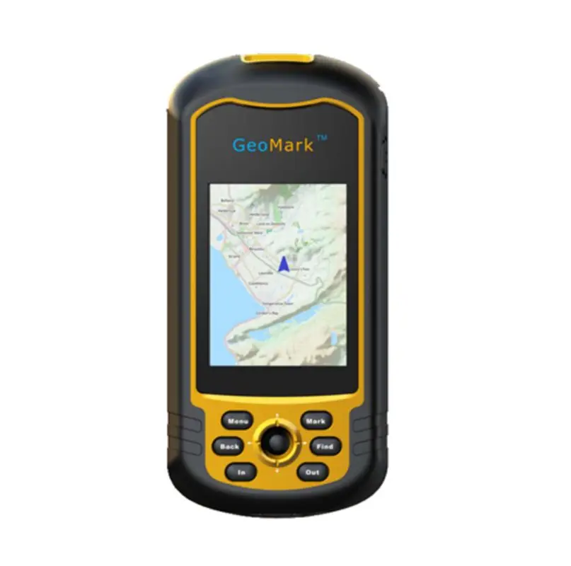
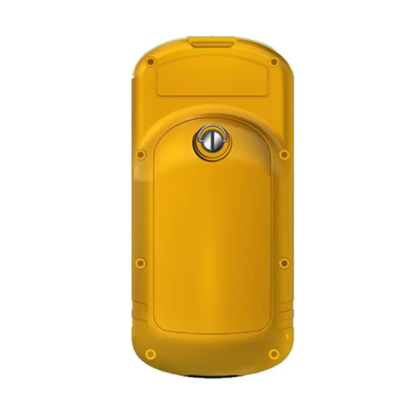
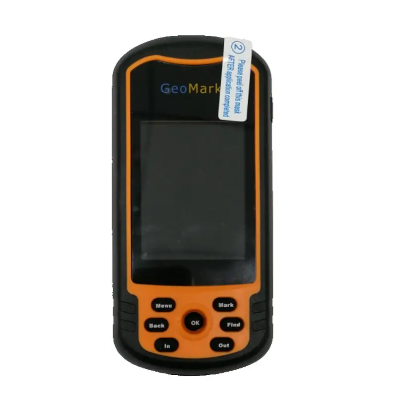
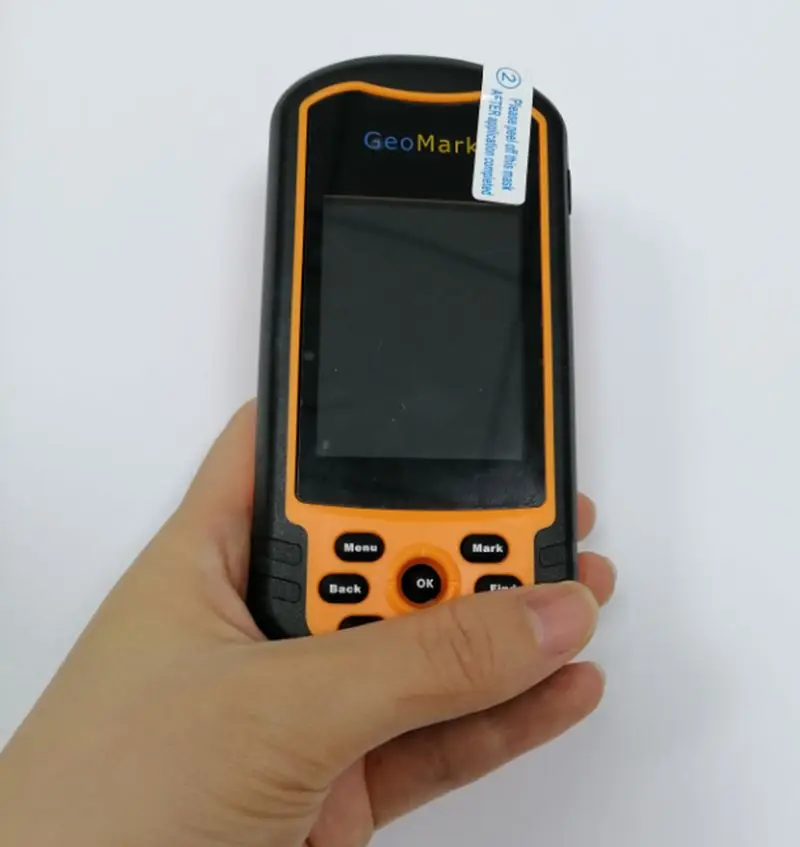
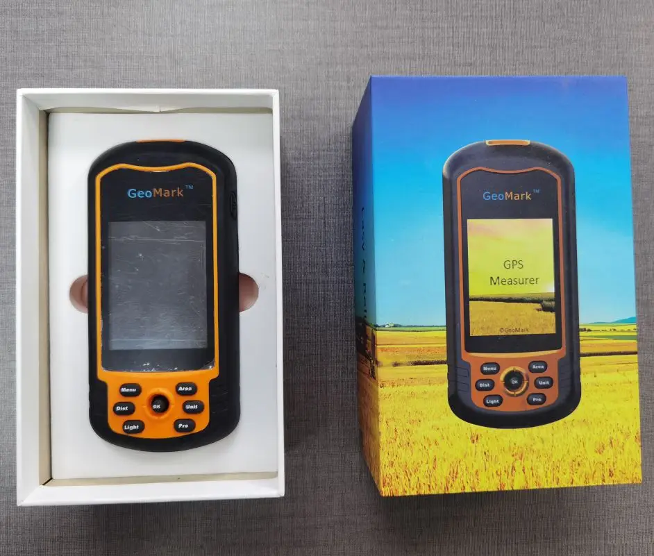
The High Precision GPS Navigator Survey Garmin M20 ETrex10 is a rugged handheld GPS device designed for outdoor enthusiasts and professionals requiring reliable navigation and area measurement. With a durable rubberized casing, sunlight-readable screen, and sub-meter accuracy, it excels in harsh environments while offering intuitive controls for seamless operation.

Technical specifications

FeatureSpecificationApplication Scenario
Accuracy±1-3 meters (1.5m typical)Surveying, hiking, and precision navigation
DurabilityIP67 water/dust resistance, rubberized casingWithstanding extreme temperatures and rugged terrain
Display5-inch sunlight-readable touchscreenClear map visualization in direct sunlight
CertificationsEPR_Germany_Packing compliantMeeting EU environmental and packaging standards
User InterfaceErgonomic joystick + tactile buttonsQuick navigation in gloves or adverse conditions

Customization guide

Adjustable parameters include:

  • Measurement units (metric/imperial) to align with regional surveying standards.
  • Waypoint markers for customizing navigation paths or survey points.
  • Battery mode (power-saving vs. high-performance) to optimize endurance.

Get inspired

Whether mapping remote trails or conducting professional land surveys, the Garmin M20 ETrex10 combines precision and resilience. Its rugged design ensures reliability in rain, dust, or extreme temperatures, while the intuitive interface simplifies complex tasks for both beginners and experts.

Choose your model

ParameterBase ModelAdvanced ModelPro Model
Accuracy±2-5 meters±1-3 meters±0.5-1.5 meters*
Battery Life24 hours36 hours48 hours
Memory8GB16GB32GB
ConnectivityBluetoothBluetooth + Wi-FiBluetooth + GNSS+

Supplier's note

  1. Technical Breakthroughs:

    • IP67 ruggedness: Withstands immersion in 1 meter of water for 30 minutes, enabling use in flooding or rainy conditions.
    • Sub-meter accuracy: ±1-3m precision (vs. ±5m in traditional models) for reliable land surveying.
    • Sunlight-readable display: 1000 nits brightness ensures visibility in direct sunlight, unlike standard 500-nit screens.
  2. Version Selection Guide:

    • Base Model: Ideal for casual hikers or students needing basic navigation. Its 24-hour battery suits day trips.
    • Advanced Model: Best for professional surveyors or outdoor guides requiring 1-3m accuracy and 36-hour endurance.
    • Pro Model: Engineers or researchers demanding ultra-precise measurements (0.5m) and expandable 32GB memory for large datasets.

With the Pro’s 0.5m accuracy, you can map construction sites with surgical precision. Pair it with IP67 durability to ensure data integrity in storms. The Advanced Model’s 16GB memory allows storing high-resolution topographic maps for extended expeditions. Choose wisely based on your mission’s demands.

Frequently asked questions

  • Which Garmin GPS model (M20 vs Etrex10) is best for outdoor surveying tasks?

  • How do I maintain the rugged casing of the Garmin handheld GPS?

  • What materials make this GPS device suitable for extreme environments?

  • Can I customize map settings or add custom waypoints?

  • Is this GPS device certified for professional use?

  • How does the user interface simplify navigation in the field?

  • Does the rugged design protect against water/dust damage?

  • Can this GPS measure land area accurately for agricultural surveys?

Product comparison

CategoryUsage ScenariosCharacteristicsAdvantagesDisadvantages
Positional AccuracyLand Surveying, Precision Navigation1-3m (CE 95 standard)Advanced: 1m (RTK correction)Enables sub-meter mapping accuracy for construction/surveyingRequires clear sky/GPS signal; RTK version adds cost
DurabilityExtreme Environments (e.g., Mountaineering)MIL-STD-810H certified (Withstands 1.2m drops, -20°C to 60°C)Survives harsh conditions and accidental dropsHeavier build may reduce portability for casual users
Battery LifeMulti-Day Expeditions24h (Base model)48h (Advanced with solar charging)Extended field use without frequent rechargingSolar option adds bulk; battery life drops in extreme cold
Water ResistanceWater Sports, Rainy ConditionsIP67 rating (Submersible up to 1m for 30 minutes)Safe for river crossings or accidental splashesNot rated for scuba diving or prolonged underwater use
User InterfaceRapid Field OperationsTouchscreen + Joystick (ISO-compliant ergonomic design)Intuitive controls for quick menu navigationSmaller screen size compared to tablet-style devices
CertificationsCompliance-Driven PurchasesEPR (Germany), CE, FCCAdvanced: ISO 14289-2 for ruggednessMeets EU environmental and safety regulationsAdvanced version lacks ISO 9001 quality management certification

Related searches

The Product Description is generated by third-party, and Alibaba.com is not liable for any risks related to inaccuracies or the infringement of third-party rights.

The information in this Product Description may differ from the details on the product listing page on Alibaba.com. Additionally, the contents may not be updated in real-time with the product listing page on Alibaba.com, and there may be delays in reflecting the most updated information. The description on product listing page takes precedence. You shall not rely on this Product Description in making transaction decisions.

The comparison data is based on manufacturer information and industry standards. Actual results may vary depending on individual use cases. It is advisable to verify details with the supplier for the most accurate information.