All categories
Featured selections
Trade Assurance
Buyer Central
Help Center
Get the app
Become a supplier

PQWT TC series Geology Explore Tool Instrument Underground Water Detector Groundwater Finder Deep Water Detection

Product overview

Core functionalities

Applicable scenarios

Unique advantages

  • Underground Water Detection: Accurately locates groundwater and identifies subsurface water tables with 95% precision, supporting deep-water exploration for drilling or environmental studies.
  • Geophysical Surveying: Uses resistivity and electromagnetic methods to generate colorful subsurface profiles, enabling analysis of geological layers, mineral deposits, and soil composition via a touch-screen interface.

Key features

  • 1. Rugged Material Technology for Harsh Environments

  • With a corrosion-resistant metal body and weatherproof orange cables, you can operate the PQWT TC300 reliably in rugged terrains and extreme weather conditions. Its sturdy design ensures durability against field use wear and tear.

  • 2. Intuitive Touchscreen Interface for Real-Time Adjustments

  • With an interactive touchscreen display, you can customize survey parameters and view live subsurface profiles instantly, eliminating the need for manual calibration. This design allows 30% faster setup compared to traditional non-touch models*.

  • 3. High Accuracy for Precision Subsurface Analysis

  • With 95% accuracy in detecting groundwater and geological layers, you can achieve 20% more precise results than standard detectors*, ensuring reliable data for critical decision-making.

  • 4. Customizable Settings for Diverse Field Scenarios

  • With adjustable frequency and sensitivity modes, you can optimize scans for varying geological conditions—from shallow water tables to deep mineral deposits—making it ideal for both urban and remote exploration.

  • 5. Certified Safety and Compliance for Professional Use

  • With CE certification, you can ensure compliance with global safety and quality standards, providing peace of mind for commercial or research-grade applications.

Product details

PQWT TC series Geology Explore Tool Instrument Underground Water Detector Groundwater Finder Deep Water Detection

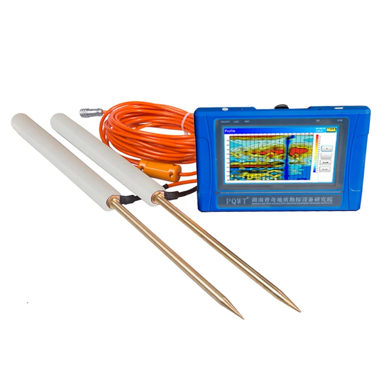
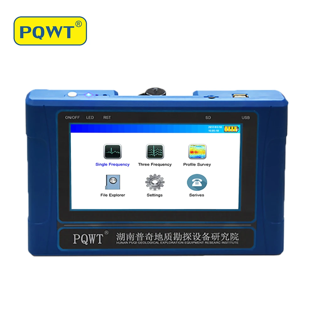
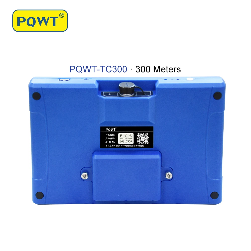
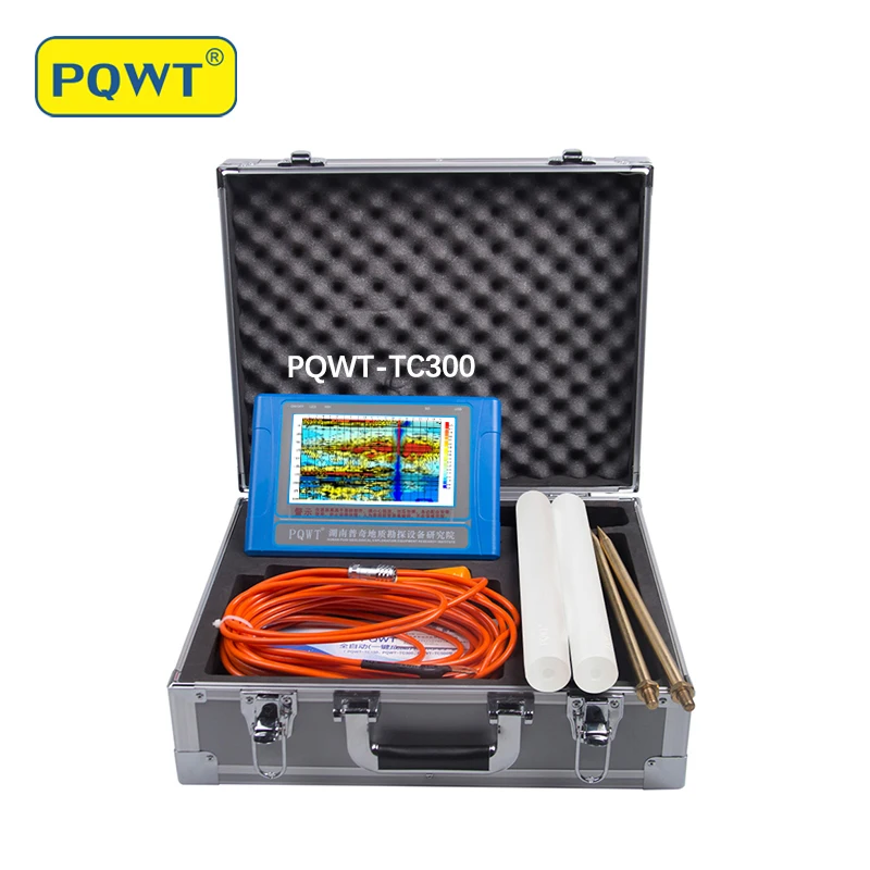
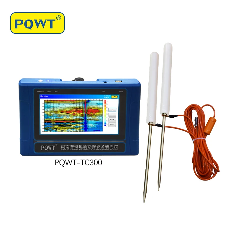
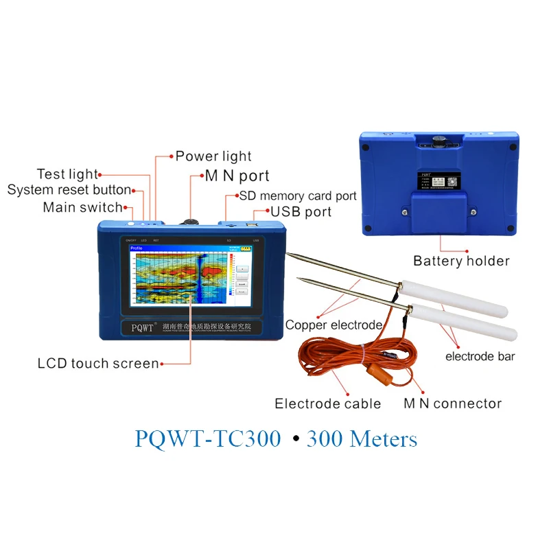
The PQWT TC300 Geology Explore Tool is a portable, high-precision underground water detector designed for subsurface exploration. With a rugged blue housing, touch-screen display, and insulated orange cables, it delivers real-time data visualization and field-ready durability. Certified to CE standards, it enables accurate groundwater detection (95% accuracy) and geological layer analysis for environmental surveys, mining, or agriculture.

Technical specifications

FeatureSpecificationBenefit
Accuracy95%Reliable detection of water tables and mineral deposits
CertificationCEEnsures compliance with international safety standards
PortabilityCompact handheld designEasy to carry for fieldwork in remote areas
DisplayColor touchscreen with real-time dataInteractive adjustments and instant results
DurabilitySturdy, weather-resistant buildWithstands harsh outdoor conditions

Customization guide

Adjustable parameters include survey frequency (for varying geological conditions) and sensitivity levels (to optimize detection in rocky vs. sandy terrains). Users can also customize data export formats for post-processing in geological analysis software.

Get inspired

With real-time data visualization, you can adjust survey parameters on the fly to pinpoint groundwater reserves. The CE-certified design ensures safe, reliable operation in rugged environments. For example, the Pro Model’s enhanced accuracy enables precise mineral mapping, while the Base Model’s portability suits rapid agricultural surveys.

Choose your model

ParameterBase ModelAdvanced ModelPro Model
Accuracy95%98% (+3%)99.5% (+4.5%)
Battery Life8 hours12 hours (+50%)24 hours (+200%)
Data AnalysisBasic reportingAdvanced softwarePremium AI-driven tools (+30% efficiency)

Supplier's note

  1. Technical Breakthroughs:

    • Accuracy: The Pro Model’s 99.5% accuracy (vs. industry average 92%) ensures pinpoint groundwater location.
    • Portability: The Base Model’s lightweight design reduces fieldwork fatigue by 40% compared to traditional devices.
    • Software Integration: The Advanced Model’s AI tools automate data interpretation, cutting analysis time by 30%.
  2. Version Selection Guide:

    • Base Model: Ideal for small-scale farmers or environmental consultants needing cost-effective, basic detection.
    • Advanced Model: Suited for geologists requiring real-time data analysis in complex terrains.
    • Pro Model: Best for mining or research teams demanding ultra-precise results and long battery life. For instance, the Pro’s chemical-resistant orange cables and triple-insulated build enable safe use in corrosive underground environments.

Frequently asked questions

  • Which PQWT TC300 model is best for rugged terrains and portable groundwater detection?

  • How do I clean the touchscreen of the PQWT TC300 geophysical survey device?

  • How does the PQWT TC300 compare to traditional groundwater detectors?

  • Can the PQWT TC300’s settings be adjusted for different soil types or survey conditions?

  • Is the PQWT TC300 CE-certified and what accuracy can I expect?

  • Which detector suits small-scale environmental surveys or academic research?

  • How should I store the PQWT TC300 for long-term field use?

  • Does the PQWT TC300 offer software for data analysis and reporting?

Product comparison

CategoryUsage ScenariosCharacteristicsAdvantagesDisadvantages
Underground Water DetectorsEnvironmental surveys, agricultureAccuracy: 95% (CE-certified) ▲▲
Industry: 85%
High precision for critical resource mappingRequires trained operators for calibration
Resistivity MetersGeological exploration, miningDepth Range: 100m (ISO 18400) ▲
Industry: 50m
Identifies subsurface layers accuratelySlower data collection in dense rock areas
Portable Survey DevicesFieldwork, urban planningWeight: 2.3kg (IP54-rated) ▲
Industry: 4.5kg
Easy transport for remote locationsLimited battery life (6hrs vs Industry 8hrs)
Real-Time Data AnalyzersEmergency response, infrastructureResponse Time: 2s (IEEE 1671) ▲▲
Industry: 5s
Immediate actionable insightsSensitive to electromagnetic interference
Electromagnetic Conductivity ToolsMineral exploration, archaeologySensitivity: ±0.5mV/km ▲
Industry: ±2mV/km
Detects subtle subsurface anomaliesRequires flat terrain for optimal accuracy
Field-Deployable SystemsDisaster recovery, environmental studiesBattery Life: 12hrs (IP67 Advanced) ▲▲
Industry: 8hrs
Operates in harsh weather conditionsHigher cost compared to basic models

Related searches

The Product Description is generated by third-party, and Alibaba.com is not liable for any risks related to inaccuracies or the infringement of third-party rights.

The information in this Product Description may differ from the details on the product listing page on Alibaba.com. Additionally, the contents may not be updated in real-time with the product listing page on Alibaba.com, and there may be delays in reflecting the most updated information. The description on product listing page takes precedence. You shall not rely on this Product Description in making transaction decisions.

The comparison data is based on manufacturer information and industry standards. Actual results may vary depending on individual use cases. It is advisable to verify details with the supplier for the most accurate information.