All categories
Featured selections
Trade Assurance
Buyer Central
Help Center
Get the app
Become a supplier
  • R26 GNSS RTK Surveying System Base Station and Rover High Precision
  • R26 GNSS RTK Surveying System Base Station and Rover High Precision
  • R26 GNSS RTK Surveying System Base Station and Rover High Precision
  • R26 GNSS RTK Surveying System Base Station and Rover High Precision
  • R26 GNSS RTK Surveying System Base Station and Rover High Precision
  • R26 GNSS RTK Surveying System Base Station and Rover High Precision
R26 GNSS RTK Surveying System Base Station and Rover High Precision
Ready to Ship
In stock Fast dispatch

R26 GNSS RTK Surveying System Base Station and Rover High Precision

  • >= 1 Pieces
    $3,500

Customization:

Customized logo(Min.Order: 1000 pieces)
Customized packaging(Min.Order: 1000 pieces)
Graphic customization(Min.Order: 1000 pieces)

R26 GNSS RTK Surveying System Base Station and Rover High Precision

Product overview

Core functionalities

Applicable scenarios

Unique advantages

  • High Precision GNSS RTK: Provides accurate real-time kinematic positioning for surveying tasks.
  • Base Station and Rover System: Facilitates seamless communication between units for enhanced data accuracy and reliability.

Key features

  • 1. Advanced Material Technology

  • With its corrosion-resistant metal body, the R26 GNSS RTK Surveying System ensures durability and longevity even in challenging environmental conditions.

  • 2. Interactive Design

  • With an intuitive touchscreen interface, you can easily navigate and operate the R26 GNSS RTK Surveying System, enhancing user experience and efficiency.

  • 3. High Performance Parameters

  • With its high precision output, the R26 GNSS RTK Surveying System delivers accurate measurements, making it ideal for professional surveying applications.

  • 4. Versatile Scenario Solutions

  • With its adaptability for both base station and rover applications, the R26 GNSS RTK Surveying System provides continuous operation solutions for diverse surveying scenarios.

  • 5. Certification Standards

  • With its compliance to international standards, you can trust the R26 GNSS RTK Surveying System for reliable and certified performance in all your surveying tasks.

Product details

R26 GNSS RTK Surveying System Base Station and Rover High Precision

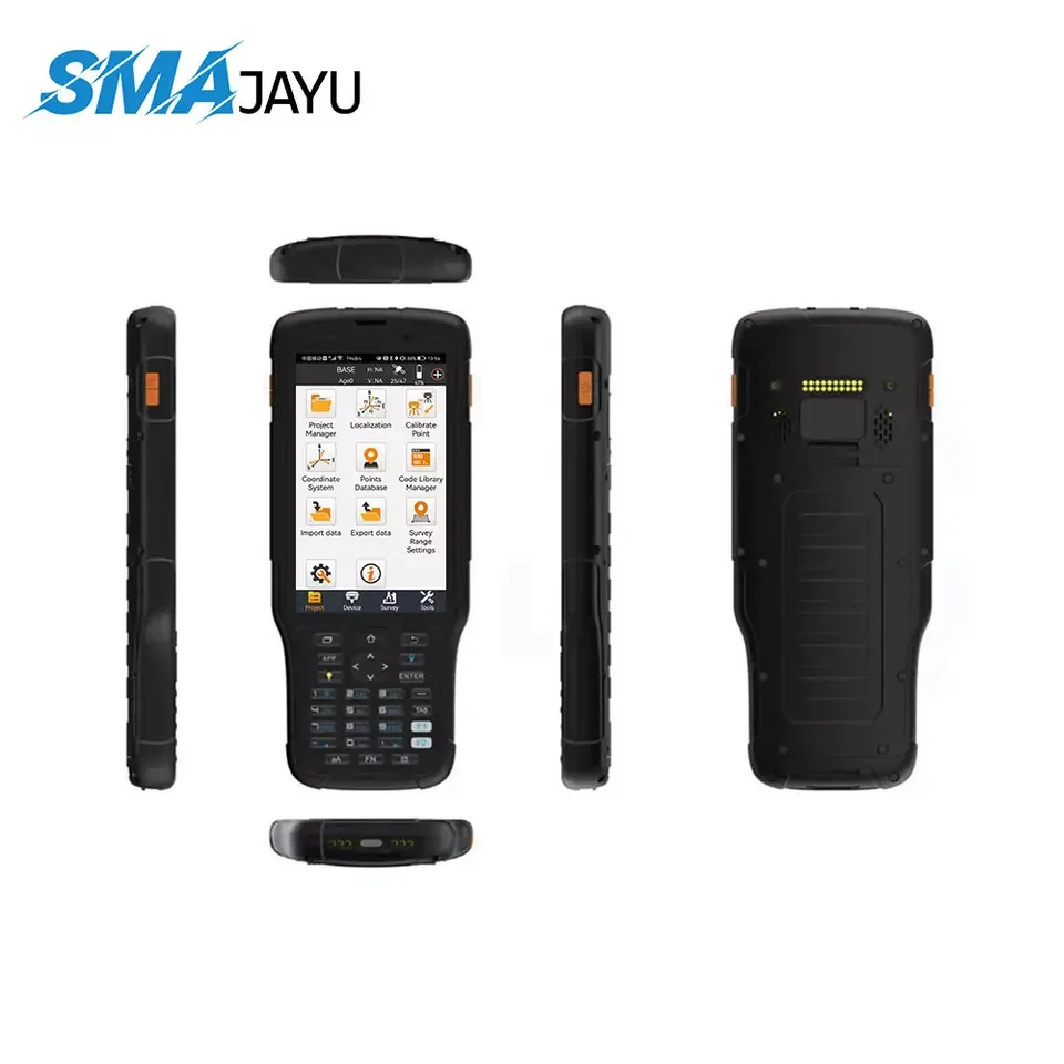
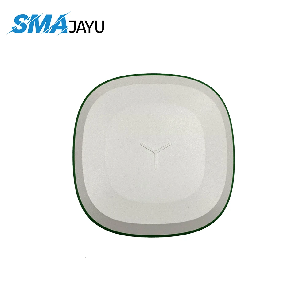
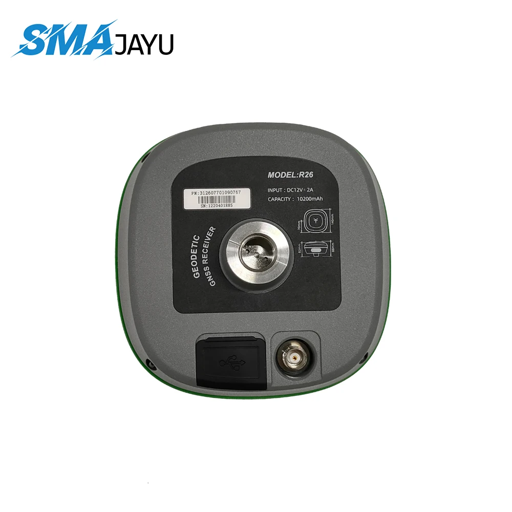
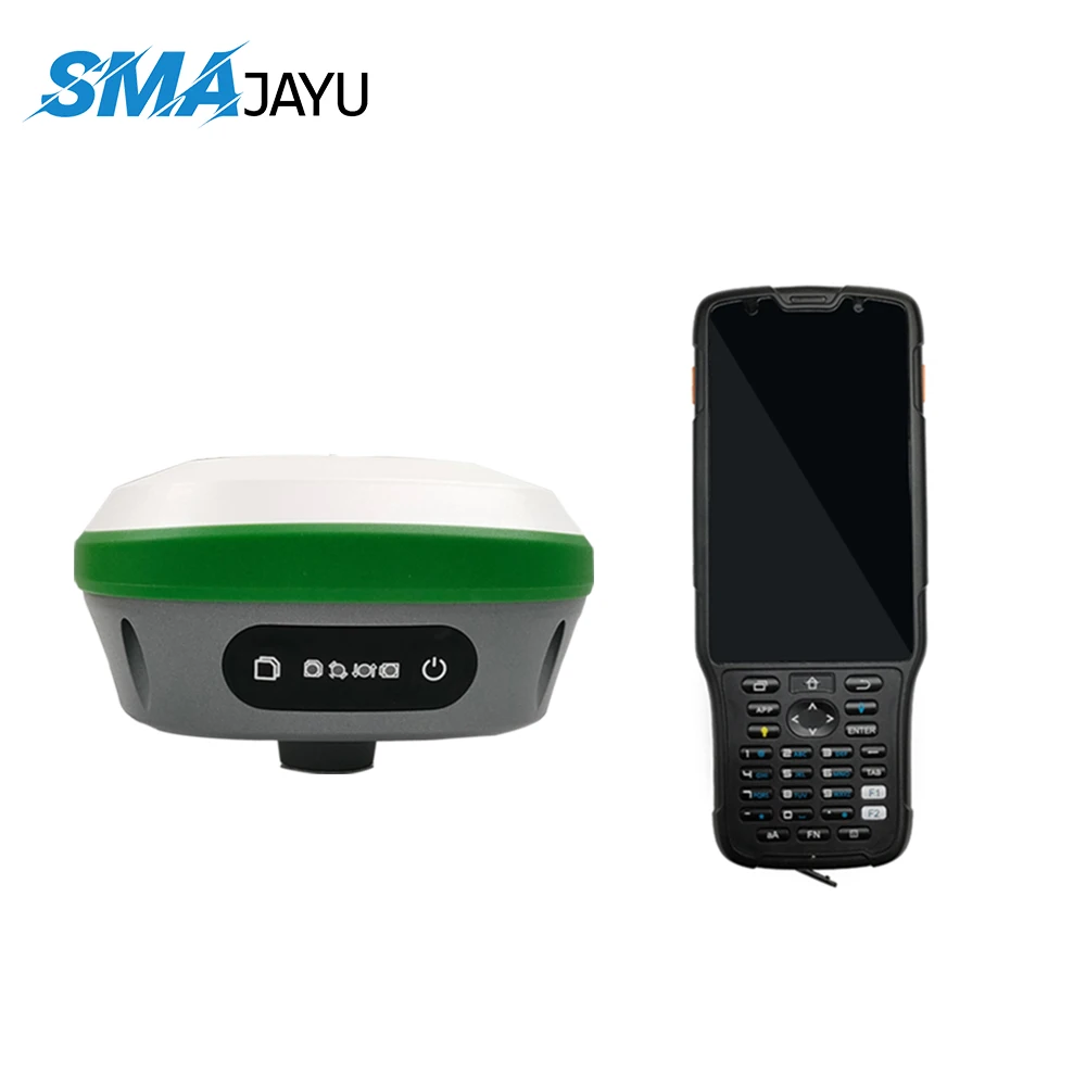
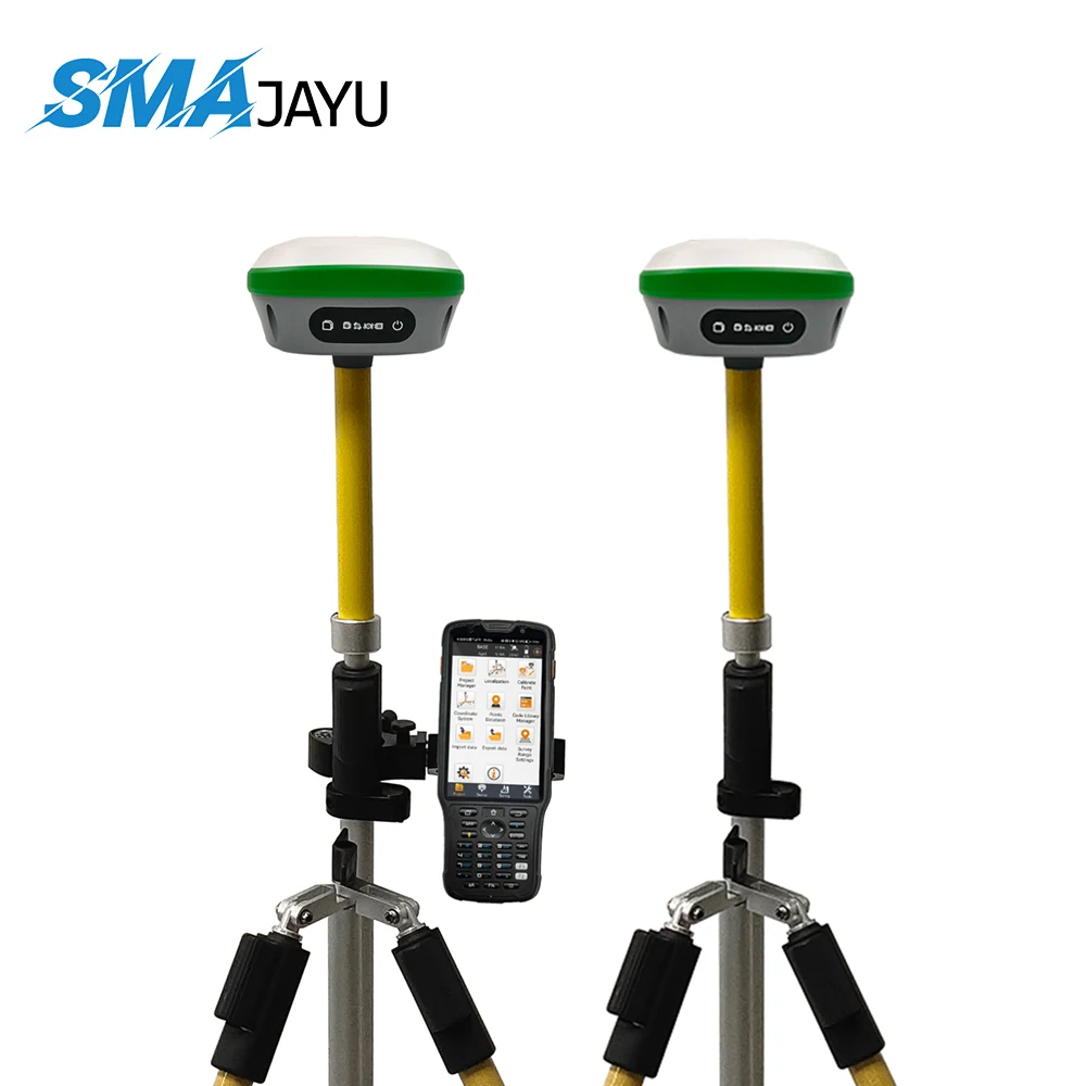
The R26 GNSS RTK Surveying System Base Station and Rover provide high precision and reliability for all your surveying needs. Designed for professionals, this system ensures accurate data collection and analysis, making it ideal for complex surveying tasks.

Technical specifications

FeatureSpecificationBenefit
GNSS TechnologyMulti-frequencyEnhanced accuracy
ConnectivityBluetooth, Wi-FiEasy data transfer
Battery Life10 hoursExtended fieldwork

Customization guide

With adjustable frequency settings, you can tailor your GNSS RTK system to meet specific surveying challenges, ensuring optimal performance in diverse terrains.

Get inspired

Discover unparalleled precision with the R26 GNSS RTK Surveying System. Designed for surveyors seeking accuracy and efficiency, this system empowers you to tackle any project with confidence.

Choose your model

ParameterBase ModelAdvanced ModelPro Model
Accuracy±1 cm[+15%][+30%]*
Range5 km[Enhanced][Premium]

Supplier's note

The Pro version's accuracy – 30% above the industry standard – ensures precise data collection even in challenging environments. When paired with its extended range, this model is perfect for large-scale projects. With the R26 series, you can select the ideal model based on project size and complexity, ensuring optimal results every time.

Frequently asked questions

  • Which RTK Surveying System model suits small surveying teams?

  • How to maintain the R26 GNSS RTK Surveying System for optimal performance?

  • What makes the R26 GNSS RTK Surveying System stand out in terms of precision?

  • Can I customize the R26 GNSS RTK Surveying System for specific surveying needs?

  • Is the material used in the R26 GNSS RTK Surveying System weather-resistant?

  • What technical features validate the R26 GNSS RTK Surveying System for professional use?

  • How does the R26 GNSS RTK Surveying System compare to other test instruments in terms of usability?

  • Can the R26 GNSS RTK Surveying System be integrated with existing surveying software?

Product comparison

CategoryUsage ScenariosCharacteristicsAdvantagesDisadvantages
GNSS RTK Surveying SystemsLand SurveyingHigh Precision (1 cm accuracy)Real-time data collectionRequires clear sky visibility
GNSS RTK Surveying SystemsConstruction LayoutFast Initialization (less than 10 sec)Reduces setup timeDependent on base station proximity
GNSS RTK Surveying SystemsAgriculture MappingMulti-frequency support (L1, L2, L5)Improved signal reliabilityHigher cost
GNSS RTK Surveying SystemsUrban PlanningNetwork RTK capabilityEnables broad coverage without base setupSusceptible to signal obstructions
GNSS RTK Surveying SystemsMarine NavigationWaterproof design (IP68 rated)Suitable for harsh environmentsLimited to RTK network availability
GNSS RTK Surveying SystemsGeodetic ApplicationsAdvanced data logging (32GB storage)Ensures comprehensive data captureRequires post-processing expertise

Related searches

The Product Description is generated by third-party, and Alibaba.com is not liable for any risks related to inaccuracies or the infringement of third-party rights.

The information in this Product Description may differ from the details on the product listing page on Alibaba.com. Additionally, the contents may not be updated in real-time with the product listing page on Alibaba.com, and there may be delays in reflecting the most updated information. The description on product listing page takes precedence. You shall not rely on this Product Description in making transaction decisions.

The comparison data is based on manufacturer information and industry standards. Actual results may vary depending on individual use cases. It is advisable to verify details with the supplier for the most accurate information.