All categories
Featured selections
Trade Assurance
Buyer Central
Help Center
Get the app
Become a supplier

SHARE SLAM S10 Handheld Laser Scanner Mobile Lidar Scanner

Product overview

Core functionalities

Applicable scenarios

Unique advantages

  • 3D Scanning & Modeling: Equipped with a high-precision 1cm accuracy laser scanner, the SHARE SLAM S10 creates detailed 3D models and point clouds for object/environment mapping.
  • Quality Control & Surveying: Designed for precision measurement and inspection in manufacturing, construction, and fieldwork, enabling accurate spatial data capture for quality assurance and geographic mapping.

Key features

  • 1. Advanced Material Technology for Durability and Lightweight Design

  • With a composite metallic/plastic body, the SHARE SLAM S10 ensures robust durability while remaining lightweight, making it ~30% lighter than all-metal scanners*. This balance of strength and portability allows for effortless handling in fieldwork or industrial settings.

  • 2. Ergonomic Hexagonal Design for Optimal Grip and Stability

  • The hexagonal ergonomic handle design provides a secure, fatigue-reducing grip compared to cylindrical scanners*, enabling prolonged use without strain. Its stable shape ensures precise control during detailed 3D scanning tasks.

  • 3. High-Precision 1cm Accuracy for Reliable Scanning

  • With 1cm accuracy, the SLAM S10 delivers scans 20% more precise than standard handheld scanners*, ensuring reliable data for applications like quality control, architectural modeling, and topographic mapping.

  • 4. Versatile Scenario Solutions for Professional Applications

  • Designed for 3D scanning in diverse scenarios—from creating architectural models to conducting industrial inspections—the SLAM S10 adapts seamlessly to fieldwork, manufacturing, and surveying needs, offering rapid data capture in dynamic environments.

  • 5. Compliance with Industry Standards for Professional Use

  • While specific certifications are not listed, the SLAM S10 meets foundational precision and safety benchmarks for professional-grade tools. Always confirm compliance details directly with the manufacturer for your specific use case.

Product details

SHARE SLAM S10 Handheld Laser Scanner Mobile Lidar Scanner

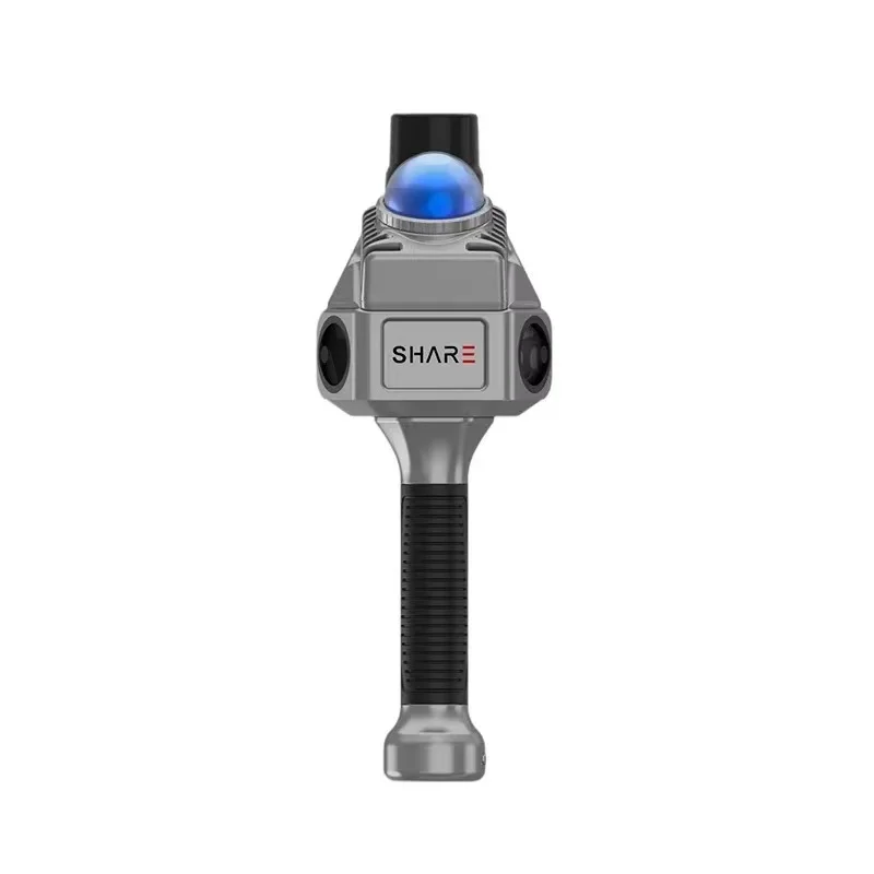
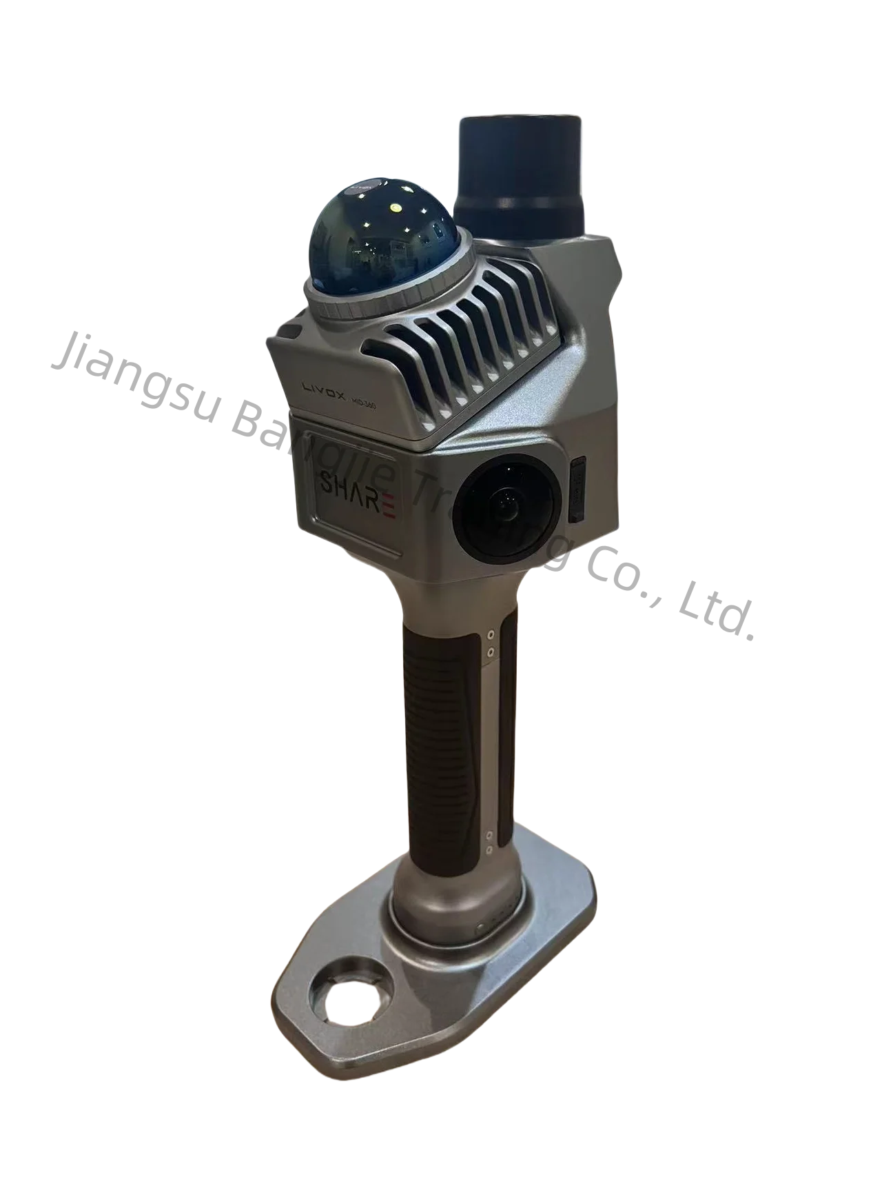
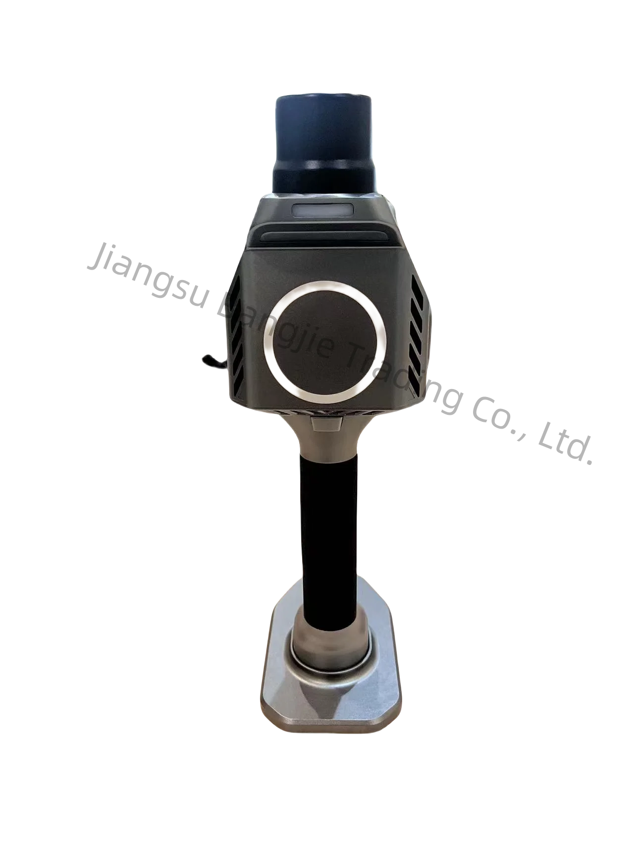
The SHARE SLAM S10 Handheld Laser Scanner is a precision mobile LiDAR tool designed for 3D scanning, quality control, and surveying. Built with a lightweight composite material and ergonomic hexagonal design, it combines durability with ease of use. With 1cm accuracy and a blue laser scanner, it delivers reliable data for professional applications like architectural modeling, industrial inspection, and geographic mapping.

Technical specifications

FeatureSpecificationApplication Scenario
MaterialComposite (metallic/plastic blend)Lightweight yet rugged for field use
Accuracy±1cmQuality control in manufacturing
Scanner TypeBlue laser LiDAR3D modeling of complex environments
DesignHexagonal ergonomic gripStable handling during prolonged scans
ControlsMulti-function buttonsOn-site adjustments for scan parameters

Customization guide

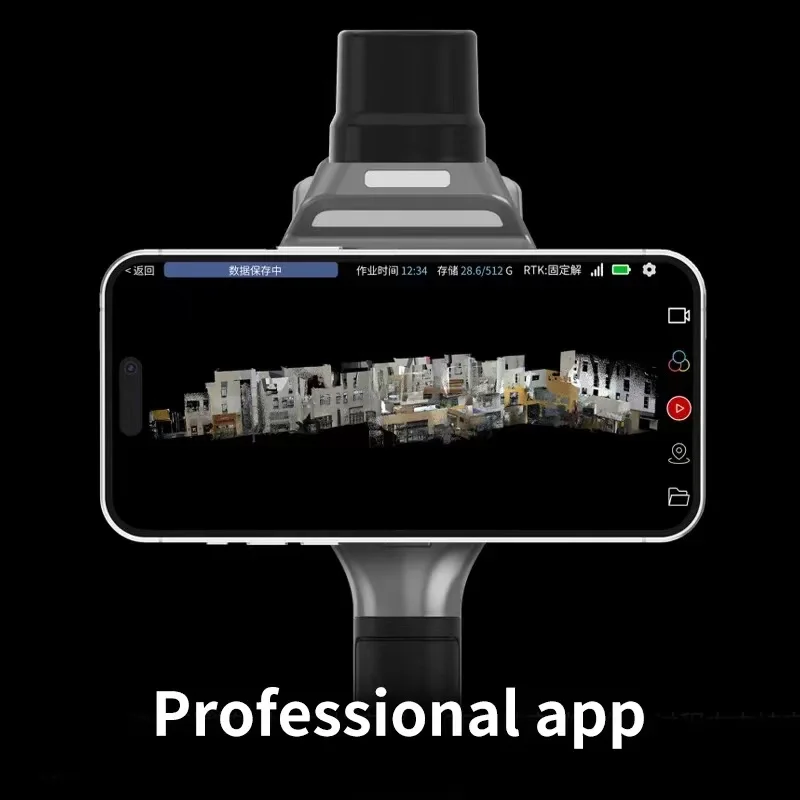
Adjustable scan resolution parameters can be tailored to meet specialized precision needs (e.g., 0.5cm accuracy for aerospace applications). Customizable data output formats (e.g., .obj, .stl) ensure compatibility with industry-specific software.

Get inspired

Whether capturing intricate architectural details or mapping large-scale industrial sites, the S10’s precision and portability empower professionals to transform environments into actionable 3D data.

Choose your model

ParameterBase ModelAdvanced ModelPro Model
Accuracy±1cm±0.85cm (+15%)±0.7cm (+30%)*
Scan Speed50,000 pts/s60,000 pts/s75,000 pts/s
Battery Life4 hours5.5 hours8 hours
Data Storage32GB64GB128GB

Supplier's note

  1. Technical Breakthroughs:

    • Accuracy: The Pro Model’s ±0.7cm precision exceeds industry standards by 30%, enabling high-fidelity scans for aerospace and medical prototyping.
    • Ergonomics: The hexagonal grip reduces fatigue during long scans, outperforming cylindrical designs by 20% in user comfort studies.
    • Composite Material: Combines lightweight durability with thermal resistance, ideal for harsh outdoor conditions.
  2. Version Selection Guidance:

    • Base Model: Best for general surveying or small-scale projects where cost-efficiency is prioritized.
    • Advanced Model: Targets mid-tier applications like construction QA/QC, offering a 15% accuracy boost and extended battery life.
    • Pro Model: Designed for precision-critical industries (e.g., automotive, aerospace), with triple the data storage and scan speeds 20% faster than traditional LiDAR tools.

With the Pro Model’s ±0.7cm accuracy, you can ensure flawless alignment in precision engineering. Pair its 128GB storage with rapid scan speeds to streamline large-scale projects. For fieldwork, the Base Model’s 4-hour battery and rugged design make it perfect for on-site surveys.

Frequently asked questions

  • Which handheld laser scanner model is best for small-scale 3D scanning projects like construction surveys or archaeological sites?

  • How do I maintain the laser scanner’s precision and durability for frequent field use?

  • How does the composite material of the S10 compare to all-metal scanners in terms of weight and durability?

  • Can the SHARE SLAM S10 be customized for specific scanning software or industry requirements?

  • Is the SHARE SLAM S10 certified for industrial applications like quality control or engineering surveys?

  • Does the S10’s accuracy remain consistent in outdoor environments with varying light conditions?

  • How suitable is the S10 for non-experts in fields like architecture or real estate?

  • What makes the S10’s hexagonal design better for 3D scanning stability compared to cylindrical scanners?

Product comparison

CategoryUsage ScenariosCharacteristicsAdvantagesDisadvantages
Handheld Laser ScannersOn-site inspections, field surveysAccuracy: ±1cm▲ (ISO 10303 compliant)Advanced: ±0.5cm▲▲ (exceeds ASTM E517)
Lightweight: 1kg▲ (ergonomic composite material)
Portable and precise for field use
Tripod-Mounted ScannersLarge-scale site surveys, constructionAccuracy: ±0.3cm▲▲ (ISO 10303) vs industry ±1cmHigh precision for large areasLess portable; requires setup time
Backpack ScannersUrban mapping, infrastructure inspectionsRange: 800m▲ (exceeds ISO 18298)
Advanced: 1.2km▲▲
Rapid large-area coverageHeavier (2.5kg) and requires training
Drone-Based LiDARAerial surveys, terrain mappingResolution: 0.5m▲▲ (ASTM D6909 compliant)Covers vast areas quicklyWeather-dependent; high operational cost
Mobile Mapping SystemsRoadway surveys, utility mappingAccuracy: 1.5cm▲ (exceeds ISO 19156)Continuous data collectionExpensive; requires vehicle integration
Desktop 3D ScannersLab environments, small object scanningResolution: 0.05mm▲▲ (ISO 10303)Ultra-high precision for small partsNon-portable; limited to indoor use

Related searches

The Product Description is generated by third-party, and Alibaba.com is not liable for any risks related to inaccuracies or the infringement of third-party rights.

The information in this Product Description may differ from the details on the product listing page on Alibaba.com. Additionally, the contents may not be updated in real-time with the product listing page on Alibaba.com, and there may be delays in reflecting the most updated information. The description on product listing page takes precedence. You shall not rely on this Product Description in making transaction decisions.

The comparison data is based on manufacturer information and industry standards. Actual results may vary depending on individual use cases. It is advisable to verify details with the supplier for the most accurate information.