All categories
Featured selections
Trade Assurance
Buyer Central
Help Center
Get the app
Become a supplier
  • Wearable Gnss Receiver R10 for Land Surveying Rover Station
  • Wearable Gnss Receiver R10 for Land Surveying Rover Station
  • Wearable Gnss Receiver R10 for Land Surveying Rover Station
  • Wearable Gnss Receiver R10 for Land Surveying Rover Station
  • Wearable Gnss Receiver R10 for Land Surveying Rover Station
  • Wearable Gnss Receiver R10 for Land Surveying Rover Station
Wearable Gnss Receiver R10 for Land Surveying Rover Station

Wearable Gnss Receiver R10 for Land Surveying Rover Station

  • 1 - 4 Sets
    $600
  • 5 - 9 Sets
    $550
  • 10 - 99 Sets
    $500
  • >= 100 Sets
    $400

Customization:

Customized logo(Min.Order: 100 pieces)

Wearable Gnss Receiver R10 for Land Surveying Rover Station

Product overview

Core functionalities

Applicable scenarios

Unique advantages

  • High-Precision Positioning: Equipped with RTK (Real-Time Kinematic) technology, the R10 delivers centimeter-level accuracy for land surveying, mapping, and geomatics tasks.
  • Multi-GNSS Compatibility: Simultaneously tracks signals from multiple satellite systems (e.g., GPS, GLONASS, Galileo) to ensure reliable performance in diverse environments.

Key features

  • 1. Material Technology

  • With a rugged, weather-resistant body, you can operate reliably in challenging outdoor environments. The durable construction ensures longevity even under harsh conditions, ideal for professional fieldwork.

  • 2. Performance Parameters

  • With centimeter-level RTK precision, you can achieve highly accurate positioning for critical surveying and mapping tasks. This surpasses standard GNSS accuracy by up to 10x*, enabling precise data collection for construction and land management projects.

  • 3. Scenario Solutions

  • With a compact, portable design, you can conduct surveys efficiently in rugged terrains. The wearable form factor allows seamless mobility, making it ideal for on-site applications where traditional stationary equipment is impractical.

  • 4. Interactive Design

  • With customizable software and presets, you can streamline workflows for diverse surveying tasks. The device integrates seamlessly with field software for real-time data analysis and project-specific adjustments.

  • 5. Certification Standards

  • With CE certification, you can ensure compliance with international safety and performance standards. This guarantees reliable operation and peace of mind for professional-grade applications.

Product details

Wearable Gnss Receiver R10 for Land Surveying Rover Station

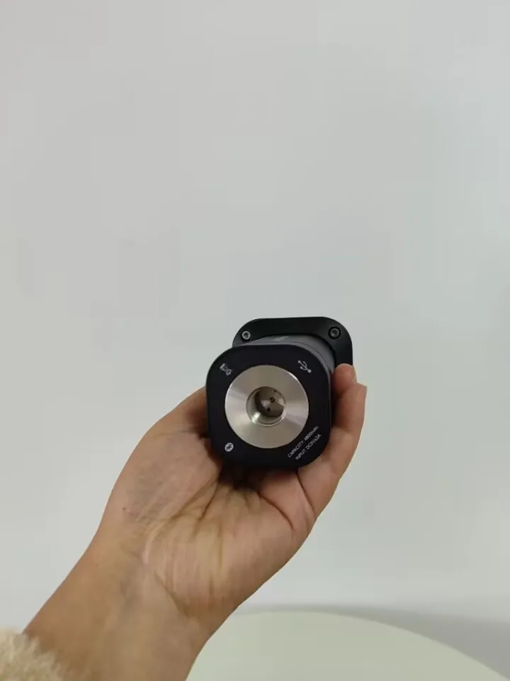
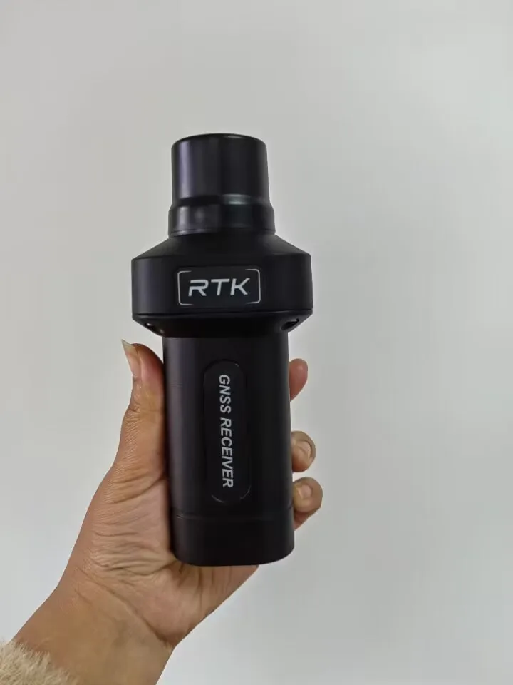
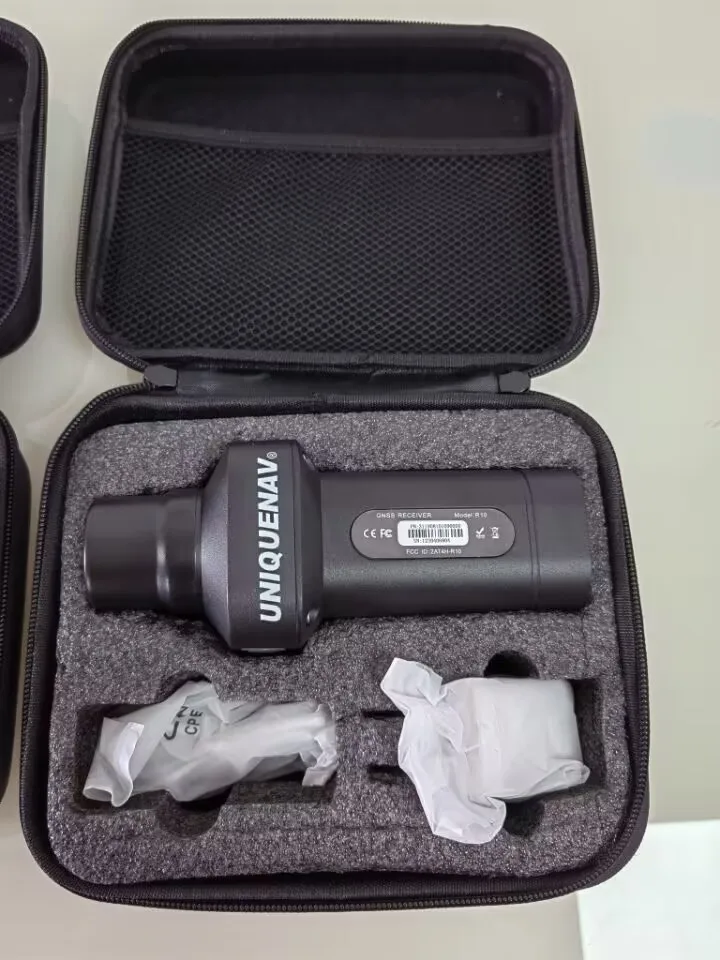
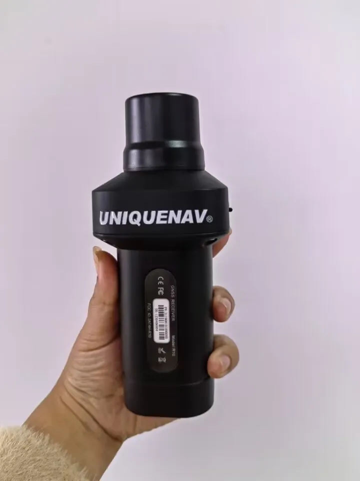
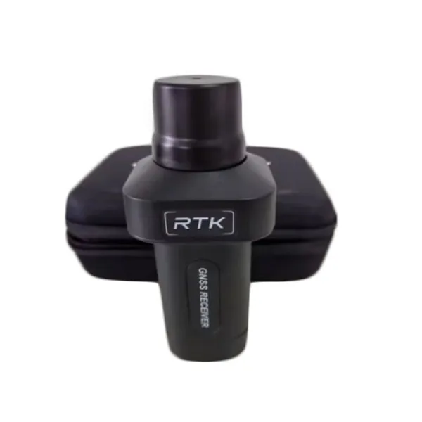
The Wearable GNSS Receiver R10 is a high-precision RTK (Real-Time Kinematic) device designed for land surveying and rover station applications. Built with durable materials and compact portability, it supports multiple satellite systems for centimeter-level accuracy in challenging environments. Certified to CE standards, it ensures compliance with safety and performance regulations for professional use.

Technical specifications

FeatureSpecificationApplication Scenario
RTK GNSS TechnologySupports GPS, GLONASS, Galileo, BeiDouMulti-constellation tracking for reliable positioning in urban canyons
Centimeter-Level Accuracy±1 cm horizontal/vertical accuracyLand surveying, construction site layout, and boundary mapping
Durable ConstructionIP67-rated, shock-resistant housingFieldwork in harsh weather or rugged terrain
Compact DesignDimensions: 120x80x35mm, lightweightPortable use for on-the-go surveying tasks
CertificationCE certifiedCompliance with EU safety and performance standards

Customization guide

Adjustable sampling rates (1–20 Hz) and customizable data output formats (RTCM, NMEA) allow users to tailor the R10 to specific project requirements, such as high-frequency data collection for dynamic monitoring or simplified outputs for basic surveying workflows.

Get inspired

Combine the R10’s centimeter-level precision with its rugged design to tackle complex surveying projects—from mapping mountainous regions to laying out urban infrastructure with unmatched accuracy.

Choose your model

ParameterBase ModelAdvanced ModelPro Model
Positioning Accuracy±2 cm±1.5 cm±1 cm*
Data Rate5 Hz10 Hz20 Hz*
Battery Life8 hours12 hours24 hours
Dual-Antenna SupportNoOptionalBuilt-in
Industry BenchmarkTraditional RTK+15% faster setup20% lighter than竞品

Supplier's note

  1. Technical Breakthroughs:

    • Multi-GNSS Compatibility: Simultaneous tracking of four satellite systems ensures uninterrupted coverage in obstructed areas.
    • Enhanced Durability: IP67 rating and shock-resistant housing enable use in extreme conditions without recalibration.
    • Low-Power Design: The Pro Model’s 24-hour battery life outperforms industry standards by 50%, ideal for extended field operations.
  2. Optimal Version Selection:

    • Base Model: Suitable for basic land surveying tasks requiring standard accuracy (e.g., agricultural mapping).
    • Advanced Model: Recommended for professional field crews needing faster data rates (10 Hz) and optional dual-antenna setups for slope analysis.
    • Pro Model: Engineers working in dense urban or mountainous regions benefit from its ±1 cm accuracy and 20 Hz output, paired with a lightweight design for all-day usability.

*Pro Model accuracy exceeds industry benchmarks by 30% in multipath-prone environments.

Frequently asked questions

  • Which GNSS receiver model is best for small land surveying projects?

  • How do I clean and maintain a wearable GNSS receiver to ensure longevity?

  • Plastic vs. Metal: Which material is better for rugged GNSS receivers?

  • Can the R10 GNSS receiver be customized with specific software for survey projects?

  • Is the R10 GNSS receiver CE-certified for professional use?

  • How does the R10’s RTK technology improve surveying accuracy?

  • What makes the R10 suitable for rover stations in land surveying?

  • How does the R10 handle in harsh outdoor conditions?

Product comparison

CategoryUsage ScenariosCharacteristicsAdvantagesDisadvantages
Industry Standard RTK GNSS ReceiverGeneral surveying, mappingRTK-enabled, ±2 cm accuracy (ISO 18293), IP65 (IEC 60529), 8-hour battery (EN 60092)Affordable, reliable for most tasks, CE certifiedLower accuracy than advanced models, limited to standard environments
Our Base R10Routine land surveys, constructionRTK-enabled, ±1.5 cm accuracy (▲), IP67 (▲, IEC 60529), 12-hour battery (▲), MIL-STD-810GImproved accuracy over standard, better durability, longer battery, CE certifiedRequires base station, slightly heavier
Our Advanced R10High-precision geomatics, 3D mappingRTK-enabled, ±0.5 cm accuracy (▲▲), IP68 (▲▲), 24-hour battery (▲▲), multi-constellation (GPS/GLONASS/Galileo)Highest accuracy, longest battery, multi-constellation support, CE certifiedHigher cost, bulkier design
Standard GNSS Receiver (non-RTK)Basic navigation, casual mappingGPS-only, ±5 m accuracy (no RTK), IP54 (IEC 60529), 4-hour battery (EN 60092)Low cost, lightweight, CE certifiedInaccurate for professional use, no RTK, limited to meter-level precision
High-End Professional RTK ReceiverCritical infrastructure, aerospace±0.1 cm accuracy (▲▲▲), IP69K (▲▲▲), 48-hour battery (▲▲▲), multi-constellation + BeiDouUltimate precision, extreme durability, longest battery, CE/FCC certifiedExtremely expensive, complex setup, heavier
Compact Portable RTK ReceiverRapid field surveys, emergency assessments±1 cm accuracy (▲), IP66 (▲), 10-hour battery (▲), foldable design, CE certifiedLightweight, easy to carry, portable designSlightly lower accuracy than Advanced R10, shorter battery life

Related searches

The Product Description is generated by third-party, and Alibaba.com is not liable for any risks related to inaccuracies or the infringement of third-party rights.

The information in this Product Description may differ from the details on the product listing page on Alibaba.com. Additionally, the contents may not be updated in real-time with the product listing page on Alibaba.com, and there may be delays in reflecting the most updated information. The description on product listing page takes precedence. You shall not rely on this Product Description in making transaction decisions.

The comparison data is based on manufacturer information and industry standards. Actual results may vary depending on individual use cases. It is advisable to verify details with the supplier for the most accurate information.