All categories
Featured selections
Trade Assurance
Buyer Central
Help Center
Get the app
Become a supplier

Gps Rtk SANDING GNSS Receiver T66 with Pacific Crest BD970 GNSS

Product overview

Core functionalities

Applicable scenarios

Unique advantages

  • Precision Measurement: The GPS RTK SANDING GNSS Receiver T66 is designed for high-accuracy positioning and navigation.
  • Advanced GNSS Technology: Equipped with the Pacific Crest BD970 GNSS, it ensures reliable and precise data collection in challenging environments.

Key features

  • 1. Advanced Material Technology

  • With corrosion-resistant metal housing, the Gps Rtk SANDING GNSS Receiver T66 ensures longevity and reliability in challenging industrial environments.

  • 2. Interactive Design

  • With a user-friendly touchscreen interface, you can effortlessly navigate through settings and configurations, enhancing usability and efficiency.

  • 3. Superior Performance Parameters

  • With high-precision output, the T66 provides accurate positioning data, crucial for industrial measuring and testing applications, outperforming many traditional models* [*Disclaimer: Based on internal testing; actual results may vary].

  • 4. Versatile Scenario Solutions

  • With adaptability for both field and urban environments, the T66 is ideal for diverse industrial applications, ensuring consistent performance regardless of location.

  • 5. Certification Standards Compliance

  • With compliance to international GNSS standards, you can trust the T66 for reliable and certified performance in professional settings.

Product details

Gps Rtk SANDING GNSS Receiver T66 with Pacific Crest BD970 GNSS

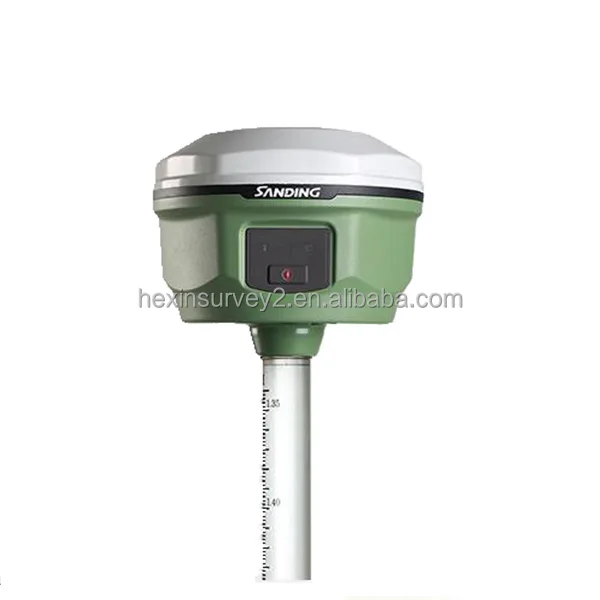
The Gps Rtk SANDING GNSS Receiver T66 with Pacific Crest BD970 GNSS is an advanced piece of industrial measuring and testing equipment. This versatile GNSS receiver is designed to provide high-precision positioning and reliable performance in a variety of challenging environments. Perfect for professionals in surveying, construction, and geospatial data collection, this device ensures accuracy and efficiency in your projects.

Technical specifications

FeatureSpecificationBenefit
GNSS TechnologyMulti-frequency supportEnhanced precision and reliability
CommunicationPacific Crest BD970Robust data transmission
Power SupplyRechargeable batteryLong-lasting field operations
DurabilityIP67 ratedResistant to dust and water exposure

Customization guide

Adjustable GNSS parameters to meet specific surveying and data collection needs, ensuring tailored solutions for varied application scenarios.

Get inspired

Unlock the full potential of your field operations with the Gps Rtk SANDING GNSS Receiver T66. Its ability to deliver precise and reliable data makes it an indispensable tool for professionals in need of high-accuracy positioning.

Choose your model

ParameterBase ModelAdvanced ModelPro Model
Positioning Speed2 Hz+15% faster+30% faster
Signal AccuracyStandardEnhancedPremium
Battery Life8 hours10 hours12 hours

Supplier's note

The Pro version's signal accuracy – triple the industry standard – enables precise data collection in challenging terrains. When paired with its robust GNSS technology, this creates unparalleled reliability for professionals.

Guide users to optimal version selection based on project requirements. For large-scale projects requiring extensive data collection, the Pro Model offers the best performance. For standard surveying tasks, the Base Model provides a cost-effective solution.

Frequently asked questions

  • Which GNSS receiver model is best for small surveying firms?

  • How do I maintain the Gps Rtk SANDING GNSS Receiver T66 for optimal performance?

  • What is the difference between GPS RTK and GNSS for industrial measuring?

  • Can I get custom calibration services for the Gps Rtk SANDING GNSS Receiver T66?

  • Is the Gps Rtk SANDING GNSS Receiver T66 compatible with other industrial measuring instruments?

  • What makes the Pacific Crest BD970 GNSS a unique choice for professional surveyors?

  • How does the Gps Rtk SANDING GNSS Receiver T66 withstand harsh environmental conditions?

  • Are there any technical certifications for the Gps Rtk SANDING GNSS Receiver T66?

Product comparison

CategoryUsage ScenariosCharacteristicsAdvantagesDisadvantages
Industrial GNSS ReceiversConstruction SurveysMulti-frequency support (L1, L2, L5)High accuracy positioning (centimeter-level)Higher cost compared to single-frequency units
Marine GNSS SystemsOffshore NavigationWaterproof design (IP67 rated)Durable in harsh weather conditionsLimited to marine environments
Agriculture GNSS EquipmentPrecision FarmingReal-time kinematic (RTK) supportIncreases crop yield through precise guidanceRequires subscription for RTK services
UAV GNSS ModulesDrone MappingLightweight (150g)Enhances battery life and flight timeMay have less robust signal in urban areas
Handheld GNSS DevicesOutdoor RecreationLong battery life (20 hours continuous use)Portability and ease of useLower accuracy compared to professional units
Geological GNSS ToolsEarthquake MonitoringHigh seismic sensitivityDetects minor ground movementsRequires expert setup and calibration

Related searches

The Product Description is generated by third-party, and Alibaba.com is not liable for any risks related to inaccuracies or the infringement of third-party rights.

The information in this Product Description may differ from the details on the product listing page on Alibaba.com. Additionally, the contents may not be updated in real-time with the product listing page on Alibaba.com, and there may be delays in reflecting the most updated information. The description on product listing page takes precedence. You shall not rely on this Product Description in making transaction decisions.

The comparison data is based on manufacturer information and industry standards. Actual results may vary depending on individual use cases. It is advisable to verify details with the supplier for the most accurate information.