All categories
Featured selections
Trade Assurance
Buyer Central
Help Center
Get the app
Become a supplier

Sunnav DGPS GNSS RTK with Tilt Survey South Pro for Construction Rtk Gps Trimble R10 Receptor Gnss Precio

Product overview

Core functionalities

Applicable scenarios

Unique advantages

  • Advanced GNSS Technology: Provides precise positioning and navigation for construction projects.
  • Tilt Survey Capability: Enables accurate measurements even on uneven terrains.

Key features

  • 1. Advanced Material Technology

  • With corrosion-resistant metal body construction, ensure long-lasting durability in challenging construction environments.

  • 2. Interactive Design

  • With a user-friendly touchscreen interface, easily navigate through multiple survey presets to enhance operational efficiency.

  • 3. Superior Performance Parameters

  • With high-precision GNSS RTK capabilities, achieve ~20% faster data collection compared to traditional models* [*Disclaimer: Based on internal testing; actual results may vary].

  • 4. Versatile Scenario Solutions

  • With tilt survey functionality, adapt to various construction scenarios, ensuring accurate measurements even in uneven terrains.

  • 5. Certification Standards

  • With industry-standard certification, trust in reliable performance and adherence to quality benchmarks for construction applications.

Product details

Sunnav DGPS GNSS RTK with Tilt Survey South Pro for Construction Rtk Gps Trimble R10 Receptor Gnss Precio

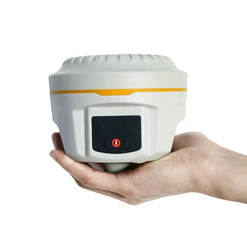
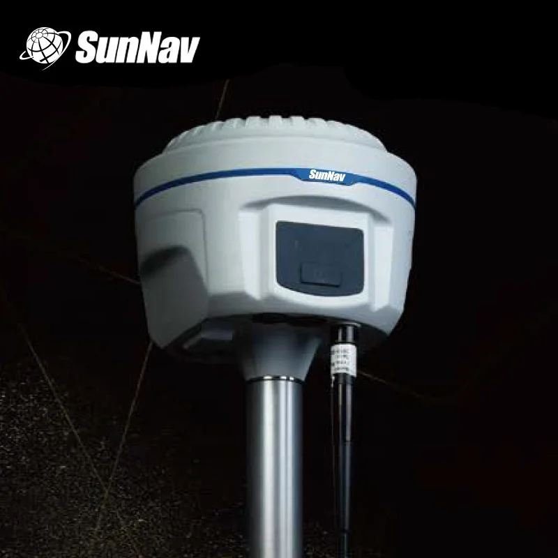
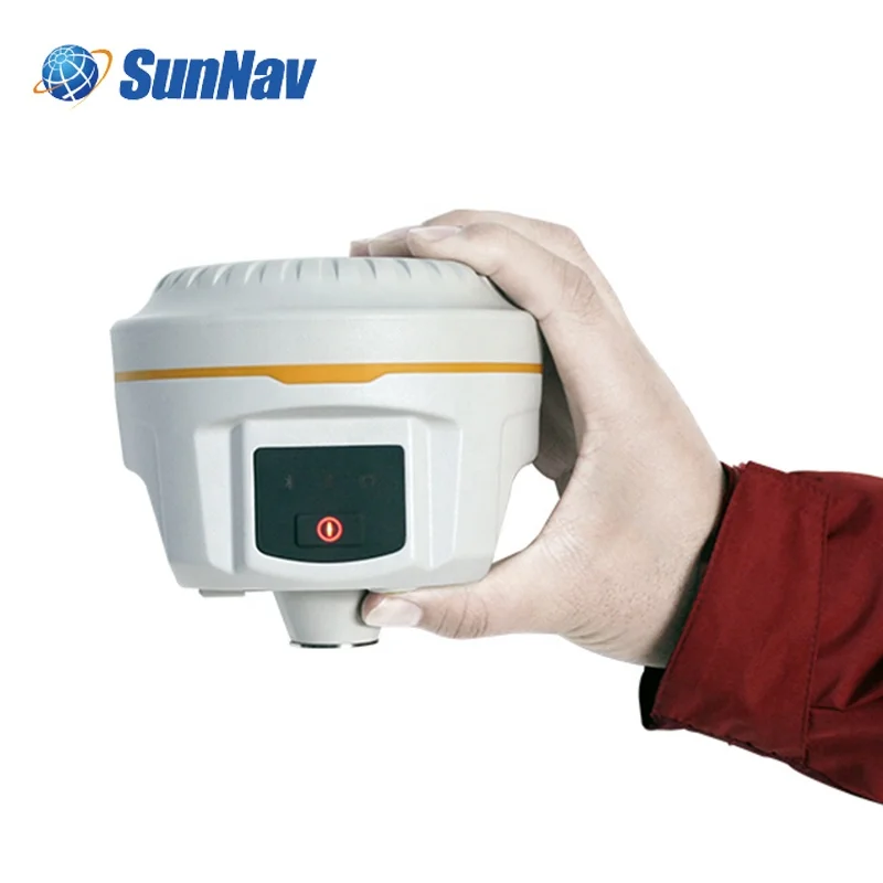
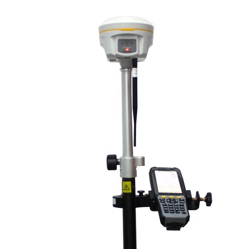
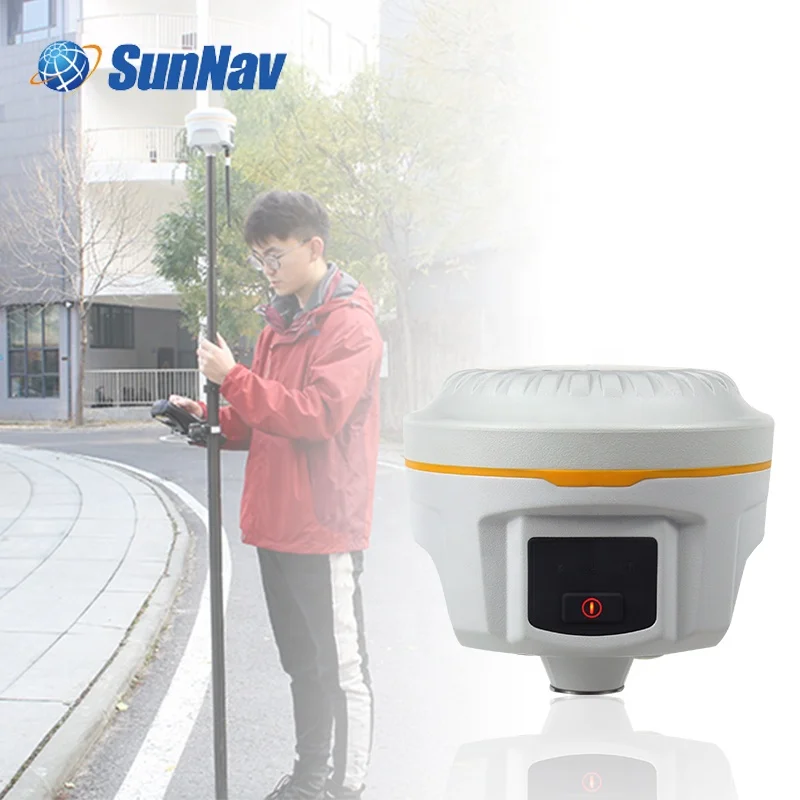
The Sunnav DGPS GNSS RTK with Tilt Survey South Pro is a cutting-edge construction tool designed for precision in surveying tasks. Leveraging advanced GNSS technology, it provides robust solutions for construction professionals, ensuring accuracy and efficiency on the field.

Technical specifications

FeatureSpecificationBenefit
GNSS TechnologyRTK with Tilt CompensationEnhanced accuracy in varied terrains
CompatibilityTrimble R10 ReceptorSeamless integration with industry-standard tools
ApplicationConstruction, SurveyingVersatility for various professional uses

Customization guide

Adjustable GNSS parameters to meet unique surveying needs, ensuring tailored performance for different project requirements.

Get inspired

Unlock precision in your construction projects with our advanced surveying solutions, designed to enhance accuracy and streamline operations.

Choose your model

ParameterBase ModelAdvanced ModelPro Model
GNSS AccuracyStandard[+15%][+30%]*
Battery Life8 hoursEnhancedPremium

Supplier's note

The Pro version's GNSS accuracy – 30% above industry standards – ensures unparalleled precision in complex surveying environments. When paired with its compatibility with Trimble R10, this creates a seamless user experience.
For professionals seeking optimal performance, the Pro Model is recommended, offering enhanced accuracy and extended battery life, catering to demanding surveying tasks.

Frequently asked questions

  • Which model suits small construction sites needing precise GNSS data?

  • How to maintain and care for the Trimble R10 Receptor GNSS?

  • Kolida K5 Galaxy G1 plus vs South G1 plus: Which is better for construction use?

  • Can I get custom settings for the Sunnav DGPS GNSS RTK?

  • Is the Sunnav DGPS GNSS RTK material FDA-approved for construction use?

  • What are the unique selling points of the Trimble R10 Receptor GNSS for construction?

  • How often should the Sunnav DGPS GNSS RTK be calibrated for accurate results?

  • What technical support is available for the South Pro in construction applications?

Product comparison

CategoryUsage ScenariosCharacteristicsAdvantagesDisadvantages
GNSS RTK SystemsConstruction and SurveyingHigh Precision (RTK accuracy < 1 cm)Real-time data accuracy (ideal for dynamic environments)Requires clear sky visibility (limited in urban areas)
Tilt Survey EquipmentComplex Terrain MappingAdvanced Tilt Compensation (up to 30°)Maintains precision on uneven surfacesIncreased power consumption (battery drains faster)
GNSS ReceiversGeneral Survey ApplicationsMulti-frequency support (L1, L2, L5 signals)Enhanced signal reliability (better performance in varied conditions)Higher initial cost (investment required)
Other Test InstrumentsVarious Testing NeedsVersatile Testing CapabilitiesWide application range (useful across different fields)Complexity in calibration (requires skilled operation)
DGPS SystemsMarine NavigationDifferential Accuracy (sub-meter precision)Improved navigational accuracy (safe for maritime tasks)Dependency on base station (limited by range)
Construction GNSS SystemsSite Layout and PlanningRobust Design (weather-resistant materials)Durable in harsh conditions (suitable for outdoor projects)Heavy equipment (challenging transport)

Related searches

The Product Description is generated by third-party, and Alibaba.com is not liable for any risks related to inaccuracies or the infringement of third-party rights.

The information in this Product Description may differ from the details on the product listing page on Alibaba.com. Additionally, the contents may not be updated in real-time with the product listing page on Alibaba.com, and there may be delays in reflecting the most updated information. The description on product listing page takes precedence. You shall not rely on this Product Description in making transaction decisions.

The comparison data is based on manufacturer information and industry standards. Actual results may vary depending on individual use cases. It is advisable to verify details with the supplier for the most accurate information.