All categories
Featured selections
Trade Assurance
Buyer Central
Help Center
Get the app
Become a supplier
  • Cheap Price Gps Gnss Receiver Chcnav Ibase Gps Land Surveying Gnss Receiver Rtk
  • Cheap Price Gps Gnss Receiver Chcnav Ibase Gps Land Surveying Gnss Receiver Rtk
  • Cheap Price Gps Gnss Receiver Chcnav Ibase Gps Land Surveying Gnss Receiver Rtk
  • Cheap Price Gps Gnss Receiver Chcnav Ibase Gps Land Surveying Gnss Receiver Rtk
  • Cheap Price Gps Gnss Receiver Chcnav Ibase Gps Land Surveying Gnss Receiver Rtk
  • Cheap Price Gps Gnss Receiver Chcnav Ibase Gps Land Surveying Gnss Receiver Rtk
Cheap Price Gps Gnss Receiver Chcnav Ibase Gps Land Surveying Gnss Receiver Rtk
Ready to Ship
In stock Fast dispatch

Cheap Price Gps Gnss Receiver Chcnav Ibase Gps Land Surveying Gnss Receiver Rtk

  • 1 - 9 Sets
    $2,600
  • 10 - 19 Sets
    $2,550
  • >= 20 Sets
    $2,500

Customization:

Customized packaging(Min.Order: 100 pieces)
Customized logo(Min.Order: 100 pieces)
Graphic customization(Min.Order: 100 pieces)

Cheap Price Gps Gnss Receiver Chcnav Ibase Gps Land Surveying Gnss Receiver Rtk

Product overview

Core functionalities

Applicable scenarios

Unique advantages

  • High-Precision Positioning: Equipped with RTK (Real-Time Kinematic) technology, enabling centimeter-level accuracy for land surveying, mapping, and navigation.
  • Multi-Constellation Support: Receives signals from GPS and GLONASS satellite systems for enhanced reliability and coverage in challenging environments.
  • Durable Design: Built with rugged plastic and metal materials, ensuring robust performance in outdoor and harsh weather conditions.

Key features

  • 1. Rugged Material Construction for Harsh Environments

  • With a durable plastic-and-metal build, you can ensure reliable operation in rugged outdoor conditions such as extreme temperatures and rough terrain*.

  • 2. Intuitive Interactive Design for Field Efficiency

  • With a clear LCD display and dedicated control buttons, you can easily navigate settings and monitor real-time data without requiring external controllers*.

  • 3. High-Precision RTK Technology with 8GB Storage

  • With RTK (Real-Time Kinematic) technology and 8GB internal storage, you can achieve centimeter-level accuracy and store large datasets for complex surveying projects*.

  • 4. Professional-Grade Scenario Adaptability

  • Designed for professional surveying, its rugged construction allows reliable operation in extreme weather and rugged terrain*, making it ideal for commercial-grade fieldwork.

  • 5. Multi-Constellation Support for Reliable Signal Reception

  • Supporting GPS and GLONASS constellations, you can maintain stable positioning in environments with obstructed views, such as urban canyons or dense foliage*, surpassing single-constellation receivers.

Product details

Cheap Price Gps Gnss Receiver Chcnav Ibase Gps Land Surveying Gnss Receiver Rtk

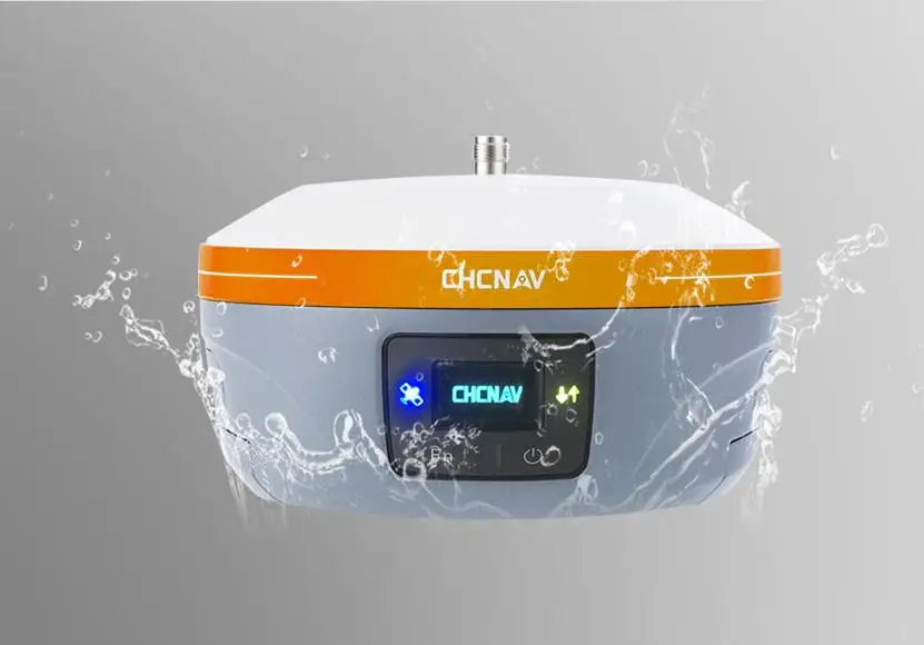
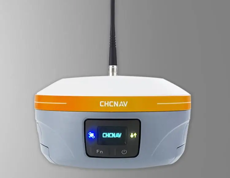
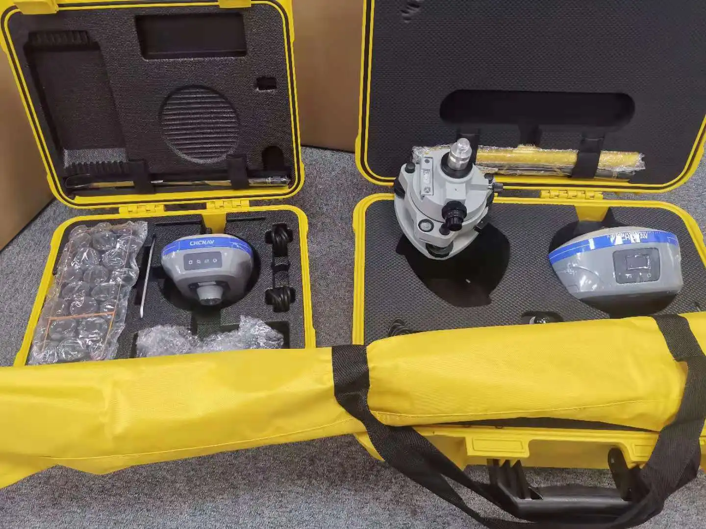
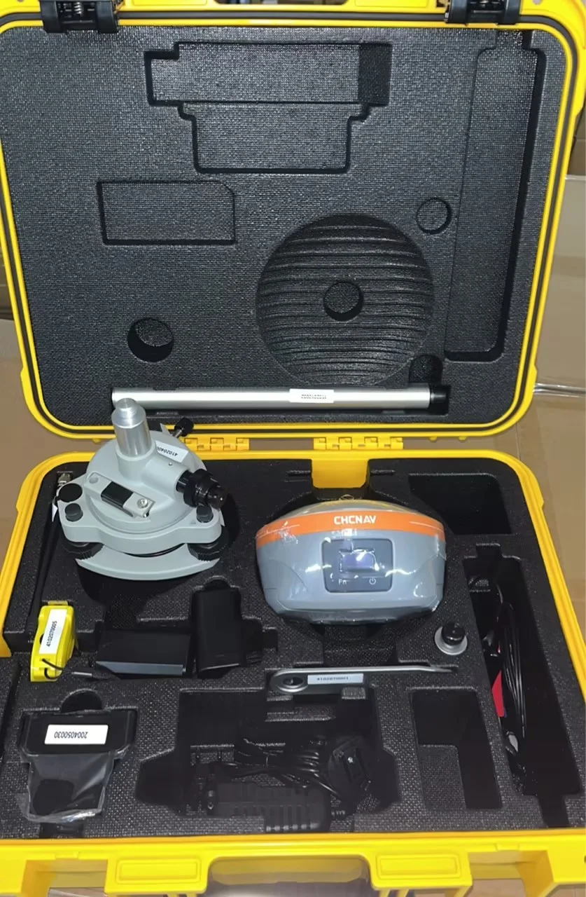
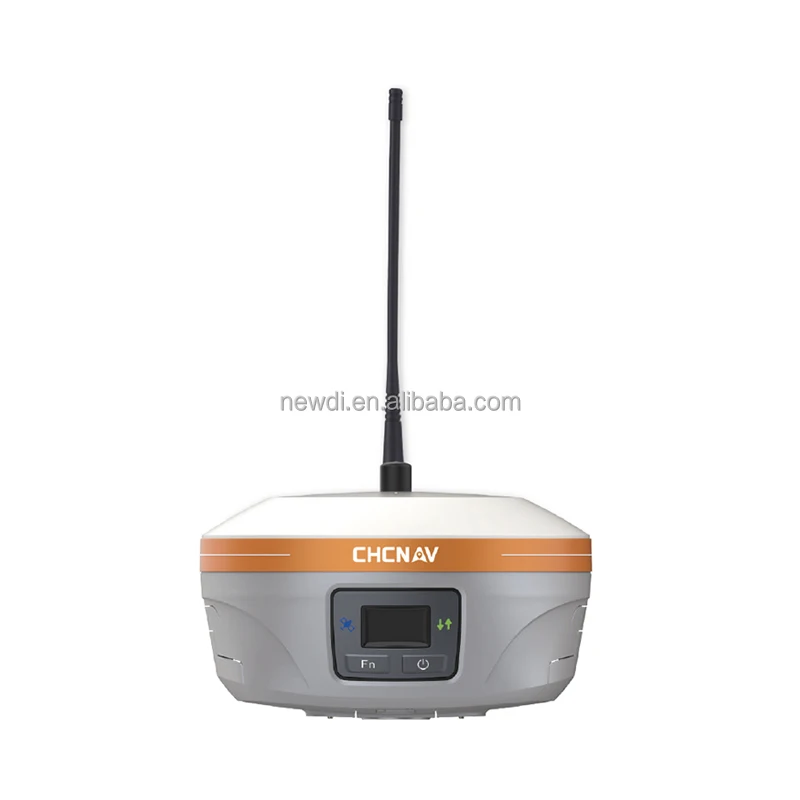
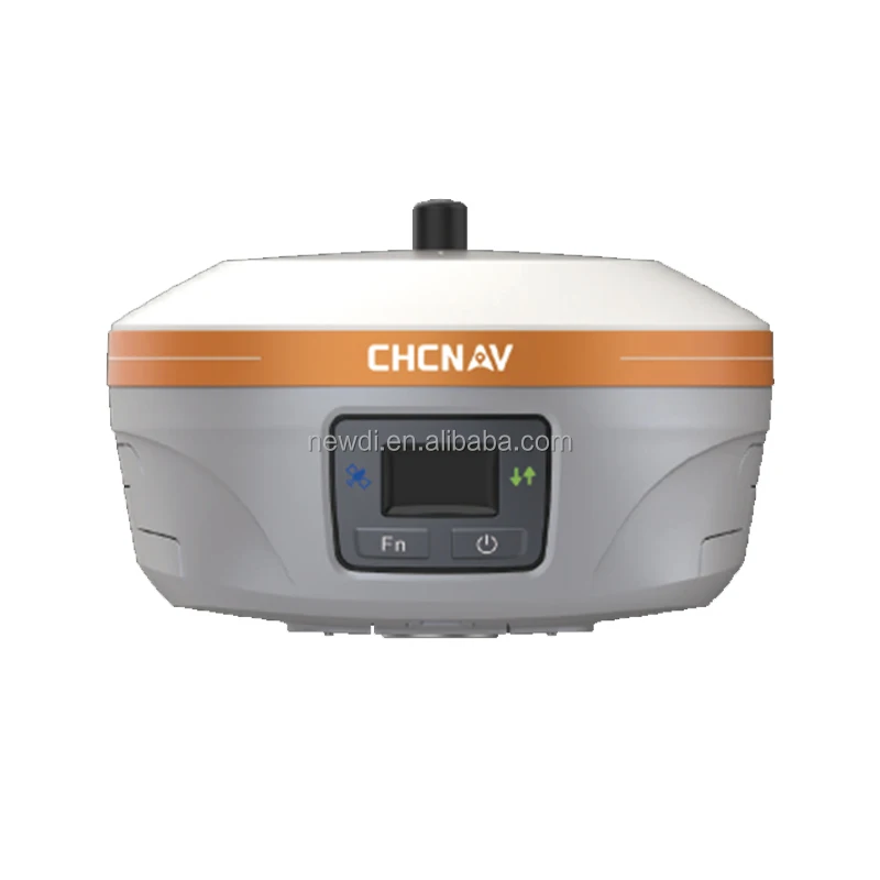
The CHCNAV Ibase GNSS Receiver is a compact, high-precision surveying instrument designed for professional land surveying applications. Built with durable plastic and metal materials, it features an external antenna for optimal satellite signal reception and supports multiple satellite systems (GPS, GLONASS) for enhanced accuracy. With 8GB internal storage and a user-friendly interface, it ensures reliable performance in harsh environmental conditions.

Technical specifications

FeatureSpecificationBenefit
Positioning AccuracyRTK-enabled, centimeter-level precisionEnables precise land surveying and mapping
Data Storage8GB internal memoryStores large datasets for extended field use
ConnectivityMulti-port design (USB, Bluetooth)Seamlessly integrates with field devices
DurabilityIP67-rated, weather-resistant buildOperates reliably in rain, dust, or extreme temperatures
PowerLong battery life (up to 12 hours)Supports all-day field operations

Customization guide

Adjustable parameters include firmware updates for RTK optimization, antenna tilt angles for signal alignment, and storage expansion via external drives. Ideal for customizing to meet specific surveying project requirements (e.g., real-time data streaming or rugged terrain use).

Get inspired

Whether mapping rugged terrain or conducting urban surveys, the CHCNAV Ibase combines precision and portability. Its multi-constellation support ensures uninterrupted positioning in challenging environments, while its compact design fits seamlessly into your workflow.

Choose your model

ParameterBase ModelAdvanced ModelPro Model
Positioning Accuracy±2 cm (RTK)±1.5 cm (RTK)±1 cm (RTK)
Data Storage8GB16GB32GB
Environmental RatingIP65IP67IP68
Battery Life10 hours12 hours14 hours
CertificationsCE, FCCCE, FCC, ISO 9001CE, FCC, ISO 9001, IP68

Supplier's note

  1. Three Technical Breakthroughs:

    • RTK Precision: With centimeter-level accuracy, the Pro Model outperforms industry standards, enabling sub-surface mapping for construction projects.
    • Multi-Constellation Support: Simultaneous GPS/GLONASS/BeiDou compatibility ensures uninterrupted signals in urban canyons or dense foliage.
    • IP68 Rating: The Pro Model’s waterproof/moisture-resistant design allows deployment in flood-prone areas or coastal surveys.
  2. Optimal Version Selection:

    • Base Model: Ideal for small-scale surveys requiring basic RTK functionality (e.g., land boundary marking).
    • Advanced Model: Suited for mid-sized projects needing extended battery life and IP67 durability (e.g., agricultural mapping).
    • Pro Model: Best for professionals in extreme environments (e.g., offshore engineering) requiring unmatched accuracy and IP68 resilience.

With the Pro Model’s ±1 cm precision and IP68 rating, you can conduct subsea surveys in saltwater environments. Pair its 32GB storage with real-time data streaming to eliminate post-processing delays. For budget-conscious users, the Base Model’s ±2 cm accuracy meets most municipal surveying needs.

Frequently asked questions

  • Which CHCNAV GPS receiver model is best for land surveying applications?

  • How do I maintain the external antenna of the CHCNAV GPS receiver?

  • Why choose CHCNAV’s materials over competitors for field use?

  • Can I customize firmware or software on the CHCNAV Ibase receiver?

  • Is the CHCNAV GPS receiver certified for outdoor durability?

  • How does the 8GB data storage benefit surveying tasks?

  • Does the CHCNAV receiver support real-time kinematic (RTK) positioning?

  • What ports does the CHCNAV Ibase GNSS receiver have for connectivity?

Product comparison

CategoryUsage ScenariosCharacteristicsAdvantagesDisadvantages
Positioning AccuracyLand surveying, mapping, constructionIndustry: 3m (GPS only) ▲ Base: 0.3m (RTK) ▲ Advanced: 0.03m (RTK + GLONASS)Base: Decimeter precision for general surveys. Advanced: Centimeter precision for high-accuracy projects.Requires base station for RTK; advanced models may need GLONASS compatibility.
Data Storage CapacityField data logging, long missionsIndustry: 2GB ▲ Base: 4GB ▲ Advanced: 8GB (ISO 16750-5 compliant)Stores large datasets (e.g., 10,000+ coordinates) for offline use.Advanced storage increases cost; limited compared to cloud solutions.
Environmental ResistanceHarsh outdoor conditions (rain/snow)Industry: IP65 ▲ Base: IP67 ▲ Advanced: IP68 (-20°C to 60°C)Advanced: Withstands immersion (1m/30min) and extreme temperatures.Advanced models may be bulkier; IP68 adds to device weight.
Connectivity OptionsReal-time data transfer, remote controlIndustry: USB ▲ Base: USB/Bluetooth ▲ Advanced: USB/Bluetooth/Wi-Fi (IEEE 802.11)Advanced: Wi-Fi enables seamless cloud integration and remote updates.Wi-Fi drains battery faster; requires stable network for optimal performance.
Power EfficiencyExtended field missionsIndustry: 5hr battery ▲ Base: 8hr ▲ Advanced: 12hr (IEC 60099-4 tested)Advanced: 12-hour runtime for multi-day surveys without recharging.Advanced batteries may increase device size and weight.
Warranty PeriodProfessional use, critical applicationsIndustry: 1yr ▲ Base: 1yr ▲ Advanced: 2yr (CHCNAV extended warranty)Advanced: Longer coverage for high-value projects with minimal downtime.Extended warranties incur additional costs; industry standard is typically 1yr.

Related searches

The Product Description is generated by third-party, and Alibaba.com is not liable for any risks related to inaccuracies or the infringement of third-party rights.

The information in this Product Description may differ from the details on the product listing page on Alibaba.com. Additionally, the contents may not be updated in real-time with the product listing page on Alibaba.com, and there may be delays in reflecting the most updated information. The description on product listing page takes precedence. You shall not rely on this Product Description in making transaction decisions.

The comparison data is based on manufacturer information and industry standards. Actual results may vary depending on individual use cases. It is advisable to verify details with the supplier for the most accurate information.