All categories
Featured selections
Trade Assurance
Buyer Central
Help Center
Get the app
Become a supplier
(802 products available)


 Ready to Ship


Arduino lidar and ultrasonic distance sensors are available in several types. This variability is often based on their operating principles and application requirements. These types incorporate different technologies for preference. Hence, understanding these differences in types ensures effective selection for particular projects.
Traditional Lidar Sensors
Lidar sensors that utilize laser technology to measure distances accurately are called conventional lidar sensors. These sensors create precise 2D or even 3D maps of the environment by scanning an area and capturing millions of data points quickly. Applications in mapping, autonomous vehicles, robotics, and environmental monitoring demand high accuracy and a long range, for instance, conventional lidar sensors.
Time-of-Flight Lidar
ToF lidar calculates distances by measuring the time it takes for a emitted light pulse to return to the sensor. In this kind of sensor, the light pulse is sent, the time taken is measured, and distance calculation occurs. This type of lidar is often simpler to implement and more affordable for shorter ranges. Common applications are obstacle avoidance in drones and simple indoor mapping, for example, in a time-of-flight lidar.
Solid-State Lidar
Solid-state lidar uses no moving parts and incorporates microelectronic components to replace typical mechanical systems. Such sensors tend to be more robust, compact, and affordable in mass production. Applications in automotive and mobile mapping require such sensors. These applications demand lightweight and durable equipment.
Swept-Source Lidar
These lidar systems work by using a light source with a broad wavelength range that is systematically "swept" over the spectrum. This technology is often applied in biomedical imaging and atmospheric observation. These observations require rapid data collection over short or extended distances.
Narrowband Lidar
Narrowband lidar systems are similar to swept-source systems, but here, the light source and detector work by segmenting narrow frequency bands. This band segmentation improves measurement precision and is useful for detecting gases or biological materials. Environmental monitoring and pollution detection are common applications for narrowband lidar.
Robotics and Autonomous Systems
Precise awareness of the environment is provided by arduino-based lidar systems in robotics. This awareness enables navigation and autonomous decision-making. Such li dars are widely used in mobile robots, drones, and autonomous vehicles for mapping, obstacle detection, and path planning. The affordability and adaptability of Arduino-based systems make them suitable for early-stage development and educational applications.
Agriculture
In precision agriculture, lidar technology has been increasingly adopted. The technology is used to assess crop health, determine field topography, and identify areas needing irrigation or fertilization. Lidar-based systems offer detailed 3D images of fields. This imaging allows farmers to make informed decisions about resource management, enhancing crop yields, and minimizing waste.
Forestry and Environmental Monitoring
Environmental monitoring, such as forest inventory and habitat mapping, uses Arduino lidar.
They are particularly useful for measuring tree height, canopy density, and topography mapping. Such measurements are essential for sustainable forest management. This technology also has applications in ecological studies by providing data on wildlife habitats and biodiversity.
Surveying and Mapping
Arduino-based lidar systems provide quick and cost-effective solutions for surveying and mapping tasks. These systems are frequently applied in topographic surveys, real estate development site mapping, and component monitor in infrastructure projects. While perhaps not as precise as conventional lidar systems, Arduino lidar's affordability makes it a practical option for small-scale or initial survey endeavors.
Search and Rescue Operations
Lidar-equipped drones and robots help search and rescue teams conduct operations in challenging or unknown environments. The technology generates detailed 3D maps that assist in locating victims, identifying hazards, or understanding the terrain. Arduino-based lidar systems are particularly helpful in scenarios where low cost and portability are necessary for quick response.
Industrial Automation and Quality Control
In manufacturing environments, Arduino-based lidar systems play a role in automating processes such as inventory management and quality control. These systems can quickly measure object dimensions and ensure the accuracy of products. Also, they inspect various areas within production lines. This application improves efficiency and minimizes human error in multiple industrial tasks.
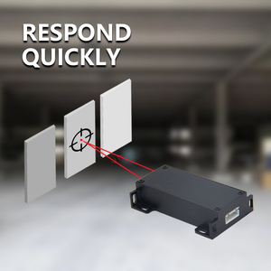
Arduino lidar's main function is to measure distances by using laser pulses and return to the sensor after hitting an object.
The measured distance acts as the basis for creating a detailed map of the surrounding environment. Usually, this is accomplished by rotating the laser emitter in a typical lidar system. Therefore, a 3D view of an area is generated in a scanning manner.
Combining these distance measurements with the positional data from an inertial measurement unit, or IMU, leads to an accurate environmental representation. Here, the IMU provides real-time orientation data, which frequently updates the scan results to maintain precision amid movement.
For many hobbyists and professionals, Arduino-based lidar systems are affordable. This affordability is mainly due to widespread Arduino components and effective hardware integration. Consumers can acquire distance measuring devices for personal use without breaking the bank.
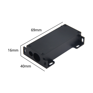
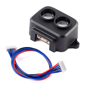
Most Arduino lidar systems are light and compact. This makes them portable and easily adjustable to various platforms. They are mountable on drones, mobile robots, or handheld devices for outdoor applications. Their mobility is perfect for tightly spaced or temporary use fields.
The Arduino platform's open-source nature means users can freely modify and enhance the hardware and software used in their projects. This flexibility encourages a wide community contribution that leads to design refinement, software growth, and inclusive support for different applications.
Range measurement, mapping, and object detection are a few applications of this lidar system. Indoor and outdoor usage, which includes robotics and environmental monitoring, is common.
Real-time distance measurements enable dynamic interactions with surrounding environments. Real-time data acquisition is a fundamental requirement of many autonomous systems and robotic competitions. Without it, tasks could not be performed effectively.
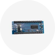
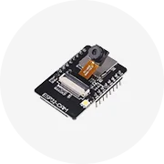
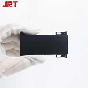
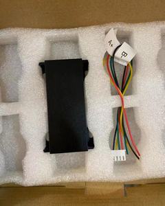
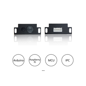
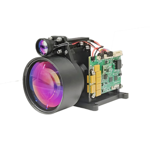
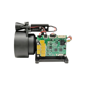
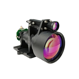
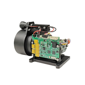
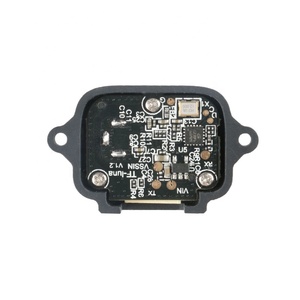
Usually, an Arduino lidar system consists of a basic Arduino board, a commercially available lidar sensor module, and supporting components like a power supply and an IMU.
The lidar sensor is responsible for all the distance measurements through laser pulses. Popular sensor modules include the Velodyne or LIDAR-Lite series.
The Arduino board acts as the primary controller. It receives all the sensor data, processes it, and communicates with any other connected devices. The IMU works with the Arduino board to provide orientation data and improve mapping accuracy through motion tracking integration.
Users should note that all the sensors and components in this system are mountable in an open-frame design. This design allows easy access during component change and facilitates quick part swap for maintenance.
Here are the key factors when choosing the appropriate Arduino lidar system:
Range
The effective scanning distance of a lidar sensor mainly determines its potential applications. Indoor tasks, such as robotic navigation, generally need a shorter range, say within 10 meters. Whereas outdoor applications, such as mapping, commonly opt for an extended range. Users should, therefore, ensure they have the right device to fit their requirements and purpose.
Accuracy and Resolution
Different applications require varying degrees of accuracy. Meter-level accuracy suffices for some basic tasks. But for professional mapping or robotics, centimeter-level accuracy is necessary. Resolution, on the other hand, defines how closely spaced the distance measurements can be taken. Higher resolution improves detail in the generated maps but comes at a cost of processing power and time.
Speed
Measurement speed becomes crucial in dynamic environments where quick data acquisition is necessary. The faster the lidar can perform scans, the more responsive the system will be when used in applications like autonomous vehicles or real-time robotics.
Power Consumption
Low power consumption is key when performing many outdoor applications, such as drones and mobile robots. Reducing overall power usage increases operational time. In situations where continuous indoor use is unaffordable, reduce consumption to avoid overheating and high electricity bills.
Compatibility
To build a functioning system, ensure that all components work with one another. So ensure the chosen lidar sensor, Arduino board, and any supporting sensors, like the IMU, are compatible. This step reduces integration and configuration complexity.
Cost
Arduino-based lidar systems are cheap, but cost varies based on the sensor's range, accuracy, and resolution level. Evaluating performance against the budget to ensure requirements are met is important. In case there are any trade-offs, prioritize needs critical to achieving project outcomes.
A1: Lidar that uses an Arduino board for control and data processing is known as Arduino lidar. You can easily tweak this type of lidar. Conventional lidar, on the other hand, is not easily modifiable. It also has different control and data processing techniques. Basically, they both function differently from each other.
A2: Generally, the operational range of this system depends primarily on the specific lidar sensor used. Most indoor applications have a typical range of around 10 meters. Most outdoor applications require a lidar system that can reach up to 100 meters. Always confirm the system's specs before using them.
A3: Yes, they are usable in both indoor and outdoor environments. Still, they perform best in controlled indoor spaces where they have obstacles to scan. When used outdoors, their performance can be affected by strong sunlight and other environmental factors.
A4: These systems are best for hobby projects, education, and prototyping due to their affordability and ease of use. These systems are not intended for professional-grade applications. Professional-grade hardware will likely perform better and be more accurate than these basic hardware setups.
A5: Adding an Inertial Measurement Unit (IMU) to the Arduino lidar system will increase distance measurement accuracy. This device provides orientation data and keeps the distance measurements precise even when the platform holding the sensor is in motion.