All categories
Featured selections
Trade Assurance
Buyer Central
Help Center
Get the app
Become a supplier
(1413 products available)


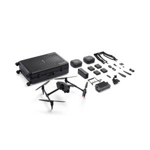


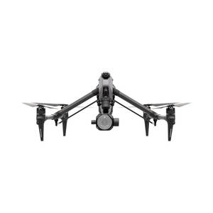
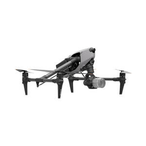
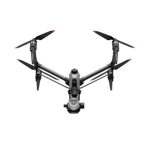
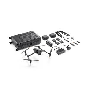


 Ready to Ship
Drone waypoints can be categorized based on different application requirements and deployment environments. Each type covers unique operational needs, from mapping and surveying to more specialized uses. Understanding the various kinds helps users select the most appropriate settings for their applications.
Geographic waypoints are fixed locations defined by specific latitude and longitude coordinates on a map. They form the foundational elements of a drone's flight path in geographic-based missions like aerial mapping, surveying, and inspection. These waypoints are typically selected on a mapping interface and can be adjusted by dragging them to new positions.
Mission-centric waypoints trigger specific drone actions, such as taking a photo at that location, launching, or surveying. These waypoints are integral for automated missions, particularly in commercial applications like real estate, agriculture, and infrastructure inspection, where drones must perform multiple tasks with high precision. Drones often come equipped with multifunctional sensors that capture aerial images and data.
Dynamic waypoints can change in real-time during a drone's flight. They are particularly useful for applications requiring flexibility, such as tracking moving objects or responding to environmental changes. For instance, delivery drones might use dynamic waypoints to adjust their flight paths based based on real-time traffic or weather conditions. Similarly, drones used for wildlife monitoring could change their flight paths if the subject being tracked moves.
Altitudinal waypoints include elevation data, making them essential for missions involving multi-level flight paths, such as building inspections or powerline surveys. These waypoints ensure that the drone maintains the correct altitude as it moves from one point to another. Additionally, some drones can be programmed to follow terrain to capture mapping data. This feature is essential for drone-based aerial photographs and video footage on uneven ground.
Return-To-Home waypoints define the automatic return point for a drone, usually its starting location. This function provides an essential safety net, automatically bringing the drone back if the battery runs low, the signal is lost, or the pilot manually initiates RTH. Many consumer and professional drones have an RTH feature, which can be set to a different location for added security.
Drone waypoints have significant commercial value across various industries. Users increase operational efficiency and data collection accuracy by enabling automated, mission-specific flights. Here are some of the most compelling commercial uses of drone waypoints:
In precision farming, drones equipped with various sensors can capture vital information about crop health, soil conditions, and field profiles. Using programmed waypoints, drones can move over large farmlands while capturing aerial photographs and data in a matter of minutes. This technology allows farmers to monitor their crops and manage their fields more efficiently.
Waypoints on drones ensure that construction sites and engineering projects are thoroughly mapped and monitored consistently. By automating drone flight paths over key project areas, companies can use aerial mapping to track progress, identify potential issues, and compare actual work against design plans. These capabilities lead to improved project management and reduced costs and delays.
Waypoint-driven drones facilitate the inspection and maintenance of critical infrastructure like power lines, wind turbines, and oil rigs. By automating the flight over key areas, companies can conduct quicker and safer inspections while capturing detailed images and data that enable predictive maintenance. This approach reduces inspection costs and minimizes downtime.
Drones can reach disaster zones quickly while navigating predetermined waypoints. Automated aerial photographs can assist in search and rescue operations, damage assessments, and delivering medical supplies or other critical goods to locations that might be difficult to reach by land.
Autonomous drone delivery systems depend on waypoints to transport packages efficiently. By planning flight paths over urban and rural areas, companies can minimize delivery times while navigating obstacles and adhering to regulatory constraints. Waypoints enable real-time adjustments to delivery routes based on traffic, weather, or other unforeseen circumstances.
Waypoints allow drones to conduct comprehensive aerial surveys and create high-resolution maps for various uses, including real estate and urban planning and environmental monitoring. Automated flights along programmed waypoints ensure consistent coverage and data collection, boosting aerial mapping efficiency and accuracy. Drone-based aerial mapping and surveying are faster and cheaper than traditional approaches.
When selecting drone waypoint products for clients, wholesalers should consider various factors that affect drone performance and user experience. Here are some of those factors:
Different drones have unique waypoint software requirements. For instance, while some drones support basic waypoint navigation, others might require more complex settings involving dynamic or altitude waypoints. To make the products appealing to a wider audience, businesses should ensure that their drone waypoints are compatible with various drone models.
It's important to consider how easy it is to program the waypoints and plan the missions. Wholesalers can consider drone navigation and positioning products with user-friendly interfaces that make it easier for users to set waypoints. Also, clients might be interested in drone waypoints with mobile app compatibility because many users will probably want to set them through mobile devices.
Autonomous drones' operational range depends on the drone waypoints used and the mission requirements. For instance, drones for mapping and surveying need waypoints with high positional accuracy to ensure precise data collection. Conversely, waypoints do not need arrows with high accuracy if the drones are for short-distance deliveries. While selecting waypoints, businesses should consider the various operational ranges and accuracy of their clients' drones.
Waypoint function varies depending on the product. Some waypoints include simply recording drones, while others have complex functions like varying altitudes, geographic coordinates, and return-to-home points. Businesses can consider multi-functional waypoints for clients using drones for various applications.
Once clients have purchased drone waypoints, they will probably need further support and assistance with any problems or challenges. That is why it is important for wholesalers to consider drone positioning and navigation products from manufacturers with a good reputation for providing timely technical support, including detailed user manuals and tutorials.
Drones are high-precision machines that require regular maintenance to ensure optimal performance. It will help clients provide better services and enjoy higher customer satisfaction and loyalty.
Regular Software Updates
Most consumer and commercial drones have intelligent flight systems that control the drone's positioning. It ensures that the drone follows the programmed waypoints accurately. However, if the drone's flight system or remote control needs an update, the drone might develop some flight issues.
To update the drone software, users should check for any available updates and ensure that the drone is connected to the mobile application and the internet. Then, they should locate the update section and follow the given prompts to complete the update task.
Battery Care
Clients should be advised never to let drone batteries drop below 10% charge to prolong the battery's lifespan. Conversely, they should not overcharge the batteries because it might reduce their capacity. Finally, spare batteries should also be kept to allow customers to complete their activities without interruptions.
Regular Inspections
Frequent checks for any signs of wear are essential in maintaining drones. Checking the drone's body for any damage is important. Customers should be encouraged to use dry cloth to clean the blades and body and avoid water and other liquids.
Waypoint Settings
Clients should ensure that the waypoints are set properly before the mission begins and that some products have the option of setting virtual barriers that restrict drones from entering any dangerous space.
Repairing Drones
While many modern drones are built with non-removable components, some high-end commercial models have parts that can easily be removed and replaced when they develop faults. In situations where the damage is beyond repair, customers might have to buy another professional drone.
Professional Help
Users should also take their drones to professional repair stores if they are not familiar with electric devices and have no idea how to make drone repairs. Also, some companies like Triple A have repair programs that allow users to replace broken drones with refurbished ones at reduced prices.
A1.Ins Environment, drone software, precision of the remote control, and obstacles like trees, mountains, and buildings are some key factors that affect the drone's performance during the waypoint mission. Understanding the environment helps businesses set drone-operated waypoints and choose the best drones for clients. In situations where the environment has obstacles, waypoints have virtual fencing that prevents the flying drone from entering hazardous areas.
A2.Yes, waypoints are pre-programmed positions that tell a drone where to fly. Drones follow the mission path and complete assigned tasks like taking pictures, checking stuff, and delivering packages. Additionally, waypoints have built-in virtual barriers that restrict drones from entering any dangerous space.
A3.Drone waypoints are important because they help make flying drones simple and accurate. Additionally, they allow drones to follow flight paths automatically, eliminating the need for manual control. Drone waypoints increase operational efficiency and data collection accuracy and provide comprehensive mapping for various applications.
A4.First, clients should ensure that their drones have acquired a GPS signal. If the drone has not acquired a GPS signal after some time, clients can turn off the drone and turn it back on again. If the drone is still unable to acquire GPS, clients can try moving it to another location.
A5.Validation of drone waypoints can occasionally be problematic due to weather and some other factors. For instance, flying a drone on a windy day can affect the accuracy of its flight path. Similarly, if GPS satellites are blocked by tall buildings, the drone might not acquire the mapped waypoints.